Advice from a pro on introducing UAS into your practice.
UAS are quickly transforming from cutting-edge to standard tools for geospatial mapping and surveying. How will your firm be competitive and turn this technology into a profitable business?
Get Smart about Regulations
The greatest challenge to the industry has been navigating the thicket of FAA compliance. The good news is that regulatory uncertainty and complex compliance requirements are almost behind us. Since 2015, the FAA has made steady progress with sensible rules that make commercial operations practical.

John Perry, CEO of Altavian
For example, instead of the notarized paper-based process for registering your UAS, a simple online form is available at http://registermyuas.faa.gov/. The FAA also now provides a standard Certificate of Authorization to all exemption holders that lays out the rules of the road (or airspace, I suppose), so you don’t have to wait for authorization on each project. Plenty of resources are available on the FAA website on how to register your drone and conduct authorized operations, with reputable providers offering short webinars to get up to speed.
Better yet, you will soon no longer be required to obtain an exemption. The FAA has been working on a new set of regulations, 14 CFR Part 107, for several years. The final step of this process is currently underway, and the anticipated date for new regulations is June of this year.
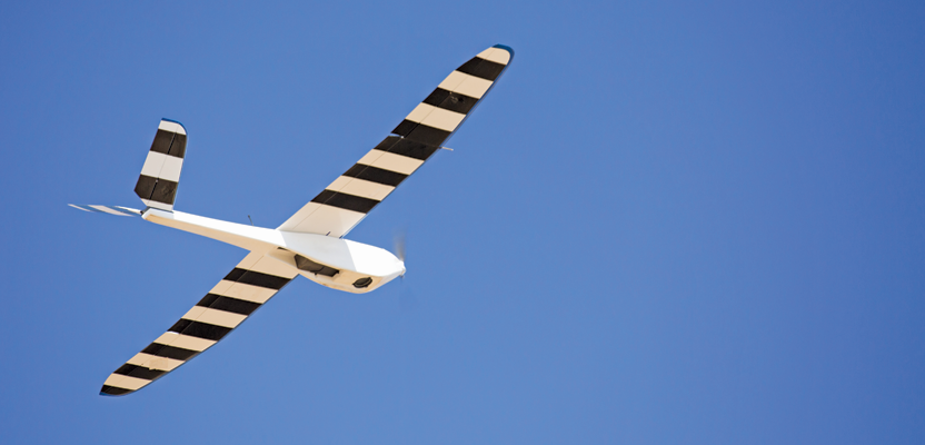
Invest in the Right Equipment
Purchasing a drone can seem daunting (there are over 1,200 models registered with the FAA), so good business sense and a decent understanding of both the aviation and geospatial technologies is crucial. Here are a few key factors to consider:
1. Operational Capability
“Should I buy an airplane or a multi-rotor?” is usually the first question we’re asked by the uninitiated. Multicopters are typically easier for beginners but are practical only in very low winds and smaller project areas, up to a couple of hundred acres at most. Airplanes can be operated in a wider range of conditions and can acquire data efficiently over thousands of acres but need more training for the pilot. You should also consider specialized features, such as water-landing capabilities for coastal projects or the ability to capture oblique imagery of structures.
2. Platform Stability
From a safety perspective, aerodynamically stable airplanes can safely glide to the ground in the case of an emergency, and some multicopters are designed to safely recover from the loss of one or more rotors. In either case, it is crucial that the aircraft is designed to fly safely within the regulations and minimize vibration, turbulence, and wind disturbances so that high-quality imagery can be captured. Photogrammetric accuracy depends on the resolution of the imagery, so the quality of your drone will affect the quality of your data!
3. Sensor Quality
Of course, the quality of the sensors available on the drone is the most important factor for geospatial data production. Geospatial professionals understand that accuracy or resolution figures depend on the particulars of each project. No matter what is advertised, ask detailed questions about the quality of the imaging sensor, lens, and other optics, GPS receivers and antennas, and any other sensor and data quality control features available. Better data in is better data out, and the sensor specifications give you an apples-to-apples comparison of the value of the data you can acquire.
4. Support and Maintenance
Drones that are designed for day-to-day surveying and mapping use are priced from $10K and up and are a substantial business investment. Unfortunately, the truth is that price is often not an indicator of quality. Moreover, the training, repair, and maintenance costs are not to be ignored. Flimsy parts and hobby-shop builds lead to frequent downtime that will end up costing you time, money, and reputation when clients are waiting on their data. Look for proven drone models from providers who are ready to support your business, not just sell you the drone.
Focus on Business Fundamentals
We understand that reliably delivering cost-effective and useful geospatial products to your clients trumps the “wow” factor of drones. The truly successful business operations we’ve seen come when a geospatial firm identifies a specific client need, usually among existing customers, and carves out a competitive advantage in delivering that with their UAS compared to their existing approach.
From state and federal agencies to State Farm, John Deere, Exxon Mobile, Duke Energy, Bechtel, and Rio Tinto, the steady stream of press releases hint at the amount of market development happening. We often hear from smaller firms that the market seems to be out of reach for them. The reality is that the thousands of small- to mid-sized surveying and mapping companies and other geospatial data providers have to seize the potential of this market.
Yes, a few of the early-adopter firms have gotten off to a false start, stymied by poor equipment choices, unprepared for the regulations, or without a plan for delivering value to their customers. But in the end, no one understands your client’s needs better than you, and in most cases the financial benefit of using drones works only if the equipment and assets are utilized in a local region.
The most important advice we give to our clients is to understand that there isn’t any magic in the drone business. The fundamentals of how you have built your surveying and mapping business are still the keys to success. Building customer relationships and educating them about your services, training and efficiently managing your field crews, building a competitive advantage with higher-quality data products or more efficient data production workflows: these are all the same things you need to focus on when you start your drone operations.