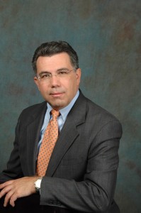
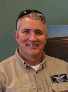
Interviews with representatives from ASPRS, AUVSI, SPAR Point Group, MAPPS, and PAPA
Several groups have evolved over the years to represent geospatial organizations that use aerial platforms in the course of their work. We asked five of these organizations (with a combined membership in the tens of thousands) the following questions:
-
What do you do on behalf of your members?
-
What do you see as the most formidable challenges now and in the near future?
-
What specific actions are you taking to improve the climate for professionals working in their fields?
-
Where do you see your profession headed in three to five years?
-
What are your thoughts on the impending role of unmanned aerial vehicles?
-
Why should Heights readers consider joining your organization?
Here’s what they have to tell you.
ASPRS
We spoke with Dr. Michael Hauck, executive director of the American Society for Photogrammetry and Remote Sensing (ASPRS).
1.
ASPRS is a society of technical individuals and organizations dedicated to helping others make smart, professional decisions through the use of imagery and geospatial information. We do this by providing standards and best practices, professional certifications, continuing education, participation in technical activities, and opportunities generally to be of service to others.
Our members find value in collectively serving this mission, in promoting our profession, and in networking and fellowship. Now, as much as when it was founded 80 years ago, ASPRS is in a position to help its members mold the future and create a legacy for the next generation to build upon. I have heard time and again, from young professionals and senior managers alike, “I owe my career to ASPRS.”
2.
Even as the work of our members has become increasingly important to the functioning of modern society, the challenges faced by members have also increased. Members face cheap labor outsourcing from abroad, broken government contracting models, gaps in our educational system, the ever-constant pressure to lower costs, and the urgent need to innovate business models. Globalization and commoditization challenge traditional services and products, while, ironically, the new technologies we create to stay competitive also disrupt our existing businesses.
Since we face these and other challenges in common, ASPRS members are stronger when we identify them and address them together. Fortunately, ASPRS is viewed as a trusted, objective, non-political third party when it comes to technical matters, so policy makers frequently solicit the advice of ASPRS and our members.
3.
We have an active mentoring program with our young professionals that we seek to grow. We added several new student chapters recently and continue to fund scholarships and awards valued at over $50,000 each year. For continuing education, ASPRS expanded its monthly GIS-focused Geobyte webinars with CaGIS, and we are planning to add a similar series with an Asset Management theme. For professional certification, ASPRS has added lidar-specific certifications and is exploring a UAS-specific certification.
We also stood up a new technical activities division focused on the exciting UAS platform. We have greatly expanded the general interest content in our journal, PE&RS. I am really excited about the well-received improvements we have been making in our conferences (e.g. higher quality technical sessions, more opportunity to talk with exhibitors, better locations, and more time for networking).
On the standards front, ASPRS just published its new Positional Accuracy Standards and has distributed its Procurement Guidelines for public comment. Most important, we are conducting new market research to share with our members.
4.
I believe that the need for ASPRS may be greater now than it ever has been before. The growing commercialization and commoditization of geospatial information over the last decade has created a deep societal dependence upon the work of our members. Our member contributions are often behind the scenes—unknown by most citizens—but they are increasingly important and necessary to the functioning of modern society. Society needs our members, our expertise, our standards, our publications, our support for education, and our professional engagement.
ASPRS members understand and expertly address the big issues of our time—from agriculture to defense, from climate change to transportation planning, and from water resources to energy management, to name just a few. As we move forward ASPRS will continue to help its members maintain their skills and market awareness, nurture the next generation of professionals, help our members tell their stories to the public, and inspire others to join us on our journey.
5.
ASPRS recently stood up a UAS division to focus on technical activities related to autonomous systems. Some, but not enough, of our members already benefit from UAS developments. Some federal members have been using UAS for years already. Many government and contractor members have been operating under COAs, but they have limited value for most of our commercial members. Additionally, a few of our commercial members (Altavian, Trimble, Woolpert) were recently granted Section 333 Exemptions. I expect we will see more exemptions granted.
Nonetheless, I think most members would say that the current regulatory environment is holding them back. In February FAA released rules for public comment to govern commercial use of UAS within visible line of sight. Even then, final adoption of the rules may take one or more years. Rules for beyond visible line of sight will take even longer. ASPRS serves on the advisory group for FAA’s Aviation Rulemaking Committee in this area, but the committee’s work of writing proposed rules is just getting started. Meanwhile, ASPRS members in Canada and many other countries have been routinely flying UAS commercial operations for years following their local regulations.
6.
The women and men of ASPRS have immense technical depth across a broad range of disciplines that no other professional society is focused on. The work of ASPRS members is integrated into so many aspects of modern life that it is easy to take their work for granted. From the internal workings of GPS to the imagery embedded in the daily weather forecast, ASPRS members are behind the scenes making it all work for the betterment of humankind.
Whether they serve in academia, government, or industry, ASPRS members really do make a difference in improving the quality of people’s lives around the world and we want to take this opportunity to invite your readers to consider becoming a member of this critically important professional society.
AUVSI
Brian Wynne, president and CEO of the Association for Unmanned Vehicle Systems International (AUVSI), answers the six questions posed.
1.
AUVSI provides a number of services on behalf of its members—education, advocacy and unparalleled networking opportunities. Add itionally, AUVSI hosts the world’s largest conference and exposition devoted to unmanned systems, as well as a variety of workshops, webinars, and smaller targeted conferences to help spread the word about the benefits of unmanned systems.
Through AUVSI’s monthly magazine, weekly newsletter, and social media channels, as well as in-depth reports about how these systems can be used, AUVSI seeks to educate lawmakers and the public about unmanned systems.
We also have more than 30 chapters in the United States and around the world where members can locally come together to share their knowledge.
2.
One of the most challenging issues is regulation. While hobbyists have been able to fly model aircraft for decades, people who want to make commercial use of unmanned aircraft have only recently been able to begin doing so, and several countries are ahead of the United States in this regard. In mid-February, the U.S. Federal Aviation Administration (FAA) issued a proposal to allow small unmanned aircraft to begin to fly for commercial use in the United States.
Meanwhile, automakers are continuing to develop technologies to allow cars and trucks to drive themselves, and we will increasingly be seeing those on roads around the world in coming years. Nations are also developing regulations to allow greater use of unmanned vehicles on the surface of the ocean and below it. In all these cases, AUVSI is working to make sure this technology isn’t stymied by punitive legislation.
3.
On the advocacy front, at both the federal and state level, we are working to make sure that fear-based legislation doesn’t derail this industry by imposing too many limitations on the use of these systems. We also work with regulators around the world to try to develop clear standards for their use.
We continually push the FAA to complete its rulemaking for the integration of unmanned aircraft into the National Airspace System, not just for small systems but for all types of these vehicles.
We have also created a Code of Conduct for users of unmanned aircraft, and most recently created the Know Before You Fly campaign along with fellow founding members the Academy of Model Aeronautics and the Small UAV Coalition, in partnership with the FAA. This campaign helps new and existing UAS users alike know the rules about how to operate their systems safely.
4.
We see nearly limitless potential for the unmanned systems and robotics community in the near term, especially once legislation permits their widespread use. Civil and commercial users alike will see greater use of unmanned aircraft, ground robots, and maritime systems.
As the novelty continues to wear off, more attention will turn to training, certification, and standardization. This will continue a virtuous cycle as systems will continue to improve even as more of them are put into use.
The best part is that the most interesting uses for these systems likely haven’t even been thought of yet.
5.
Over the next few years, the FAA is expected to complete the first phase of UAS integration, which will allow for UAS to be used in a wide range of commercial applications, to help industries do their work faster, safer, and more effectively.
UAS will be used for everything from helping farmers care for their crops, inspecting bridges and oil pipelines, to even providing virtual real estate tours. They will also have a tremendous impact on our economy. AUVSI’s 2013 economic impact report found that in the first three years following integration, the industry is projected to create 70,000 new jobs and $13.6 billion in economic impact.
It’s impossible to envision all of the new uses and benefits that integration will bring about, but the coming years will certainly be an exciting time for unmanned systems.
6.
AUVSI is now entering its 43rd year of existence, but we still feel like we are just getting started because the technology and its capabilities are always evolving. Our mission is to promote and support the unmanned systems community through communication, education and leadership, and we welcome anyone who wants to join us on this journey.
SPAR Point Group
Lisa Murray, director of SPAR Point Group, answers the six questions posed.
1.
SPAR Point Group organizes conferences and provides news and information for professionals involved in 3D measurement and imaging technologies. Content—delivered in-person and online—gives practitioners tools and information to make better business decisions. Our whitepapers, webinars, and a weekly e-newsletter help our members stay current with evolving technologies, use cases, and workflows.
Our conferences provide a venue for keeping up on the latest trends, including new advancements in lidar, photogrammetry, and UAVs. SPAR Point Group organizes Commercial UAV Expo, SPAR Europe, European LiDAR Mapping Forum, SPAR International, International LiDAR Mapping Forum, and SPAR Japan. SPAR Point Group is wholly owned by Diversified Communications. For more information, visit www.SPARPointGroup.com.
2.
Our hardware and software providers compete in a fast-paced marketplace with ever-improving products. Competition is stiff and innovation is table-stakes. Our asset owner/end-user members face different challenges, including integrating new technologies into current workflows, managing large data, sharing data across the organization, making hardware and software selections. Our service providers also rely on us for hardware and software updates as well as providing a platform for educating potential customers.
Public awareness of the technology has grown significantly in the past few years, but clients still need to learn what 3D technologies can and cannot do and the best combination of hardware, software and skilled operators for each project. Every stakeholder needs help staying up on what’s new and what’s next.
3.
We are partnering with industry associations and universities to add content for professionals new to 3D tools, like traditional surveyors and students of geomatics. At SPAR International 2015, for example, you will see a new introductory track covering basic terms, hardware and software options, training and education options, and more.
We are interested in attracting young talent as well as traditional surveyors by offering education to help them stay competitive in an increasingly data driven profession. We offer the intro workshop and an exhibits only pass for free to encourage new attendees to check out everything SPAR has to offer. They can also subscribe to SPARView for free and get weekly updates on the marketplace.
4.
New products are being released all the time that can completely change how people are working. However, some definite trends include the use of hand-held scanning devices, integration of UAV/UAS, lower-priced scanning options, and improved software solutions. There also seems to be a convergence of technologies.
End users are less concerned with how data is acquired and more interested in data quality and optimization of data. They want to explore the limits of what they can do with the data and find ways to share information across the organization for maximum benefit.
5.
As 3D data capture professionals, our members are well-versed in precision measurement and realize the incredible impact UAV/UAS will have on industry. They are also keenly aware of the risks and challenges associated with commercial UAVs. They are anxious for more information on the cost/benefits of integrating UAVs into their workflow as well as updates on the regulatory landscape, safety and training considerations, data management, and deliverables.
In response to the need for education and information on commercial UAV use, we recently launched Commercial UAV Expo that will take place October 5-7, 2015 in Las Vegas.
6.
In addition to providing cutting-edge technology coverage for advanced surveyors and practitioners, SPAR Point Group is expanding learning levels to offer education to all stakeholder groups including asset owners, engineers, operations and maintenance professionals, and those new to 3D who may want less technical, more business-focused content. Our growing portfolio of geospatial events and online media are designed to provide a platform for global information exchange on remote sensing and 3D technology advances.
MAPPS
John Palatiello, executive director of MAPPS, answers the six questions posed.
1.
MAPPS (www.mapps.org) is the only national association exclusively comprised of private sector firms in the remote sensing, spatial data, and geographic information systems field in the United States. MAPPS provides its member firms opportunities for networking and developing business-to-business relationships, education, public policy advocacy, market growth, and professional development.
2.
MAPPS member firms face a number of challenges. First, a still-sluggish economy affects MAPPS member firms, just as it does other surveying, mapping, and geospatial companies and all business sectors. Second, the implementation of the Federal Aviation Administration rules for commercial unmanned aerial systems (UAS) will certainly impact our member firms. And the issue of government and university competition still ranks high among concerns when MAPPS polls its members.
3.
First and foremost, MAPPS has a very active government relations program to advocate for public policy and legislation, at the federal and state levels, to create a favorable climate. Additionally, we provide a forum for firm principals to engage in networking, partnering and business-to-business relationships that help grow their market and increase revenue.
In addition to traditional conferences, we’ve been implementing webinars, a blog, an inter-active website, and other media to help educate and inform our members on best practices, threats, opportunities, and government policies and to share information.
And we recently launched a series of forums—small business, surveying, infrastructure, ocean and coastal mapping, aerial acquisition, government and university competition, commercial remote sensing and licensed data, and emerging markets and emerging technologies—to facilitate collaboration and teamwork among our members in specific market, practice and technology areas.
4.
There will continue to be consolidation—more mergers and acquisitions in the geospatial profession. So, on the business side, we are likely to see more, larger firms due to this trend. New technology, applications, and an increasing consumer recognition of the power of geospatial data and the appetite for analytical solutions will all contribute to an expansion of market demand for our members’ data and services. And UAS will be a game-changer. All these factors contribute to a larger, stronger geospatial profession in the next three to five years, particularly if, from a macro sense, the economy improves.
5.
There will first be an introduction of UAS technology for small birds, operating within visual line of sight of the operator and at lower altitudes. That will transition into beyond visual line of sight, with larger UAS, and at higher altitudes.
Once commercial operations begin, I believe there will be revolutionary research and development on platforms, sensors, new and improved ways to power the birds, data storage or downlinks, navigation, as well as sense and avoid systems, along with other areas.
Imagery and geospatial data are quickly becoming one of the top anticipated uses for UAS. The ability to see, sense, and monitor from a UAS in a quick and efficient way is going to become evident very quickly. We’re working to enhance the public’s understanding, as well as that of legislators and policy makers, that there are societal benefits to geospatial data acquisition from UAS; it’s not a privacy threat. Once these benefits are recognized, there will be an explosion of this market, and I believe that will only whet the appetite of clients for imagery and data from more traditional manned aircraft to provide data that cannot be collected from a UAS.
6.
The goal of MAPPS is to “make the pie bigger” or grow the market. There is a great esprit de corps among MAPPS members, not only to grow the market, but to promote professionalism as well. We like to say MAPPS can be found at the intersection of profit and professionalism. We work cooperatively with many government agencies and other associations to support that growth.
For several years, the association has re-branded itself and moved away from its long, original name. We’re known as “MAPPS” because while the organization stated as an association of photogrammetry firms, we’ve changed as has the market and the profession.
Today, our member firms are also engaged in lidar, surveying, satellite and airborne remote sensing, aerial photography, hydrography, aerial and satellite image processing, GPS and GIS data collection, scanning, BIM, mobile mapping, conversion services and integration services, those who sell data products, as well as providers of hardware, software, and geospatial equipment. We welcome all types of geospatial companies to our membership.
PAPA
Chuck Boyle, president of the Professional Aerial Photographers Association (PAPA), answers the six questions posed.
1.
The Professional Aerial Photographers Association, International is open to aerial photographers from around the globe. Our organization encourages education through shared information, conferences with guest speakers on relevant topics, and fosters camaraderie. We promote ethical business practices, embrace new technologies, and provide practical and valuable training for members worldwide. If you are in the aerial photography or aerial videography business, or connected with it, PAPA invites you to join us.
2.
The most challenging issues are legalizing and safely integrating the use of UAV photography and video for commercial use in U.S. airspace, along with our members making the choice of whether to use that technology in their own businesses.
The barrier to entry into the UAV aerial photography business is pretty low compared to the investment in aircraft and professional pilot ratings to use manned aircraft; therefore it seems that there are new competitors popping up all over. Most of us feel that we are losing market share to people who are scofflaws and unsafe; operate their UAVs too high, too close to airports, too close to people and buildings; and have very little knowledge of what to do with the imagery they collect other than dump it onto the customer with little or no post production.
The loss of market share and thus revenue could mean for some the reason to leave the business, especially if they do not see at least the same income levels from an inclusion or conversion to UAV technology.
3.
Our organization is open to professional aerial photographers. As the majority of our membership is within the United States we use our influence to educate our members and the customers who buy aerial photography on the rules and regulations that govern our business.
We recognize the FAA as the national aviation authority of the United States authorized to regulate and oversee all aspects of American civil aviation, including the use of UAV photography. We strive to educate our members on the rules and regulations as they apply to aerial photography.
We are challenged with staying up to date and informed on any issues that may affect our members, to contribute to the conversation and have our voices and concerns heard by the FAA, and to interpret and disseminate the latest news that can affect our members’ livelihoods.
PAPA is currently evaluating the possibility of implementing a Novice Category of membership to accommodate the new UAV operator who is considering using the technology for commercial purposes.
4.
Many of our members base their business model on low-altitude aerial photography and aerial video with commercial real estate developers and construction companies as their main target markets. In the coming months and years, UAV photography will become another tool for our members catering to emerging demand for the technology in various sectors. But speed, distance to the target, location of the site, and the need for bigger, heavier cameras will still have members keeping the option of airplane and helicopter.
Additionally, many of our members are seeing a rise in demand for large, accurate, true color, and infrared aerial surveys and scanning. Location, terrain, and equipment needs will dictate which aerial platform will be used, and in most cases manned aircraft will be used.
5.
UAV photography is being seen as a viable option for many aerial photography operations, but we believe there is a misconception by the public that it will be a less-expensive option than using fixed-wing or rotor-wing aircraft. As the real cost of doing business shakes out the hobbyist from the professional, the true price tag and profits will become clearer.
If penalties for illegal UAV operators are stiff, the rules are clearly stated in order to assure a safe coexistence with manned aircraft, and those rules are adhered to, the market shall decide the most practical method of collecting aerial data.
We believe there will be very specific commercial scenarios for implementing UAVs as a solution to problems not solved by manned aircraft, but “do it your selfers” should be prepared to meet rigorous professional standards.
6.
It may sound that we are against UAV use in America, and that that is our only concern. Far from it. PAPA, International is a professional organization that has established a doctrine that fosters the notion that our members operate within the laws of their respective country, and in an ethical manner. We are not the aerial photography police, but we have ejected members for unethical behavior.
Most of our members have become certified through testing of safety, legal, and photographic knowledge. We also greatly value the artistic skills required to produce outstanding images that someone would proudly display. Our members have the opportunity to become “Masters of Aerial Photography” through a point system valuing the quality of their work and organizational participation.
We recognize that some of our existing members are considering including UAVs in their businesses and are actively preparing. Times are changing, and we have no intention of being dinosaurs. Our organization actively educates our membership and offers the resources for securing the proper FAA approvals for commercial operations.


