All posts by Angie Duman

Weekly xyHt News Links: 12/22/17
Newly Launched Seminar Programme at GEO Business 2018 Announce Call for Abstracts Bentley Institute Press Announces Availability of New BIM Publication: Plain Language BIM Topcon and Bentley Systems announce kick-off of Constructioneering Academy 3W-International – New Wankel engine 3W-180 SRE hybrid UAV Industry Outlook and Predictions for 2018 from Geo Jobe International LiDAR Mapping Forum...
xyHt Weekly News Links: 12/15/17
Transducers USA Introduces New Custom Ultrasonic Sensors Global Aerial Imaging Market – Expected to Reach $3.2 Billion by 2023 – Research and Markets Maptek unveils new strategic panel caving application Is the Newly Revised Geospatial Data Act Worth Supporting? Phase One Industrial Releases iX Capture 3.0 Software for Aerial Photography Geomni Capturing Aerial Imagery of...
xyHt Weekly News Links: 12/8/17
Bentley Systems Announces Agreement to Acquire ACTION Modulers’ Water Modeling Software Business International LiDAR Mapping Forum 2018 Conference Program Announced & Registration Open Texas Society of Professional Surveyors Recognizes Leading Land Surveyor: Doug Turner, IDS Survey Director, Named Surveyor of the Year Android software release expands GNSS analysis tool capabilities US, China cooperate on interoperability...
xyHt Weekly News Links: 12/1/17
Hemisphere GNSS debuts scalable smart antenna Orbit GT releases 3D Mapping Publisher v18 3D Laser Mapping launches campaign to release open-source LiDAR data SimActive Introduces New Technology for True Orthos Marine-i Event creates an exciting vision of the future Applanix and Think 3D Deliver UAV Lidar Mapping with Direct Georeferencing GIS Tools in EDU PR...
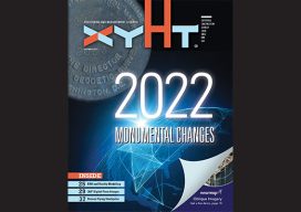
xyHt Magazine December 2017 Issue
Click on the cover below to view the December 2017 issue of xyHt magazine. Articles from this issue include: (They appear as links as they go live throughout the month.) 2022 and You (The issue’s editorial) 2022: Monumental Changes, Part 1 The Geodude on the Value of 360° Digital Panoramic Images Maps as Art: The...
xyHt Weekly News Links: 11/24/17
Topcon Agriculture announces TAP, a connected agriculture ecosystem Trimble’s 3D laser scanning and modeling offers a new way to conduct storage tank inspection in the oil and gas industry Carlson 2018 Precision 3D Topo Geospatial Data Act Save the Date for Feb. 5-7, 2018, Co-Located with ASPRS!