All posts by Matteo Luccio
Advancing GNSS
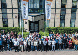
A Profile of Septentrio Editor’s note: The name Septentrio may not be familiar to you, but after their formal acquisition of Altus (with which Septentrio has collaborated for a decade) you may be hearing more about this internationally recognized, high-precision GNSS developer. A leader in GNSS research and development since 1999, Septentrio has a...
The Vanishing Divide
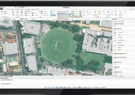
New solutions bridge the gap between CAD and GIS. Editor’s note: In our continuing examination of CAD-GIS integration we’ve presented several approaches and products. Internationally, a tremendous amount of work has been done towards integration, both in academia and in commercial software; here we introduce you to Graebert GmbH, German developer of popular CAD software...
123D Catch for the Masses
How to Make A 3D Model of Your Sleeping Cat Stereoscopic imaging, better known as 3D, is not new. In the 16th century, “binocular” images were viewed cross-eyed. In 1838, Sir Charles Wheatstone invented the stereoscope to give depth to images. It presented two offset 2D images separately to the left and right eye of...
Blending Realities
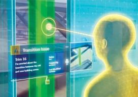
A 3D design and visualization tool with phenomenal potential in the AEC world is coming from a collaboration between Microsoft and Trimble. Imagine designing an object, in 3D and color, using only gaze, gestures, and voice (GGV) commands. Imagine designing an entire building the same way—or modifying an existing one. Imagine moving in a physical...
Geospatial PPPs
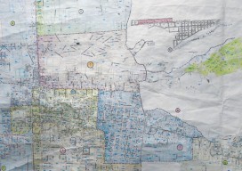
Striking the right balance in building national cadasters with private/public partnerships. Land ownership is a foundation of national economies: those who have land titles can use them to obtain credit (which is often essential to start and expand businesses), and property taxes are a key source of government funding. Therefore, authoritative and efficient land registries...
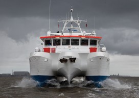
Mapping the Scottish Seabed
Six companies collaborate on a project to bury fiber optic cables under the Scottish seabed, stitching segments using hydrography, bathymetry, and surveying. On land, surveyors face challenges due to rough terrain, human activity, weather, and more. Usually, however, the ground beneath their tripods doesn’t move, they can physically occupy positions, and the air between them...