All posts by Shelly Cox
Nattaporn Thoonsaengngam
Research Assistant & Geodesist, National Astronomical Research Institute of Thailand Chiang Mai Province, Thailand “I wonder, because it is a wonder,” says Nattaporn Thoonsaengngam, a talented researcher, published geodesist, and professional photographer. The worlds of astronomy, geodesy, radio astronomy, humanity, and natural and built environments are all captured by her mind’s eye, photographer’s lens, and...
Muhammad Luqman
PhD Student, University of Melbourne Melbourne, Australia A certified surveyor from Pakistan, Muhammad Luqman is currently a PhD researcher at the University of Melbourne in the field of Earth sciences. He completed his Master of Philosophy in geomatics in 2014 with a focus on the application of geospatial technologies, as well as a master’s in...
Shane Nafe
Co-founder & President, MTX Surveying Texas, USA As the president and co-founder of MTX Surveying, Shane Nafe led the company from 2 employees to 18, with more growth expected this year. His business partner says that he has excelled faster than most professionals his age thanks to his outstanding technical abilities and leadership skills. When...

xyHt Doer: Brennan O’Neill
Brennan O’Neill Hawaiian Pacific Branch Manager for Frontier Precision Frontier Precision has been in business since 1988, selling and supporting Trimble, Nikon, Zeb-Revo, and Spectra Precision hardware and software. One thing I get a kick out of at work is, after listening to the customer, showing them the exact thing they need to do their...
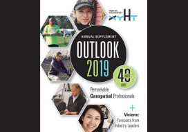
xyHt Magazine Outlook 2019 Issue
Click on the cover below to view the Outlook 2019 issue of xyHt magazine. Articles in the issue include (links will turn live throughout January and February): Coaching Robots – Continuous surveying (to support smart cities, infrastructure, geodesign, and construction) is opening expanded—but unconventional—roles for surveyors and geospatial practitioners. Gabriela Olekszyk – Surveyor & GIS Analyst, Woods Auckland,...
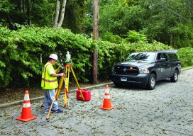
Examining Captivate
Above: A crew chief with BL Companies of Connecticut begins his day working with Captivate. The evolution of 3D surveying field software and Leica Geosystems’ Captivate might surprise you. Editor’s Note: Captivate has been widely implemented among Leica Geosystems users for several years now. In many ways it was a dramatic leap for Leica Geosystems—going...