Category Archives: Aerial/UAS

iPhone Pro 12 – Survey device??
There is a buzz on the underground, geospatial people are tweeting about lidar in the new iPhone 12 Pro. What really escalated it all was Matterport releasing a new scan app on the Apple store, it was then followed by a few geospatial people alluding to be able to scan cities and even map rooms...

Daenerys; Dothraki; Dubrovnik: How 3D Scanning Built a Game of Clones
How lidar imaging turned Dubrovnik Old Town, Croatia, into a realistic fantasy world! The sight of King’s Landing, the capital and largest city of the Seven Kingdoms, is spectacular. The population found within verges on half a million but from a bird’s eye view, it is serene and calm, with the gentle sounds of Blackwater Bay in the...

Doers: Christoph Hinte
Christoph Hinte on 25 years at Intergeo Christoph Hinte is the organizer of INTERGEO, the world’s biggest annual geospatial trade fair and conference. As CEO of HINTE Expo & Conference, he has been involved in the development and strategy of INTERGEO events since in 1995. Hinte tells xyHt why this year’s event, October 13 to...
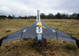
Safety First: Using Small Drones to Map Unsafe Sites
Traditionally, photogrammetry based on aerial images and stereo plotting, has been the realm of large mapping companies capable of affording the onerous ownership of planes and the high personnel cost of pilots, navigators and camera operators. The equipment used to convert the stereoscopic pairs into contour line maps cost hundreds of thousands of dollars and...
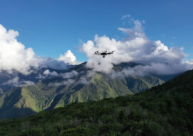
Geospatial Adventure: Mapping Ruins from Above in Peru
It wasn’t quite an Indiana Jones adventure, but Alabama-based lidar consultant Robert Graham says it’s as close as he’ll ever come to the hair-raising exploits of an audacious archaeology professor. Graham’s adventure last April did not revolve around an ark, though it did include ancient ruins, small planes landing in grass fields, machetes hacking through...
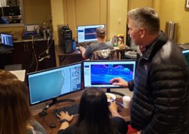
Army Corps’ (JALBTCX) data improves coastal projects
In a hotel conference room on Long Island, New York, a team of experts is processing data and information on computers. Alongside them is a large display monitor that is projecting the information. The team is the Joint Airborne Lidar Bathymetry Technical Center of Expertise (JALBTCX). “It’s a beautiful thing. On the screen they are...