Category Archives: Aerial/UAS
Why renting a UAV may make sense
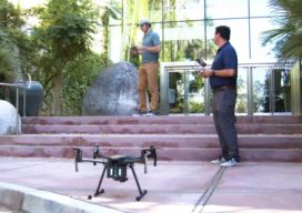
I have a land surveyor client who’s interested in getting on the UAV train. But like many, he’s concerned with the financial outlay and not quite certain if the UAV path is the right one for his firm. His main concern: Will he be able to fully utilize and monetize the investment? That’s why I’m...
Esri UC 2020 – Site Scan Drone Mapping Solution
Esri has announced Site Scan for ArcGIS—an end to end solution for UAV data capture. This year, at the User Conference, there was a buzz around drones (see what I did there), a rumor was going around that a new drone solution was being announced. Sure enough, during the plenary, Jack Dangermond, Esri co-founder and...

xyHt Weekly News Links 7/17/2020
*Click here to visit xyHt’s Virtual Trade Show* Congress Moves Against FCC’s Ligado Decision Bad Elf Flex™ Adopts the Hemisphere Phantom™ Module Honeywell Refines Navigation Revealing the World from Satellites Common Ground Alliance Launches New Expo
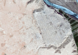
Antiquities Trafficking and the Surveyor: How Mapping is Keeping History Public
Conflicts around the world are often funded by the sale of drugs, guns, diamonds, ivory, and antiquities. Often these cultural relics stolen from home countries are purchased unwittingly abroad. One organization is hard at work to alert buyers and the art market about this growing problem, using maps to broadcast the stories of missing artifacts....
Ground Control Points as a Service?
Ground control points for aerial, satellite, and UAS imaging and remote sensing projects, large and small, can be downloaded on-demand—what a service! We look at an example service, and link to an upcoming webinar of the subject. With cameras pointed at Earth from hundreds of cubesats and tens of thousands of UAVs, in addition to...
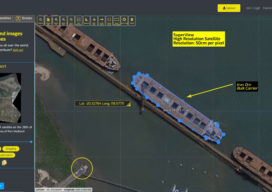
An Aerial/Satellite/UAS Image “Swap Meet”?
Australian firm Soar has been growing an interactive portal that is like a sophisticated Dropbox-eBay-Google Earth mashup where you can buy multi-platform imagery and maps from global and local resources. And, on Soar, you can post your own aerial and UAS images for resale. They’ve just added access to imagery from the SuperView satellites—50cm resolution...