Category Archives: Aerial/UAS
New Heights: Aerial Photography, Aerial Data
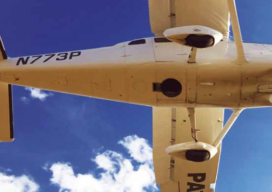
A Louisiana company upgrades its aerial photography camera hoping its business will soar Featured image: Looking up into the belly of a Cessna 206 airplane. The camera is looking down through the hole. Infrastructure like bridges (this one in Tampa, Florida), airports and oil and gas pipelines require regular aerial mapping for maintenance, installation and...
Launching the Future (of AEC)
Derek Baxter answers on how high-precision UAS mapping enables workflows for the future We’re coming up on nearly a decade of professional and pro-sumer small UAS applications for AEC and other industries. You’ll find a UAS in the toolboxes of many surveying, construction, and engineering teams, which do not give a second thought to launching...
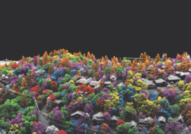
Fusing Data on Doomed Ash Trees
By using fused data gathered with lidar and hyperspectral imaging, a geospatial services company helped a large utility to identify 90% of ash trees with the potential to fall into their power lines—in a timeframe that wouldn’t have been possible without the use of remote sensing. By Ian Berdie, Zach Raymer, and Mia Chen Remote-sensing...

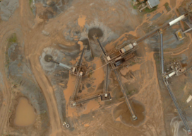
Lidar vs.Wildfires in Southern California
After the 2018 wildfires in Southern California, lidar data was collected to enable risk-mapping assessment and planning, to identify fuel-load reduction programs, and to escalate the emergency assessment of post-fire debris flow hazards. Featured image: This lidar image was taken over Lake Casitas, California. The data are clear: Natural disasters are on the rise, and...
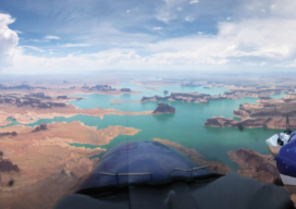
Aerial Surveys Weathering Corporate Consolidations
How Aerial Surveys, an independent aerial photogrammetry company, survived the wave of consolidations and continues to grow. Featured image: An Aerial Surveys International aircraft flies the Colorado River in Utah. Aerial Surveys International (ASI), based in Watkins, Colorado, provides aerial photogrammetry services using digital mapping cameras, film cameras, and lidar devices. It has remained independent...
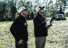
Drone Surveying in the Ozarks
Crafton Tull, an engineering and surveying firm, was tasked with the daunting job of surveying up to 160 acres to collect data needed to design a new road through the heart of the Ozarks. Professional surveyors can face intense challenges—especially when they need to complete large, complicated jobs in dangerous terrain. That’s the situation that...