Category Archives: Aerial/UAS
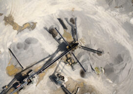
Add a Drone to Survey Fieldwork
Innovative drones offer a fast, accurate option for large-area survey data collection Since the first use of drones for commercial purposes in 2006, the drone industry has rapidly gained momentum and introduced new capabilities to serve a wide range of applications. Surveying and mapping projects pose unique challenges due to the importance of accuracy and...

Watching Rotterdam (and More)
What are drones doing Inside Europe’s biggest ports? Doing what they do best, of course, which is to fly. After years of test flights, authorities at the Port of Rotterdam in the Netherlands have given the go-signal to integrate UAVs in its operations, making it the first in Europe “to organize its own airspace...
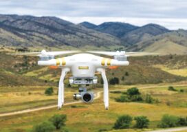
The Future of Aerial Photogrammetry
Rapid advances in technology are changing the way we map from the air, but the 100-year-old technology of mapping by crewed airplanes will continue to fly into the future For thousands of years cartographers made maps using tools that mostly measured angles and distances, allowing for positioning of fixed objects over unknown topography. The earliest...
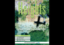
xyHt Magazine Heights 2023
Click on the cover to view the Heights 2023 supplement to xyHt magazine. Articles in the issue include: From Nadir to Oblique: From traditional airplanes to new-fangled gyroplanes, we take a look at several aspects of the aerial geospatial technologies that just keep getting better. The Future of Photogrammetry: While UAVs continue to emerge as aerial mapping vehicles, there...
Sponsored Content: Revolutionizing Utility Mapping in North America
As many of you already know, inaccurate utility locational data is one of the main causes of utility strikes. In 2021, this has led to an estimated $30 billion societal cost due to delays and damages in the USA alone, according to The 2021 Damage Information Reporting Tool (DIRT) Report released in October by the...
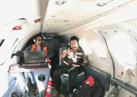
Safety is Paramount in Aerial Drone Mapping
As the Federal Aviation Administration (FAA) prepares to release its ruling covering uncrewed aircraft flights beyond visual line of sight (BVLOS) in the National Airspace (NAS) the entire industry is holding its breath preparing for a new era of certainty and expansion. Aerial photogrammetry will be one of the immediate beneficiaries of this new policy...