Category Archives: Hydro/Marine
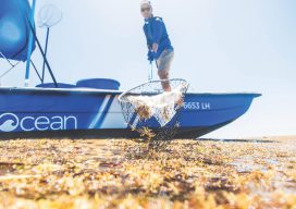
Plastic Islands No More
4Ocean uses geospatial technology to clean oceans, helping to reduce and reimagine plastic waste. The mess is big enough that it can be seen from outer space. These days, satellite imagery reveals massive islands of plastic in oceans, and the waste is so vast that various groups and inventors are trying to combat the problem...
Robotics Above, On, and Underwater
Demo-ing Drones at UAS Colorado’s “Robotics on the Rez” Event In the September 10th issue of Pangaea we talked about Future Prepping: getting ready for the next generation of geospatial technology. I’d like to add another educational resource to that list: product demos. Product demonstrations are a great way to get a hands-on look at...
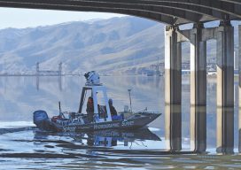
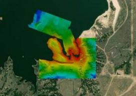
Clear Scanning on the Clearwater
Above: The survey included collecting bathymetric data on the river bottom and bridge substructure with multibeam sonar as well as capturing above- and below-waterline mobile mapping data with the Leica Pegasus: Two mobile sensor platform. Two well-paired engineering firms used high-accuracy mobile mapping to combine bathymetry and lidar data for a fast-turnaround topographic survey of...
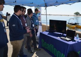
Our Changing Oceans and Coasts
Students watch a pier demonstration—back row, l to r: Clayton Harbin, Troy Peterson, Max Crowe, and Jack Jamieson from NW Michigan College and Casey O’Heran from University of New Hampshire. In front is JT. Myers, an ocean engineer at Seafloor Systems. Highlights from the U.S. Hydro 2019 Conference The U.S. HYDRO 2019 Hydrographic Society of...
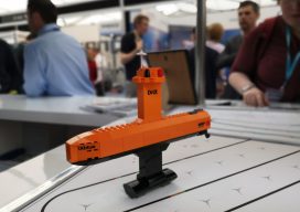
Ocean Business 2019
With preliminary surveys already starting around the coast of the UK for another round of wind farms being built, the offshore industry descended on the National Oceanographic Centre in Southampton, UK for the bi-annual event, Ocean Business, centered around the offshore survey industry. Luckily, my home is a walk away from the event, so I was more than happy...
Emily Tidey
Lecturer, Hydrographic Surveying, Otago University Dunedin, New Zealand We received a record number of nominations for geospatial professionals in New Zealand this year—and all were women! While difficult to choose from among the candidates, Emily Tidey stands out as an educator and specialist in the essential (but often overlooked) surveying discipline of hydrographic survey. Maritime...