Category Archives: Surveying

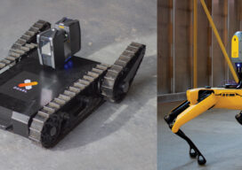
Drones in Confinement
From warehouses to underground facilities, demand for drone inspections in GPS-denied places is rising. The new flying destination for UAVs is the great indoors.

Big Man Boone
Daniel Boone was a man. Yes a big man. With an eye like an eagle and as tall as a mountain was he. Daniel Boone was a man. Yes a big man. He was brave, he was fearless and as tough as a mighty oak tree. From the coonskin cap on the top of ol’...
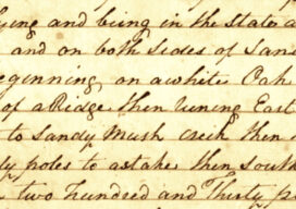
Filed vs. Recorded Documents
Many states have supplemental, or ‘alternate’ storage systems for filing survey maps that are separate and distinct from the real property records overseen by registers of deeds. While these secondary resources are of great value to surveyors and other land use professionals, their limits should be clearly understood. Whether housed in the county surveyors office,...
Innovations in AEC
I’m sure it feels the same in every industry – sometimes there are just too many acronyms to keep track of: AEC, LiDAR, VR, BIM, 3D, 4D, 7D – the list goes on and on for AEC professionals.
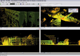
The Early Days of 3D Scanning: Part 10
In my previous article (March 2021) within my series on the Early Days of 3D Scanning, I described start-up Cyra Technologies’ significant preparations to try to secure a major, strategic vendor partner in order to take the company’s pioneering 3D scanning technology to the next big step of global commercialization.
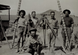
You Can Take the Surveyor Out of the Field, but….
I would speculate that very few individuals who have made a career out of land surveying started the path by saying “I really want to be a surveyor and sit at a drafting table or behind a computer all day.” Even if we started in the office, as I did on a drafting board, we...