Category Archives: Surveying
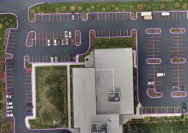
Tackling the Aerial-to-CAD Bottleneck
Aerial capture is getting easier and faster, but the subsequent step of CAD linework generation is a bottleneck—especially given the present shortage of qualified drafters. AI is stepping in to help. In 2017, the co-founders of what would become AirWorks Solutions Inc. first met and began discussing ideas for a new geospatial venture. Both had...

Boundary by Acquiescence
Legal Boundaries This time around we have a question from a Georgia reader about the doctrine of acquiescence and applying it to an existing fence that does not match the deeded measurements. Question: In the case of a line of acquiescence with an existing fence that has a history, would I...
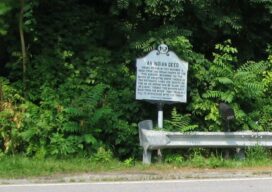
Dangerous Dargan and an Old Indian Deed
Sponsored by Xponential With apologies to both the residents of southern Washington County, Maryland, and to the Native Americans; this title reflects an old, somewhat derogatory term for an area, and the title of a sign placed by the Maryland State Roads Commission in that same area. As I was driving along Harper’s Ferry Road...

Three Critical Skills of a Land Surveyor Expert Witness
By Tony Nettleman (Part Two) Serving as an expert witness and testifying in court is enjoyable, fulfilling, and a great supplemental offering within your land surveying practice. While providing these services for the previous 20-plus years, I discovered three critical skills that will aid the surveyor in being the best expert witness they can be. ...
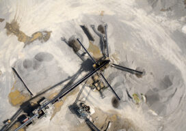
Add a Drone to Survey Fieldwork
Innovative drones offer a fast, accurate option for large-area survey data collection Since the first use of drones for commercial purposes in 2006, the drone industry has rapidly gained momentum and introduced new capabilities to serve a wide range of applications. Surveying and mapping projects pose unique challenges due to the importance of accuracy and...
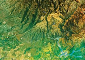
Teaching the Ethics of Geo
Maps have always been powerful means of communication, whether etched in cave walls, stone, wood, silver of centuries past, or, in the 20th Century, copper plates and, later, film. In our own century, maps are everywhere—on our phones, computers, fitness apps, and news media, communicating in a myriad of ways about changes over space and...