Free Aerial Lidar, Renewable Energy, an Infectious Mentality
At the intersection of renewable energy, big data analysis, geospatial technology, and public data availability stands the Minnesota Solar Suitability Analysis project. Primarily manned by students in the University of Minnesota Master’s of Geographic Information Science program, the project’s goal is to provide a blanket solar insolation analysis for the entire state of Minnesota. As far as the team is aware, it is the only project of its scale in existence (similar studies have been limited to metro areas or focus on rooftop insolation).
Minnesota’s statewide aerial lidar coverage and its free availability made the project possible, as well as current and developing geospatial trends in Minnesota that seek to make the most of these fields. This project also has higher implications for the spatial and renewable energy communities through its methodology, implementation, core goals and values, and intended audience.
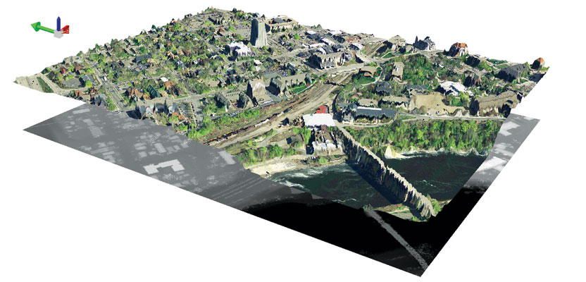
Minnesota is one of the few states with complete lidar coverage; the technology was initially adopted to track flood plains but has mushroomed in potential and uses throughout the state at both small and large scales. The blooming nature of lidar analytics suggests that the future collection of multiuse big data can only further spur the creativity of the geospatial community.
From a standpoint of renewable energy, lidar data allows for an incredibly detailed, conclusion-driven analysis for solar and wind products in Minnesota that has all been remotely sensed. This saves time, money, and manpower and would certainly not be possible through previous remote-sensing means.
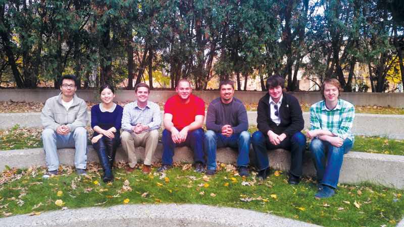
Team members (left to right): Yiqun (Ian) Xie, Yuanyuan Luo, Devon Piernot, Christopher Martin, Andrew Walz, Christopher Brink, Andrew Munsch. Previous members not pictured: Ben Gosack, Michael Moore, Molly McDonald, Stephen Palka.
However, the sheer size of the data is daunting. The Digital Surface Model (DSM) and solar analysis, derived from the lidar point clouds, are broken into 220,165 one-square-kilometer tiles and processed and then pieced together again. Initial estimations indicated that the processing required would have taken roughly five years to complete if run on a single computer. However, through the clever (and harmonious) use of spatial software, a parallel processing workflow was created to overcome these challenges and process the entire state quicker. The workflow used the Minnesota Supercomputing Institute’s High Performance Computing resources as well as virtual machines and entire labs of desktop computers. The result is an unprecedented insolation analysis and output of every square meter in Minnesota.
While overcoming the hurdles of big data manipulation and analysis is challenging, applying the outcomes to useful, accessible products may be the true pièce de résistance of the project and is a growing trend in the Minnesota geospatial/renewable energy fields. The goal is to create products that are useful to a wide audience: from experts to families and businesses interested in accessing renewable energy. The most recent work has centered on creating flexible websites, user interfaces, and applications of the results as well as sharing the resources used during the analysis. The tools are developing past broadly assessing if areas are ideal for solar energy to a multi-function analysis product with detailed outputs that could eventually replace or augment on-site assessment.
By making the products freely available, we can facilitate the best applications of the results and and allow for the most good to be done with the data at hand. In this regard, the project continues the tradition of freely available data and is transparent through every step of the process from data manipulation to results and outcomes.
This openness is an infectious mentality that has led to the growth of the project, directing future workflow development and inciting passion in the team members and adopters. The team hopes that future renewable energy products in Minnesota will adopt a similar methodology to its deliverables.