
Two tech giants embark on a collaboration and education outreach.
At June 2015’s HxGN LIVE (the annual user conference for Leica Geosystems and other divisions of Hexagon), we spied something rather surprising: an Autodesk booth. What’s more, someone at the booth was using Autodesk software for construction layout on a consumer tablet, driving a Leica Geosystems robotic total station. An attendee commented, “That’s a gutsy move.”
As we look deeper into the details of this collaboration between Autodesk and Leica Geosystems, we find that it makes a lot of sense and represents opportunity for professionals in the construction industry. This pairing is not a one-time speed date; a long-term relationship is being established.
There have always been collaborative efforts between various geospatial manufacturers and solutions’ providers, usually limited to data formats for transfer rather than interoperability of hardware and software. We sought Ken Mooyman, president of Hexagon Geosystems NAFTA (the North American division of Hexagon that includes Leica Geosystems), for his insights on the collaboration with Autodesk.

Ken Mooyman, president of Hexagon Geosystems NAFTA
A note about Mooyman: A meaningful contributor to mainstreaming the revolutionary technologies of GPS and scanning (Leica users refer to this as High Definition Scanning), he spent the early part of his career as a field surveyor working his way through the ranks. He knows the workflows, and in his field days had to struggle with the inefficiencies of legacy solutions, so he is passionate about new solutions.
“We recently made three announcements about this collaboration with Autodesk,” said Mooyman. “One announced that we are looking to work closely together as two companies trying to make a difference in the construction industry [in general], and then we made two announcements about specific solutions” (read on).
For many end users, the general impression of the successful “big-geo” companies is that they have spent many years developing in-house solutions for complete workflows, and it is mostly possible to map, design, build, and operate within one brand. What brought Leica Geosystems and Autodesk into this cross-pollination? As Mooyman noted, it was a mutual interest in doing something about challenges in the adoption of such technologies in the construction (including BIM) markets.
“We both felt that we could do things to improve workflows and encourage adoption of scanning before design, during construction, and during layout for construction,” said Mooyman. “These technologies are so helpful and beneficial but the adoption is still relatively slow; we believed we could come together, since we had this common value, to foster these changes.”
Mooyman pointed out that the mission statements of both firms have a lot of commonality and that there was an understanding in working out the details once they agreed to collaborate. At this point in the collaboration, they have decided to focus on two common choke points in AEC design-construction workflows and how to reduce data loss, time and costs for each: field-to-model and then model-to-layout.
Will there be more to come? Mooyman replied, “Because the collaboration was born of the needs of the market, it is definitely not unreasonable to think that we are going to expand this or make further announcements around other integrations to help the construction industry move forward.”
There is a universal challenge when it comes to adoption of new tech and solutions: end users are set in their ways and averse to risk, and it may be disruptive to change gears mid-stream. However, the technologies and solutions exist, and when people do make the leap and implement, it is easy to demonstrate how they can speed up production, increase efficiency, and enhance safety.

Point clouds from the Leica ScanStation P16, optimized for construction environments, now port seamlessly into Autodesk’s ReCap suite for design and BIM.
As Autodesk senior VP Amar Hanspal put it, such collaborative elements can “put the latest technologies in the hands of the users, but also the latest and most accurate information at every step of the construction process.” He adds, “This can streamline the construction process and get rid of erroneous data, wasted time, and lost productivity.”
Another stumbling block to user implementation of new tech and solutions is misconceptions about how difficult it would be to implement—and some users don’t realize there are newer options. When it comes to scanning and BIM, people imagine the workflow of high-end scanning from the days of slower hardware, software, and processors and a premium placed on operator experience. Not so anymore. More fit-for-purpose solutions are available even at the entry level.
Mooyman explained that the workflow pairing Leica Geosystems’ sensors with Autodesk’s software is suited to many BIM and construction applications. He added, “It made a lot of sense; so much of [AEC] design is done with Autodesk software that we really do need to find ways to send the data to the software in a simple and smart way. This is Autodesk software interacting with the best sensors in the world—it is more than just data flow.”
Reality Capture
BIM and AEC design benefit from data-rich environments. More data—complete and accurate data—makes for better design and management decisions. The Leica ScanStation P16, introduced in April 2015, is a powerful but simple and affordable scanner; it offers “one button operation,” even operation from a mobile app. Now scan data from the P16 can be imported natively into Autodesk ReCap—a family of solutions for processing and working with 3D point cloud data and imagery.
A free utility converts point cloud data to .rcs format that can be read by any Autodesk software (from 2014 versions forward). For images, ReCap 360 is a web-based service that converts images to point clouds, and ReCap Ultimate allows you to register points clouds from practically any images or scanner. (To learn more about ReCap, see xyHt’s December 2014 issue interview with Autodesk’s Dominique Pouliquen.)
Mooyman points out that Leica Geosystems has long been a leader in scanning and offers complete workflows. Adding Autodesk elements for certain applications is a plus. “For survey-grade, scalable point cloud management, the Leica Cyclone software, along with the CloudWorx point cloud tools, have been and will continue to be the industry standard.”
He adds, “In the construction industry, however, general contractors and subcontractors rely heavily on Autodesk solutions for modeling and, increasingly, simple point-cloud utilization across entire teams. Creating a seamless interface between an easy-to-use, push-button ScanStation, which is the ScanStation P16, and the most commonly used Autodesk tools, which include ReCap, Revit, AutoCAD, and Navisworks, give customers the best of both worlds: high accuracy and reliable scanning with streamlined workflows. Also, because the Autodesk software is used by many downstream consumers in the construction process, it extends the use of point clouds further. This will help make point cloud data available to more users, which helps to increase adoption of these efficiency-driving technologies in the construction industry.”
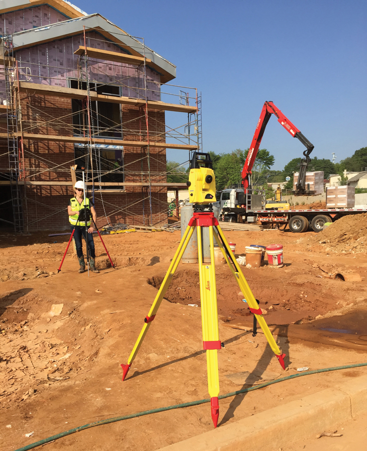
BIM Layout and Robots
A tremendous amount of effort goes into best practices for engineering design, for AEC, MEP (mechanical, electrical, and plumbing), and BIM. Good design and modeling can yield substantial benefits in energy savings, rapid construction, structural integrity, and ease of operations and maintenance. But, unless the layout step can be performed efficiently, on schedule, accurately, and without losing fidelity to the design or model, these benefits can be lost, and, worse, unforeseen errors can levy a heavy cost. It has been a long-standing universal goal to be able to remove the gap between the design/model and layout.
Another workflow improvement offered by this collaboration addresses BIM-to-field layout. Designs and models created or edited in Autodesk AutoCAD, Civil 3D, Autodesk Revit, and Autodesk Navisworks can be easily laid out in the field using the Autodesk BIM 360 Layout iPad app, and this can directly drive a Leica iCON robot 50 total station. To further close the gap between design/model and layout—“office” and “field”—the BIM 360 Layout app uses points created in Autodesk Point Layout (from said designs and models) that can be pushed into the BIM 360 Glue cloud service, although direct transfers are available to work off-
line in web-challenged areas.
Like with the reality-capture collaboration, users have multiple options to suit layout tasks of differing types, scope, and environment. Mooyman explained, “The Leica Geosystems robot with iCON software has been very well received; it was specifically developed for construction layout. If a customer is in a high-production environment doing layout for things like roadways , high-volume MEP hangers, or large, complex building structures, we absolutely believe that the iCON software and tablet are the way to go.
“However, if it is more of a BIM management process, where connecting the office and the field for construction has been a challenge, the integration of the iCON construction robot and the BIM 360 Layout app and BIM 360 Glue provides more of a seamless workflow. It allows you to extend the model to field and pull the accurate layout points directly from the model. It also opens up more possibilities for BIM and virtual design and construction departments to perform back-checking using the same instruments as the production layout teams. These capabilities broaden the use—and benefits—of accurate layout technology throughout the construction process.”
Construction-geared Education
In addition to the two specific collaborations in workflow, there is an educational element, which, as Mooyman emphasized, “the two firms spent just as much time developing as the product-based solutions. [It’s] an agreement to do a strong educational process and focus in the construction market.” The collaboration has a jointly developed website: constructrealityxyz.com.
Consider two of the educational publications found in the website’s Learning Center: “When to Use Laser Scanning in Building Construction: A Guide for General Contractors” and “Streamlined Construction Layout: A Contractor’s Guide to Saving Money and Dramatically Reducing Layout Time.” These publications are handy generic primers on the various tools used for reality capture and layout for BIM and construction, covering topics such as cost benefits and when to choose a high-end or entry-level solution. Note that the publications are refreshingly not too salesy.
Office meets field: Autodesk’s BIM 360 Layout software, running on an iPad, is operating this Leica iCON robot 50.
One of the co-authors of the latter guide, Autodesk’s Zach Crumal, demonstrated for us at HxGN LIVE the Autodesk BIM 360 Layout app he ran on a consumer tablet operating a Leica iCON robot 50. I am struck by the ease of use and smooth workflow afforded by such apps (compared to various surveying data collector software from back in the day).
We asked Mooyman about the influence of mobile devices and apps on data collectors and software. “When I think of consumer trends in 3D visualization, mobile computing, big data, crowdsourcing, simple and exciting user interfaces, and self-learning software, we see these trends moving into the professional space, and this is exciting for our industry ,” he said.
“The next generation is playing video games that already have geospatial reality in them—realistic 3D spatial relationships—and their technology expectations are greater. The way mobile apps tend to focus on easy wayfinding just like in the game interfaces—this is absolutely influencing our solutions.”
Just in Time Construction
There is also more pressure now to streamline and automate; that brings the potential for efficiency. But, as Mooyman explains, the processes have to be smarter, especially if there are simpler interfaces. “The reality is that construction teams have to accomplish more with less . To be successful you have to be faster, do more, and also use resources more efficiently—that is just business now,” said Mooyman.
“We hear from a lot of construction firms that describe their target as lean construction, much like lean manufacturing. In fact, we hear many of the same terms in construction now as we do in manufacturing, like just in time construction. I know this is something your magazine has been talking about for some time, and Hexagon has been looking at this as well. To do all this, to run these types of construction projects like a manufacturing process, does require more automation.” Mooyman cautions, “At the same time, more automation requires more quality and reliability—that really becomes paramount .”
With such demands, new solutions are developed, and collaborations like Autodesk + Leica Geosystems provide us with even more options: solutions with a closer fit to purpose. Equally important is the education component of the collaboration: users and clients benefit when the right solution is applied appropriately. More … we’d like more …
Ken Mooyman talks more about apps in a later issue.