A team of U.S. surveyors visited Ecuador to use real-time PPP to pay homage to the 18th-century “Geodesic Mission to the Equator,” one of the most difficult and significant missions in the history of surveying and geodesy.
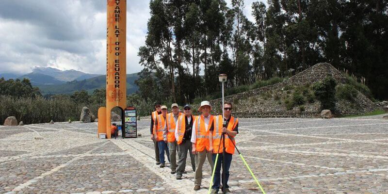
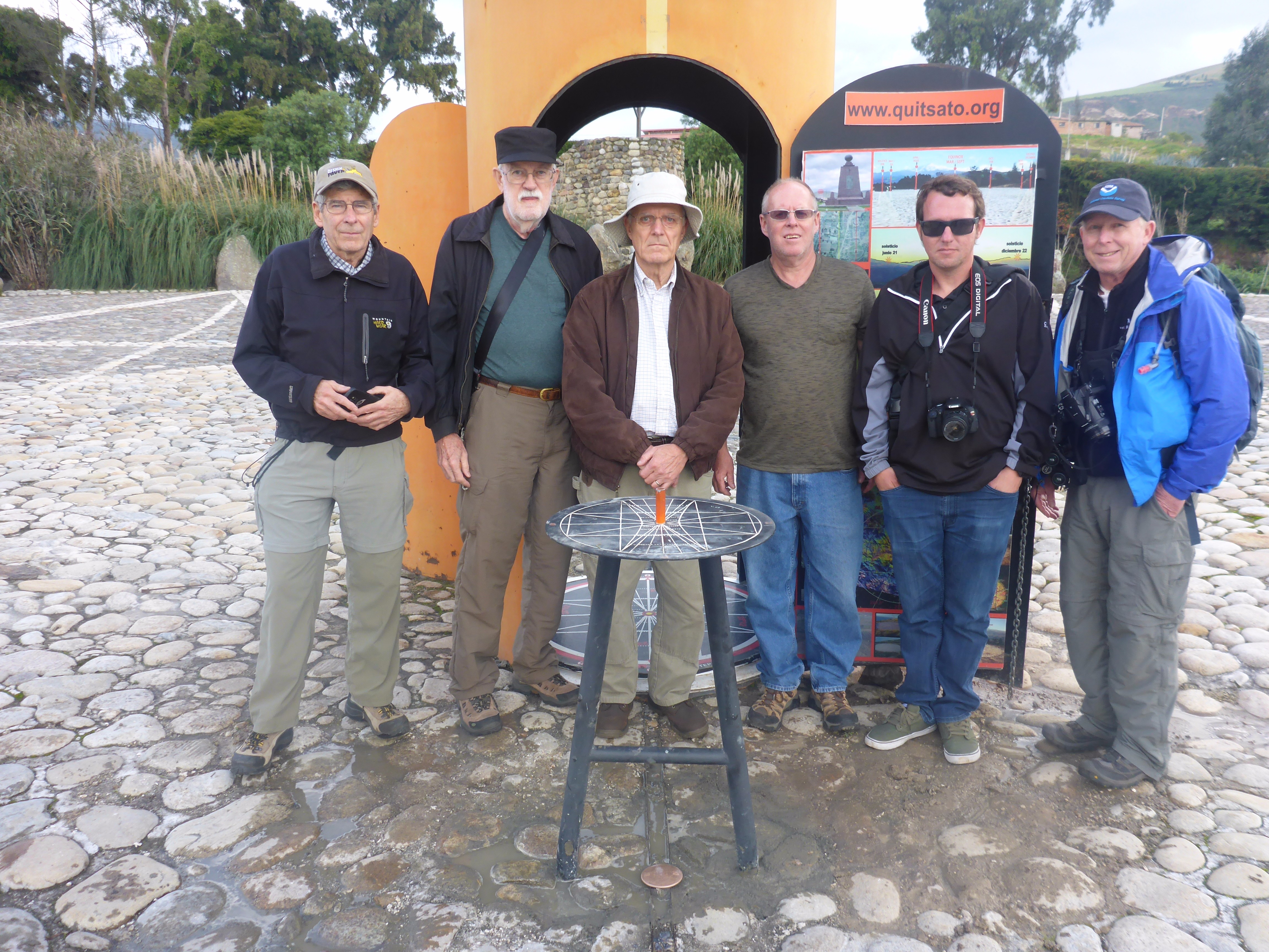
Pictured above: The team of U.S. surveyors on the 2017 Ecuador visit (from back to front): Rich Leu, John Hamilton, Ken Bays, Mark Armstrong, John Minor, and Joe Nunes (holding the Hemisphere S321 used for the commemorative survey). The team poses on the Equator at the Quitsato Sundial. Credit: Joe Nunes.
It is truly amazing how much the imaginary lines humankind has created to define the shape of our Earth have in turn served to define the physical manifestations of civilization and given form to the geospatial component of our imaginations.
Philosophers, scientists, explorers, adventurers—and eventually those who would be labeled “geodesists”—have sought for millennia to understand and define the true shape of the Earth. In the history of this quest one chapter stands out as the birth of modern geodesy. The 18th-century French/Spanish “Geodesic Mission to the Equator” was undertaken to provide the key measurements needed to resolve contentious debates on the shape of the Earth.
The mission was, in many ways, the single-most ambitious and difficult feat of geodetic surveying of its age. It was also the first truly international scientific mission and yielded significant discoveries far beyond the original charter.
The Geodesic Mission features prominently in the history of (and is celebrated in) Ecuador, a country named for the most famous of these imaginary lines. In May 2017 a small, informal “mission” of surveyors from the U.S., inspired by the Geodesic Mission, visited the capital of Ecuador, Quito, to tour sites of geodetic interest. To mark the occasion, the team performed brief observations and set a commemorative monument in cooperation with local parties.
Education was a key motivation for the 2017 mission. Potential entrants into the surveying profession and the science of geodesy must contemplate imaginary lines, esoteric conventions, and principles that might at first glance seem abstract or even absurd. The example of this 2017 team can be emulated by other groups of surveyors, in particular surveying students or even high school groups that can become immersed in the rich surveying and geodesy history of the region.
The Equator might be an imaginary line, but as the history of grand adventures like the Geodesic Mission (and this humble 2017 mission) reveal, what this line represents and its impacts on our world are real.
A Ripping Yarn
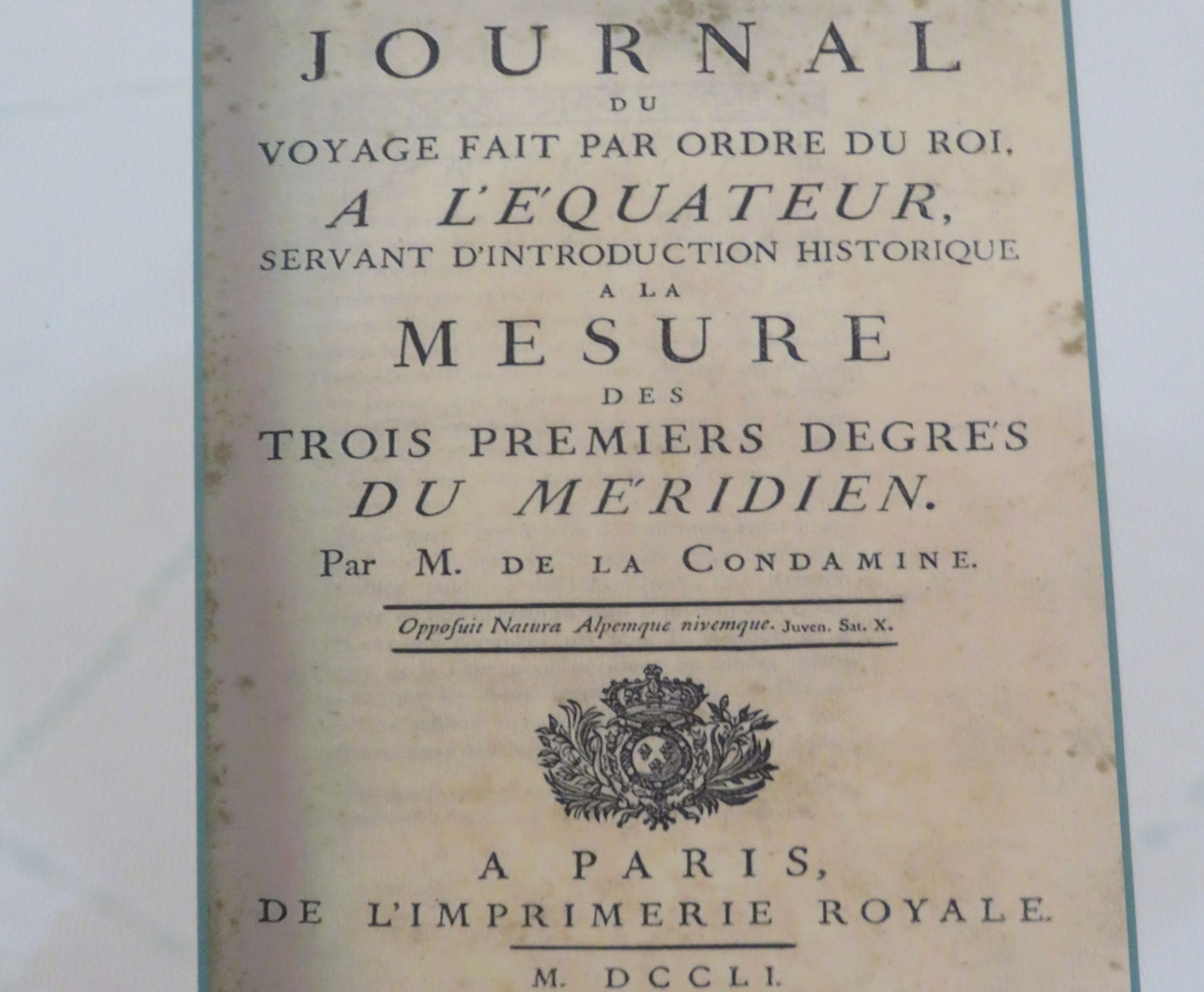
John Minor, PLS, a noted Oregon surveyor who recently retired, read a modern book examining the 18th-century Geodesic Mission to the Equator and was eager to compare notes with other surveyors on an online forum in mid-2016. I had read the same book, Measure of the Earth: The Enlightenment Expedition That Reshaped Our World, by Larrie D. Ferreiro, and several other books on the Geodesic Mission (cited by Ferreiro). We agreed: this book is one of the most fascinating reads—a must read—for surveyors and anyone else with an interest in geography and history. (See “Mission Géodésique à L’Équateur,” below.)
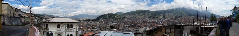
The U.S. team (right) overlooking Quito. Credit: Rich Leu. Click to enlarge, and see more photos from the team in the slideshow at the end of this article.
Minor floated the idea of a group of surveyors visiting Quito, with easy access to the Equator and the northern starting point of the observations for the Geodesic Mission. xyHt staff helped plan the mission and found sponsorship for the commemorative observations on the Equator. The National Society of Professional Surveyors (NSPS) approved the mission as educational outreach and for cultural interaction with the Ecuadorian surveying community and geodetic authorities.
We all decided to seek a location to install the commemorative brass disk as close to the actual Equator as possible and verified by observations performed by the team. Minor researched travel plans, sites of geodetic and general interest to visit in and around Quito, and local transportation, and he sought fellow surveyors interested in joining the mission.
Hemisphere GNSS, a producer of GNSS hardware and software solutions for surveying, agriculture, marine, and construction, tapped one of their field application engineers, Joe Nunes, to join the mission. Hemisphere provided the equipment for the commemorative observations (see the sidebar, “PPP and Atlas”), in addition to sponsorship such as the ground transportation for the day of the observations.
Berntsen International, a name familiar to surveyors as a leading provider of surveying marking systems, designed the stunning brass disk that would be set on the Equator and donated commemorative replica disks for the mission participants to present to key people on the trip. The disk features the flags of the U.S. and Ecuador and inscriptions that include the NSPS; The Central University in Quito (Universidad Central del Ecuador); and the IGM (Instituto Geográfico Militar, the Ecuadoran federal geographic and geodetic authority).
Joining Minor and Nunes on the mission was Mark Armstrong, retired National Geodetic Survey advisor for the Pacific Northwest, and Ken Bays, former land surveyor and geodesist with the BLM, then lead geodetic surveyor and technical manager of the Oregon real-time GNSS network.
Also joining the team was Rich Leu, a retired Iowa Department of Transportation surveyor and chairman of the Surveyors Historical Society which sponsors the annual Surveyor’s Rendezvous, and John Hamilton, a globetrotting surveyor from Pennsylvania who fit the trip into his busy schedule and was particularly welcome as the only participant fluent in Spanish. Coincidentally, John had been in Ecuador a few weeks before the trip doing volunteer work for Engineers Without Borders.
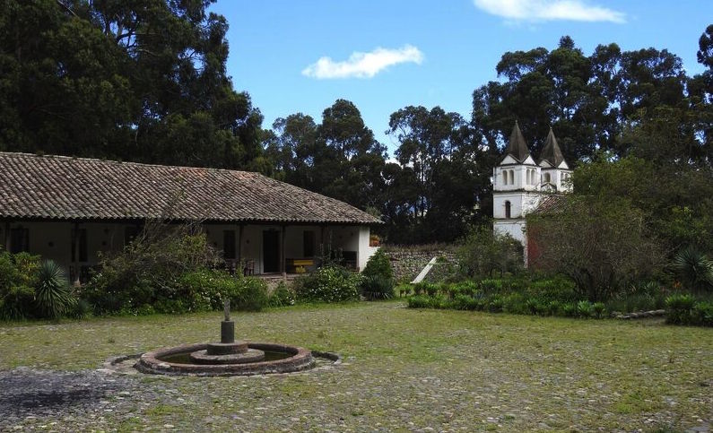
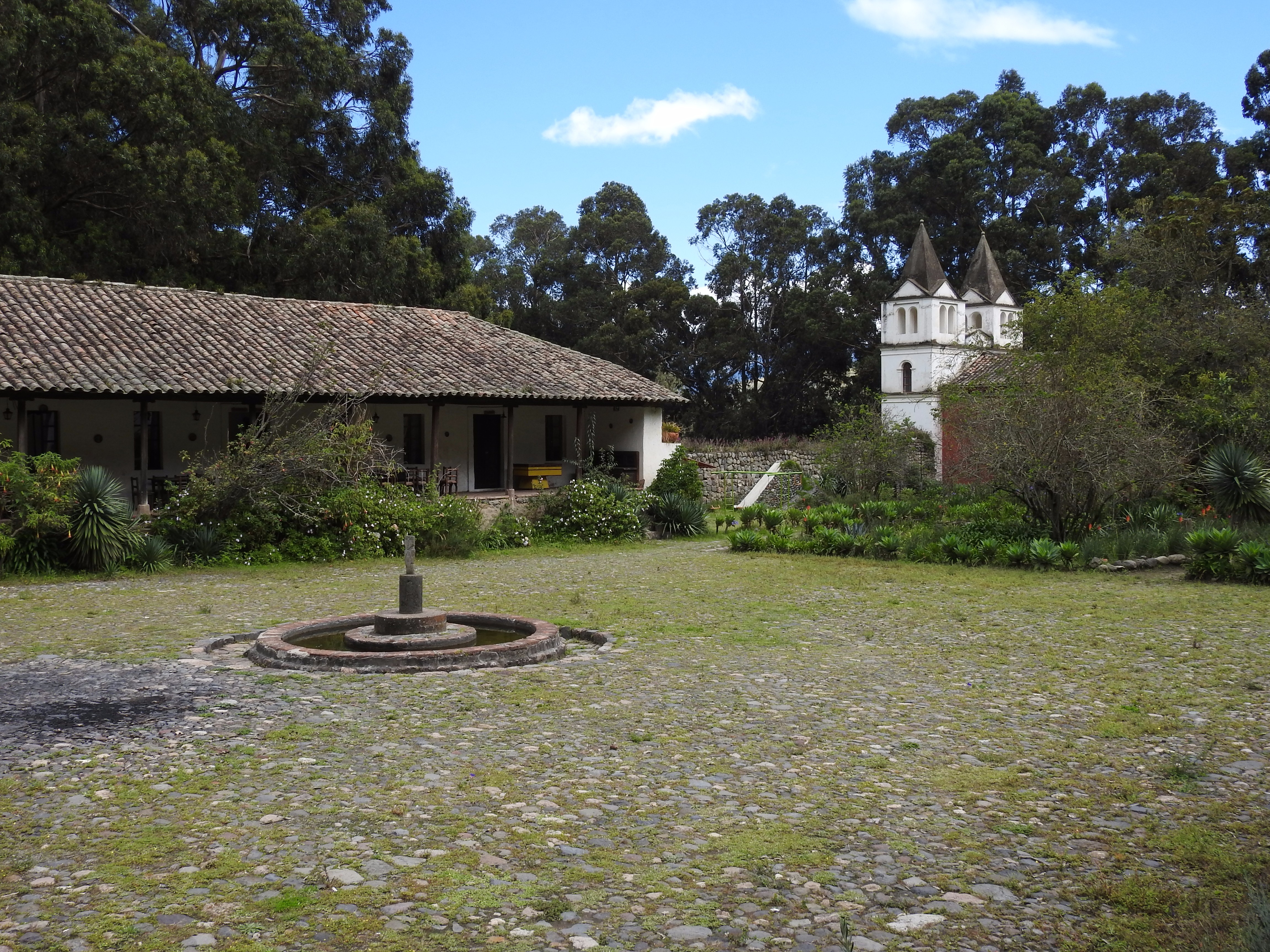
The historic Hacienda Guachalá, visited by the U.S. team, is the oldest hacienda in Ecuador (with some structures having been built in 1580). The 18th-century Geodesic Mission stayed at this hacienda early in their days in the Quito area.
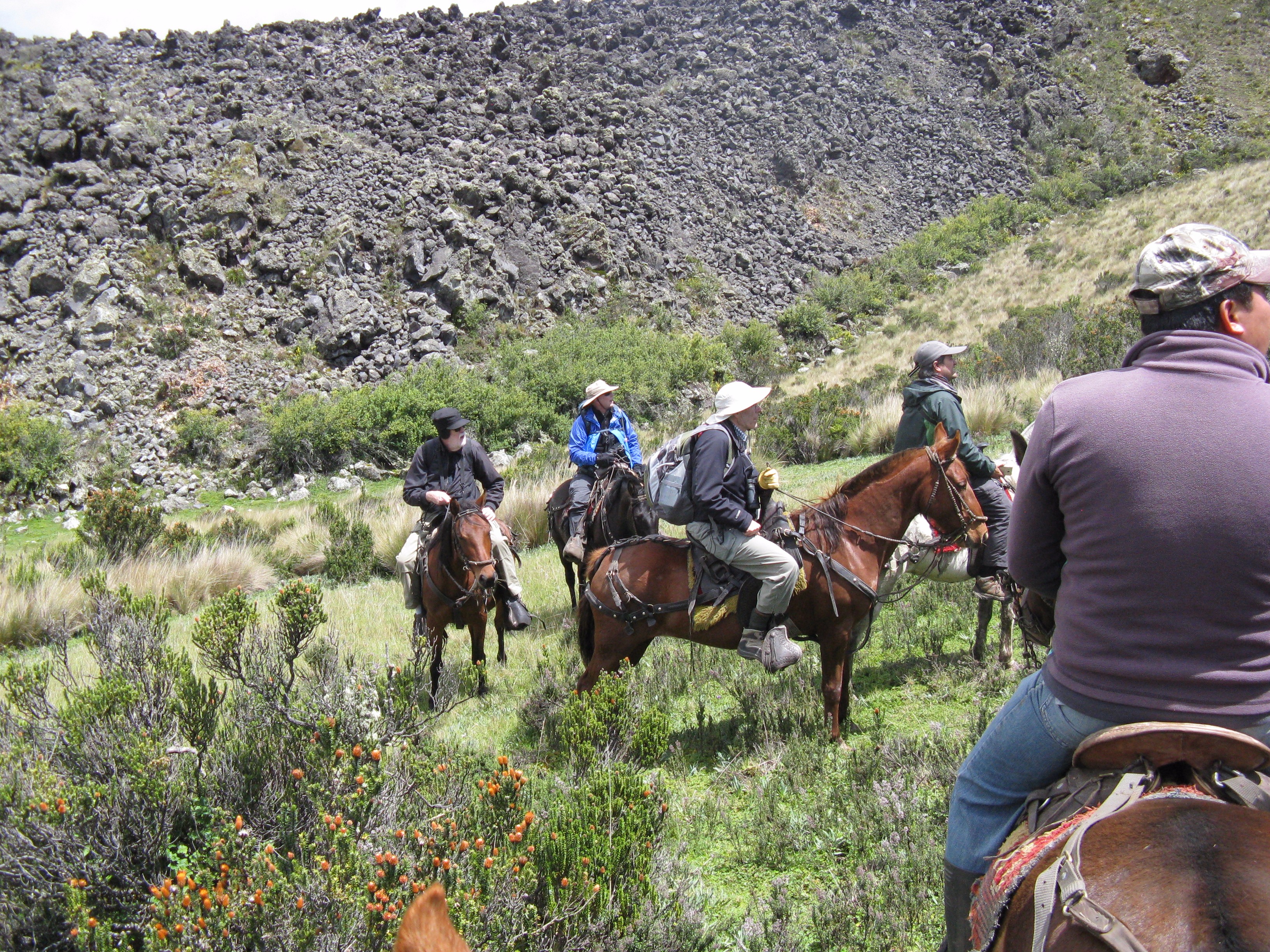
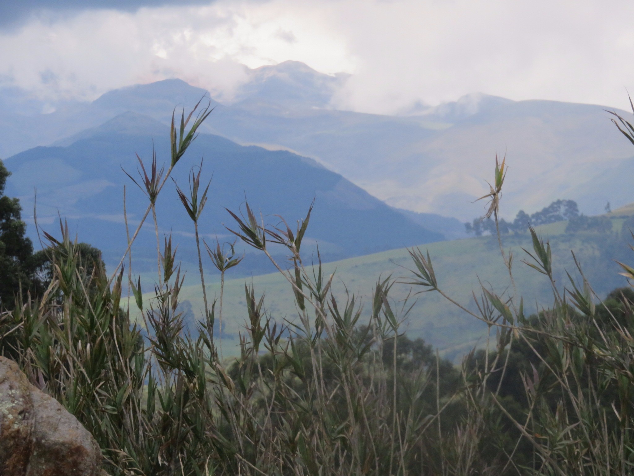
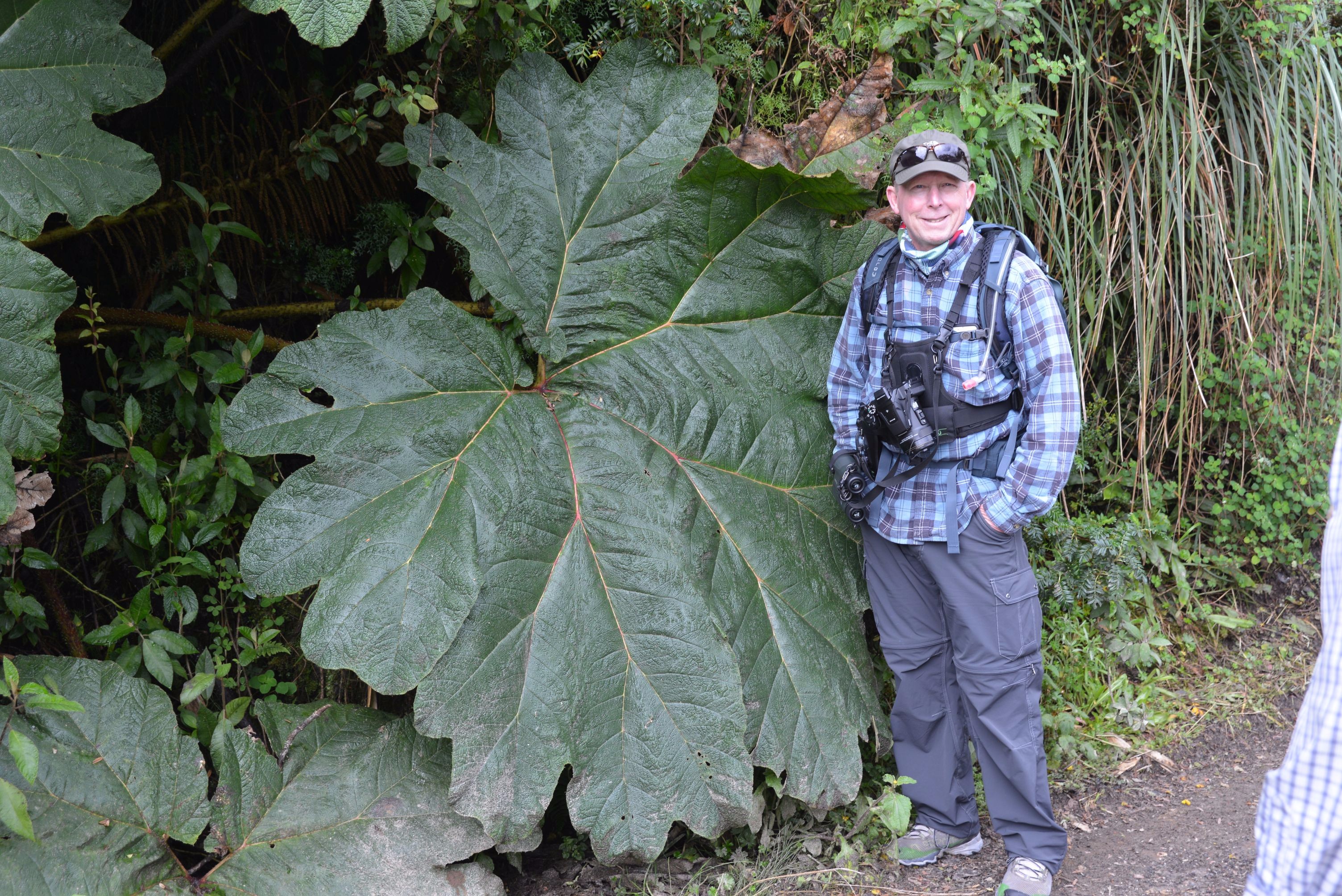
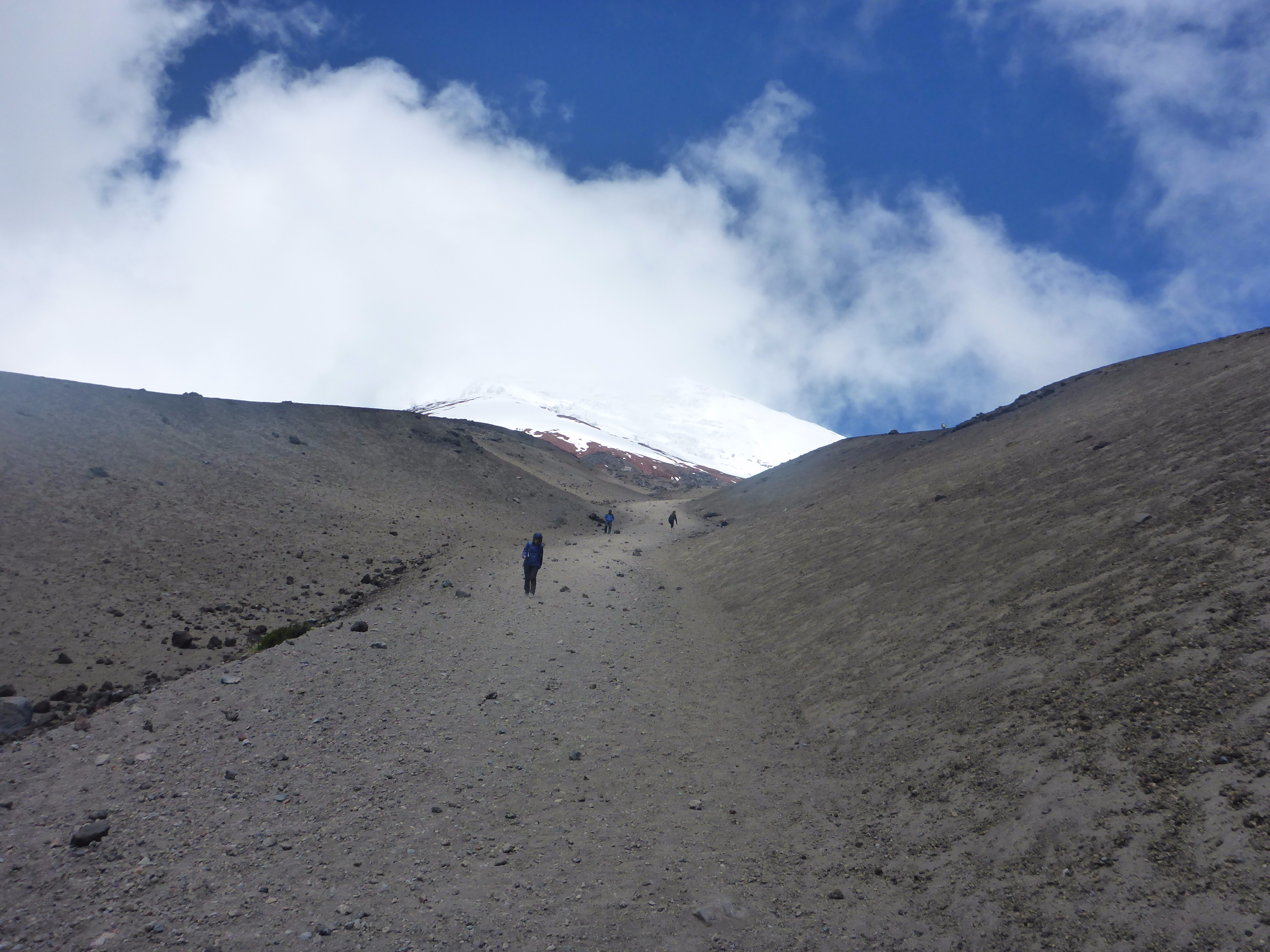
Minor had arranged several day trips and tours with the helpful Santiago Salazar of Neotropical Ecuador. These included sites of geodetic interest, a mountain horseback trip, a short “climb” on the iconic Cotopaxi volcano (featured in the original Geodesic Mission), as well as nature reserves. Mark Armstrong was one of the key birders of the team, and he marveled at the fact that there are more species of birds in Ecuador than North America and Europe combined, including more than 131 species of hummingbird.
Armstrong took thousands of nature photos, and the team even got to observe rare condors; currently there may be as few as 114 in Ecuador. Eco-tourism is a huge boost to Ecuador’s economy, and the subject is taught at the universities there. Several of Salazar’s guides, including Anna who accompanied the team on the Cotopaxi climb, are graduates of such programs.
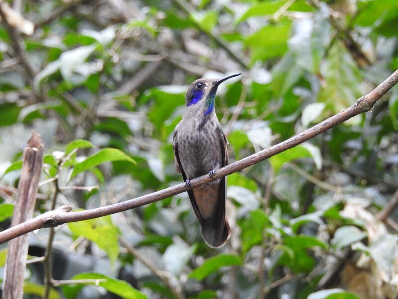
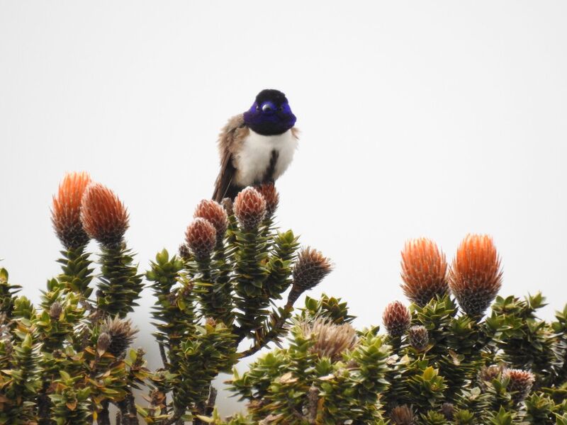
Ecuador has more species of birds than North America and Europe combined, including 131 species of hummingbird. Left: the Andean Hillstar (the only hummingbird that lives above 3000m. Right: a Brown Violetear hummingbird. Credit: Mark Armstrong.
Mission Géodésique à L’Équateur
In the early 18th century, the true shape of the Earth was a hotly debated subject, and an important one. Apart from considerations for science and astronomy, precision in navigation on the high seas was essential to success in trade and warfare; this drove the desire to resolve this matter.
There were two camps in the debate: the Cassinian (Cartesian) camp that held that the Earth was elongated at the poles, like an egg, and the Newtonian camp that held that centrifugal force of the spinning Earth made it oblate, or thicker in the middle. Adding credence to the Newtonian cause were observations of clock pendulums near the Equator in French Guiana, showing it swinging slower there; this supported Newton’s wild theory of an invisible force (gravity) that he had proposed half a century before.
The competing Academy of Sciences in Paris and the Royal Society of London championed the Cassinian and Newtonian theories, respectively. The former had its basis in a semi-theologically driven model of celestial vortices swimming in ether, while the latter was steeped in Newton’s invisible force; both were met with disbelief by many scientists.
Efforts prior to 1733 to prove whether a degree of latitude was longer the farther you travelled south from the pole involved relatively short surveys in the north and south of France. Poor instrumentation resulted in imprecise surveys that initially supported the Cassinian view. The debate continued inside the hallowed halls, in elite cafes of Paris, and even in popular culture. The playwright and satirist Voltaire, upon his return to Paris from exile in London, helped promote the work of Newton.
By 1734 there was enough of a Newtonian contingent within the French Academy of Sciences to find financial backing for an expedition to an equatorial region. The expedition was to measure the length of a degree (or degrees) of latitude to compare with those measured in France, hopefully to settle the issue.
The problem was that French holdings on the Equator were impractical for such measurements, and other regions were inhospitable or too difficult to survey in. With military alliances between countries rapidly changing, a 1733 French alliance with Spain proved fortuitous; Spanish Viceroyalties along the pacific side of South America were suitable for such measurements (and an opportunity to explore the fabled riches there and make trade overtures).
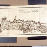
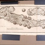
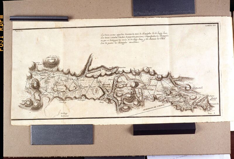
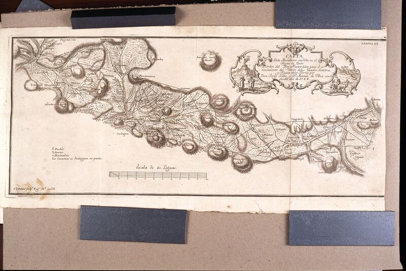
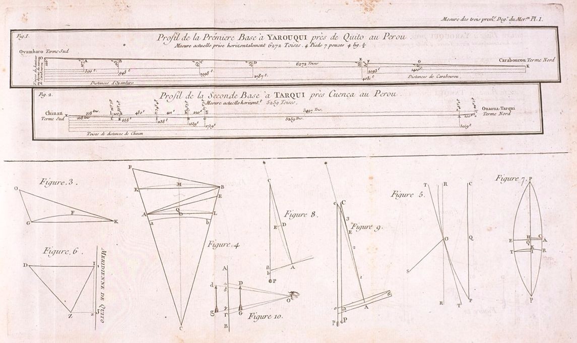
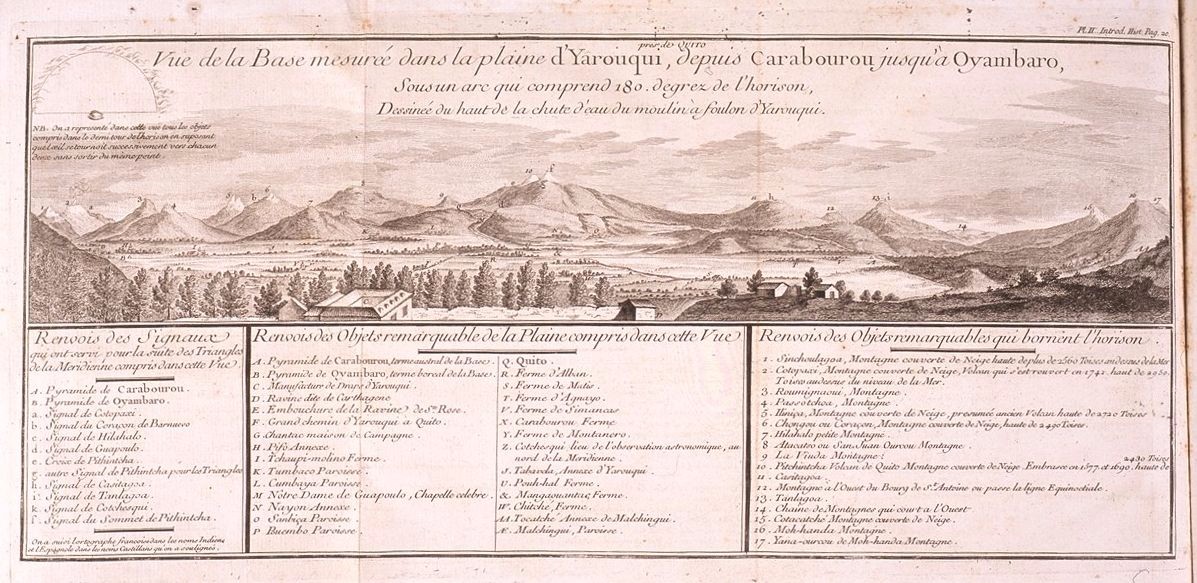
Two of many detailed maps produced by the 18th-century Geodesic mission into the Equator, copies of which are on display in the museums of Quito and at the Hacienda Guachalá. The maps of the northern (left) and southern (right) halves of the triangulation network which spanned 3 degrees of latitude were drafted under the direction of Ulloa and Jorge Juan, the two Spanish officers who accompanied the French scientific team on the mission.
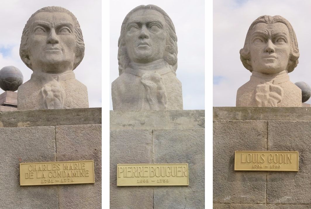
The French team included prominent scientists Condamine, Bouguer, Godin, and more—names that are familiar to Quito locals to this day. Spain agreed to participate in this first international scientific expedition by adding two military officers, Ulloa and Jorge Juan. Both Spanish officers were well versed in science, and, as events on the expedition would reveal, swordsmanship and feats of derring-do. The team grew, adding several junior scientists, surveyors, a surgeon, and servants.
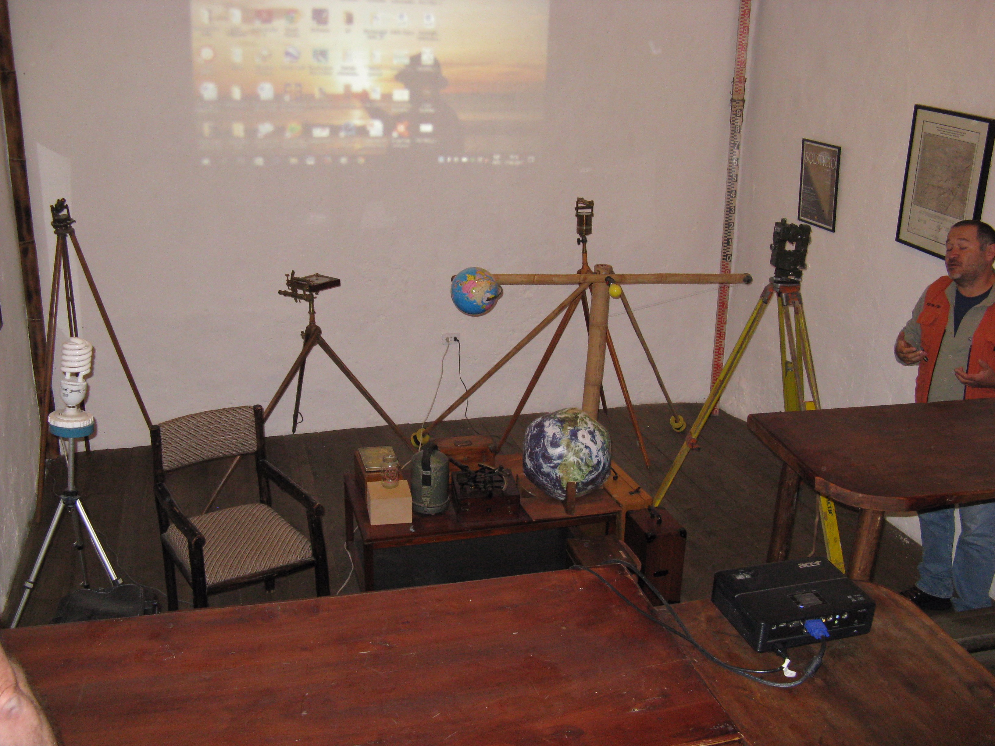
One member of the team who gets little recognition (and who was essentially stranded in Quito after the mission) was Hugo, the instrument maker. Hugo not only had to maintain and repair the delicate instruments they brought from Europe; he also was tasked with building precise quadrants and sectors from scratch, with primitive resources.
Quadrants and sectors are etched with fine angular increments; how does one measure and mark such increments with primitive tools? Hugo employed the simple method (often used at the time) of laying out a semi-circle over a mile in radius on a flat plain, measuring out chords and moving tall targets along the arc to align markings on the metal quadrant.
It took more than a year of travel before the team could begin the work of the survey. Arduous travel, illnesses, tensions on the high seas, battles at ports along the way, suspicions of locals who thought they were smugglers, and nearly impenetrable jungles finally gave way to the high mountainous region around Quito where the work was to begin.
On a plain near Quito, a nearly 12 km baseline was measured by two teams, one toise at a time. These nearly six-foot wooden rods were painstakingly placed end to end, in a shallow trench etched into the plain with wooden supports, stings, and perpendicular plumb lines to level. The wooden toise rods were calibrated with a valuable iron toise brought from France.
From the established baseline, the plan was to use the mountain tops of a volcano-lined valley running roughly south to what is now southern Ecuador and the city of Cuenca, closing out on another baseline to be established there. The angles were measured by two teams crisscrossing the valley using simple graduated quadrants (a metal quarter circle with a fixed arm and a moveable aiming arm).
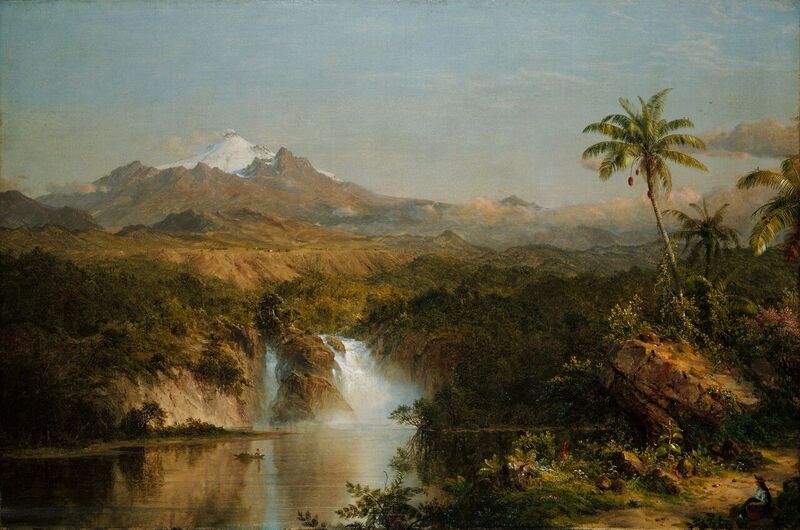
The famous painting of Cotopaxi by Frederic Edwin Church (1857); while the vistas look appealing, the dense jungles, arid plains, and icy mountains and volcanoes made for arduous work for the 18th-century Geodesic Mission.
The intrepid scientists faced far worse than the blistering heat and steaming jungle that folks back home envisioned of equatorial regions. In addition to the energy-sapping altitude (Quito is at nearly 3,000 meters), icy and windy mountain and volcano tops had to be occupied for extended observations. To perform the surveys, these scientists would climb mountains far higher than any European mountaineers had attempted. There are approximately 25 active volcanoes in the Ecuadoran Andes; these conditions truly tested their resolve.
Despite infighting, sporadic funding, sometimes-hostile (and in one case fatal) friction with locals, the teams completed the triangulation chains and closing baselines in close agreement.
Now came the work of establishing the latitude of each end, done with zenith sectors in makeshift observatories. Observations took months, as the team sought just the right sky conditions, realized errors, and started over after Hugo fabricated even larger sectors. Supplementing their observations were studies of the phenomenon of “celestial aberration,” a parallax-type effect plaguing astronomers and geodesists regarding the observed celestial bodies when the Earth was in different phases of its orbit.
The teams surveyed nearly three degrees of latitude, spanning more than 350 kilometers. They also undertook supporting surveys that brought elevation from the coast (using mountain tops for trigonometric leveling), made maps for local authorities, studied the local flora and fauna and culture, and dabbled in trade. The mission spanned a decade, from 1735 to 1744, and it brought back a wealth of geodetic and other scientific data.
For instance, the team noticed natives using an elastic type of tree sap (that bounced if formed into a ball) for various needs, so they covered their canvas tents with it to repel rain. The team would be first to introduce this “rubber” to Europe. An unrelated experiment using the mass of a volcano to measure deflection from the vertical further buoyed the science of Newton’s invisible gravity.
One note of disappointment was that in their absence, another mission north to Lapland (although on a much shorter course) had essentially settled the question of the oblateness of the Earth. However, the Equator mission is universally hailed as “sealing the deal” by providing the measurements that would form the basis for many of the elements of modern geodesy. Due in part to this data, the unit of measure (the meter) was roughly fixed as 1/10,000,000 of the distance from the Equator to the pole.
Locals in Ecuador dubbed the members of the mission “Los Caballeros de Punto Fijo,” or “gentlemen of the fixed point” (which is also the title of another fine book). There are few physical artifacts of the original mission; Quito’s airport was built over the northern baseline, and there are only replicas of some of the original commemorative pyramids and tablets. Nevertheless, visitors can find many monuments, museums, and replicas of the instruments. And simply climbing some of the surrounding hills in the thin atmosphere can give today’s surveyors an appreciation of just how arduous the work of these pioneering surveyors was.
Which Equator?
The Equator itself is a big draw for geo-tourism, but the dilemma is, “Which equator do we visit?”
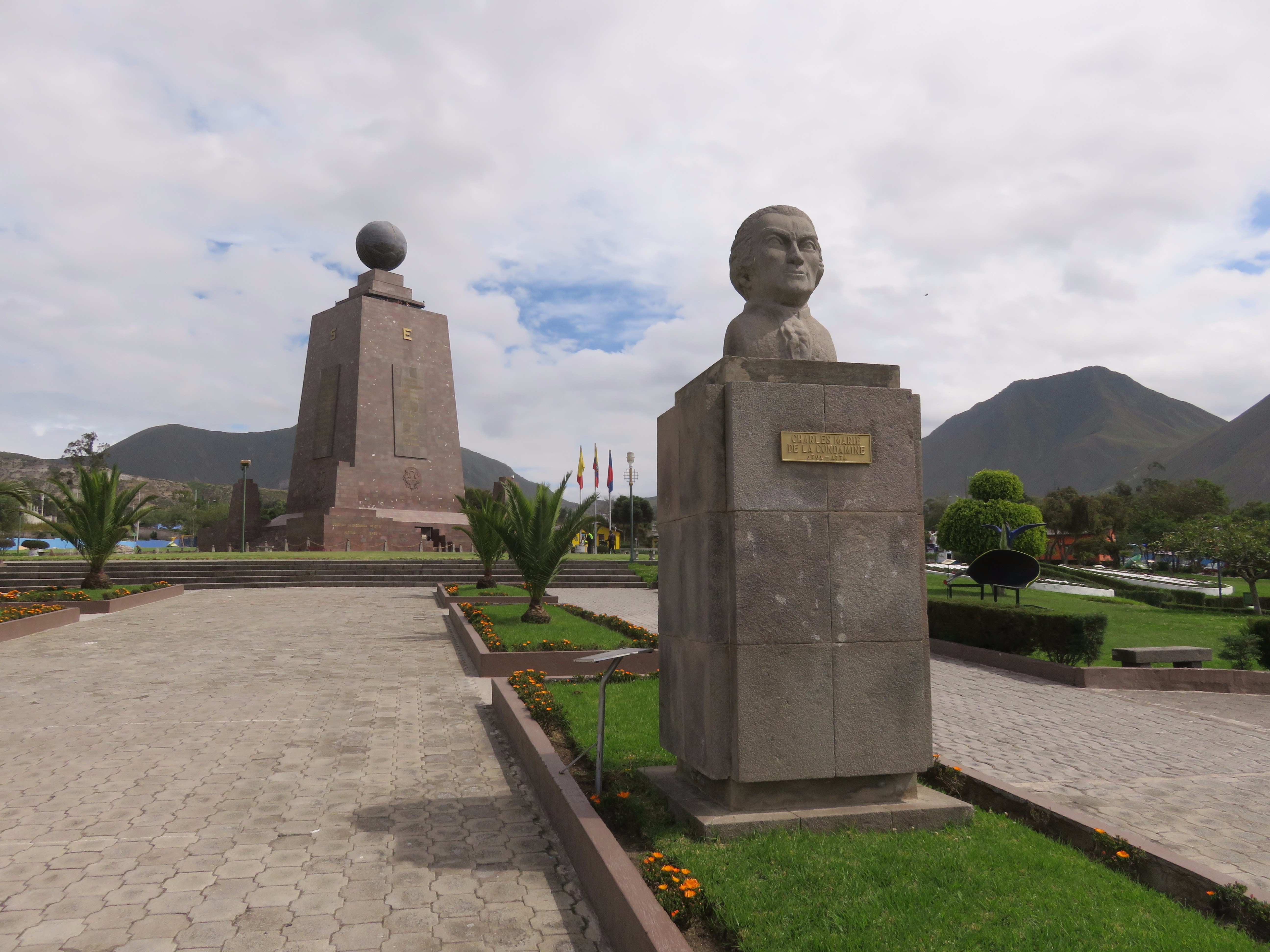
The team visited the big ceremonial equator, La Mitad del Mundo (the Middle of the World), north of Quito. This is the most visited of the sites: a huge monument, sculptures of key participants of the 18th-century of the Geodesic Mission (and a museum devoted to the same), and a line that tourists can be photographed straddling.
Geo-sticklers will note that this ceremonial equator is, in fact, several hundred meters from the actual Equator. In the days before GPS when people used purely astronomic methods, this discrepancy was not considered an error. But since the advent of GPS, several other equatorial sites (ranging from somewhat cheesy tourist attractions to serious monumentation) have sprung up.
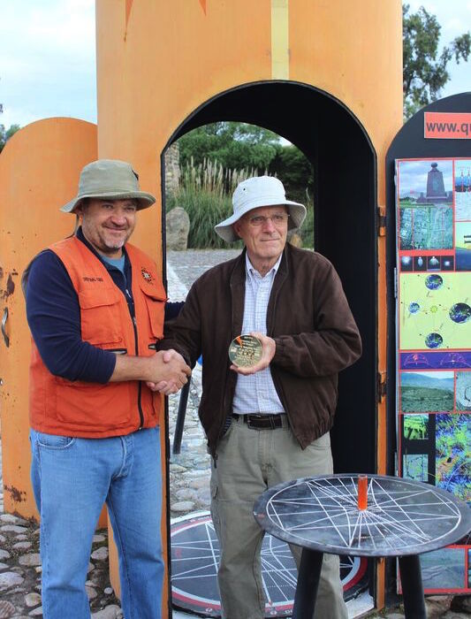
John Minor presents a commemorative disk to Cristóbal Cobo Arízaga, renowned archaeoastronomer and creator of the Quitsato sundial.
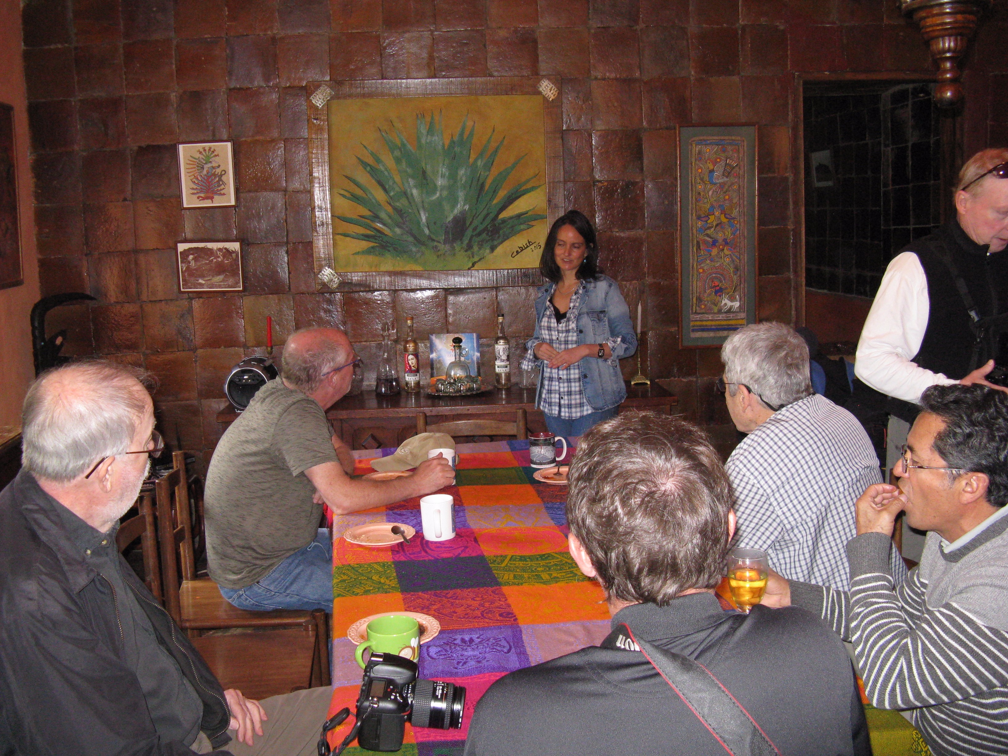
Salazaar introduced the team to an informative expert on the Equator, an internationally recognized Ecuadoran author and “archaeoastronomer.”Cristóbal Cobo Arízaga and his wife are proprietors of the historic Hacienda Guachalá, the oldest hacienda in Ecuador (with some structures having been built in 1580). The 18th-century Geodesic Mission stayed at this hacienda early in their days in the Quito area and forged lifelong friendships with the proprietors then.
Cristóbal welcomed the 2017 group and gave an informative presentation about the history of geodesy in the region. Especially fascinating was his research into Incan and pre-Incan determinations of the Equator as well as monumentation to mark seasons and celestial events. Muddy conditions prevented the team from visiting one pre-Incan site originally on the schedule.
Cristóbal’s dedication to archeoastronomy and matters of the Equator has yielded numerous books and educational materials, and he established what may be one of the few monuments on the actual Equator.
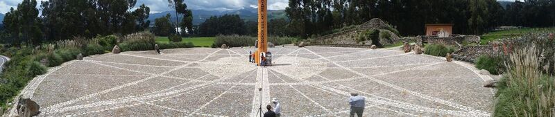
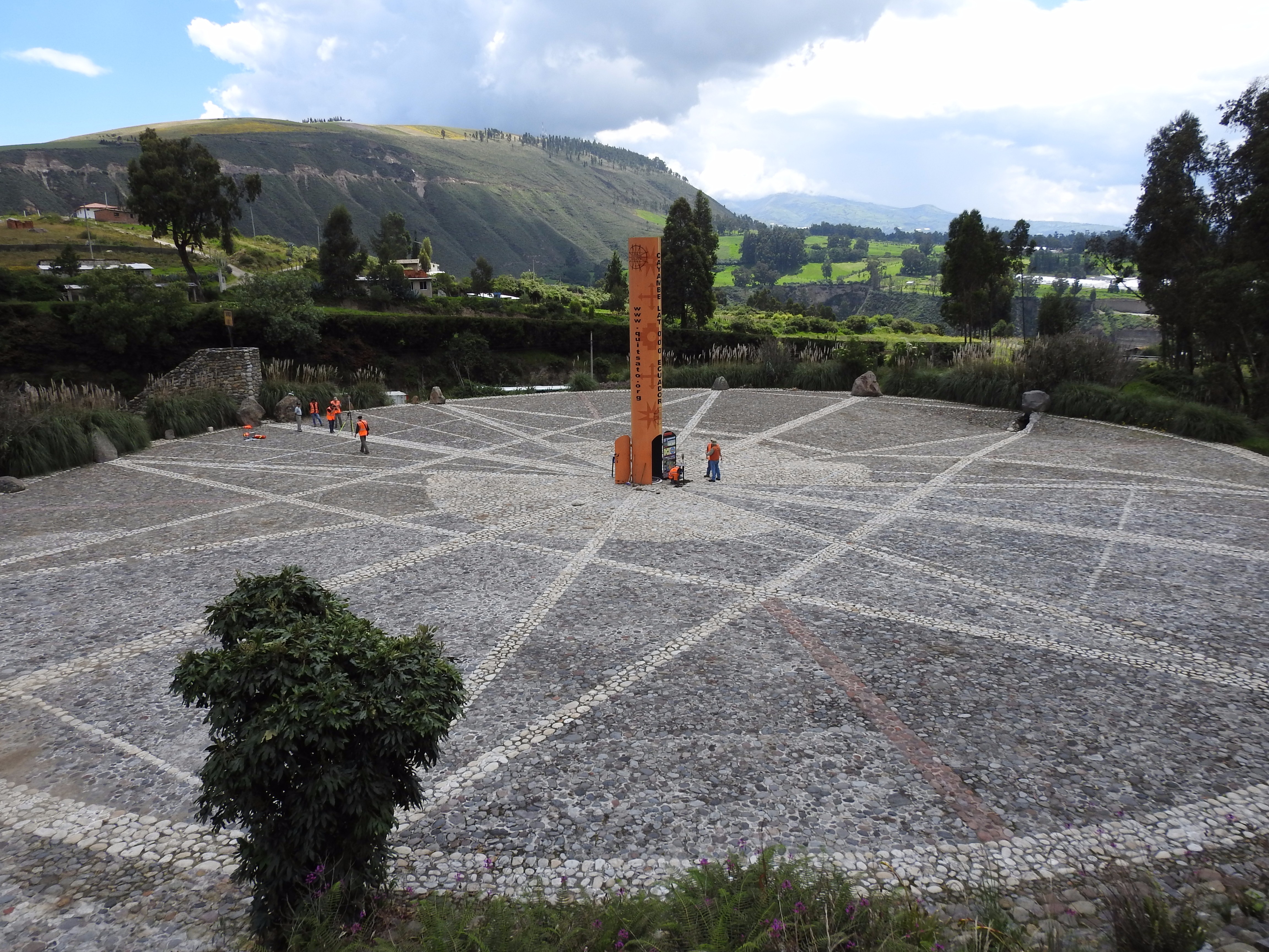
The Quitsato Sundial near Quito, Ecuador, was chosen by the 2017 delegation of U.S. surveyors to set the commemorative survey monument and make the companion PPP-GNSS observations. Quitsato is one of the few equatorial monuments that sits on the actual equator; some of the others established prior to the advent of GPS can be several hundred meters off. Credit: Rich Leu.
The Quitsato sundial is Cristóbal’s brainchild, and, in fact, he essentially funded the entire development. The circular park is paved with different colored rocks, with lines placed at the Equator oriented to track the shadow of the central pillar (or gnomon) during solstices and equinoxes.
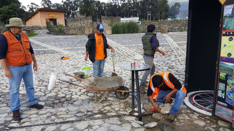
Cristóbal Cobo Arízaga (left) and his grounds crew at the Quitsato sundial prepare to set the commemorative brass disk. Cobo, an archaeoastronomer, built Quitsato about a decade ago; he and his wife are also proprietors of the historic Hacienda Guachalá.
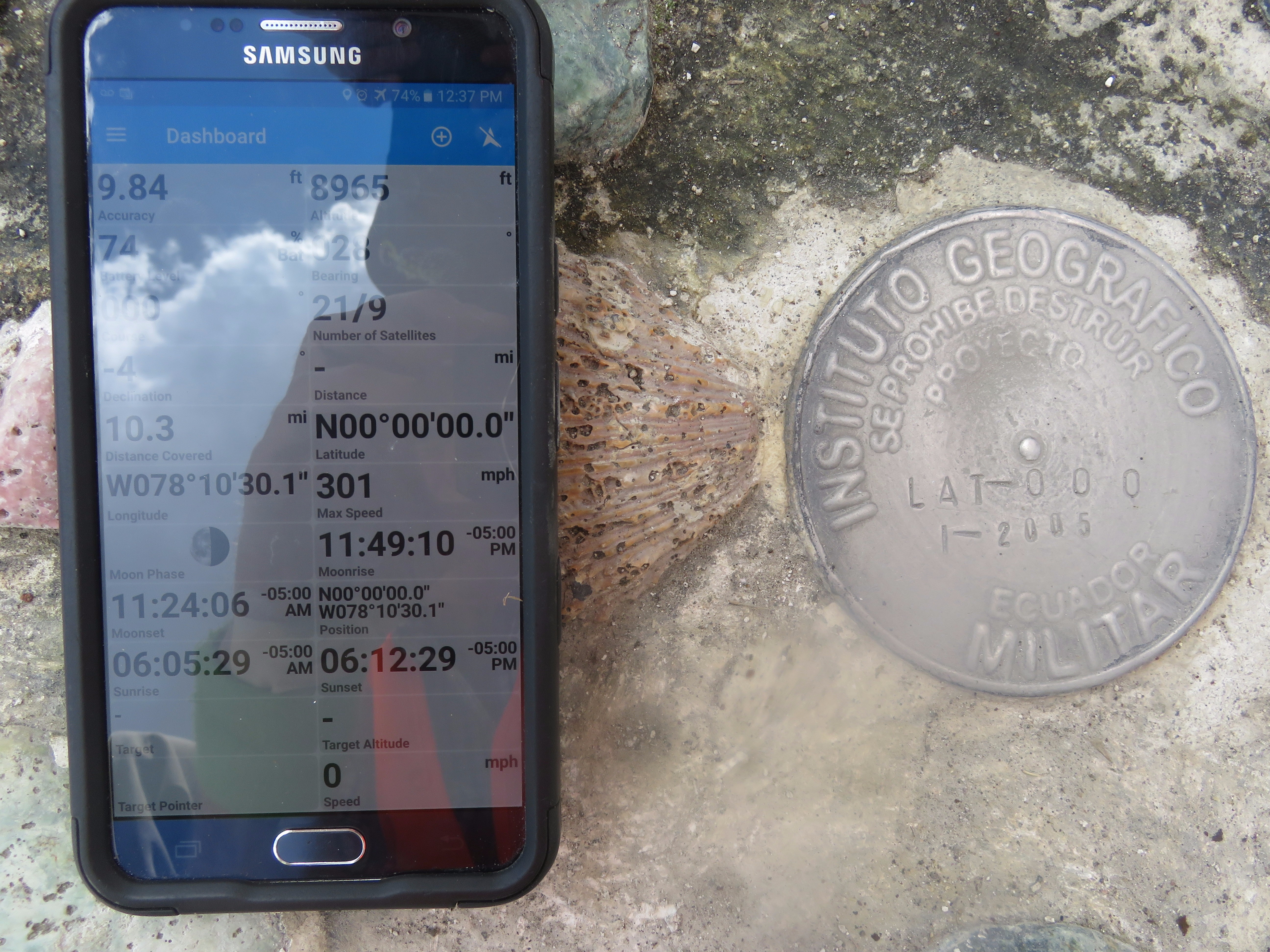
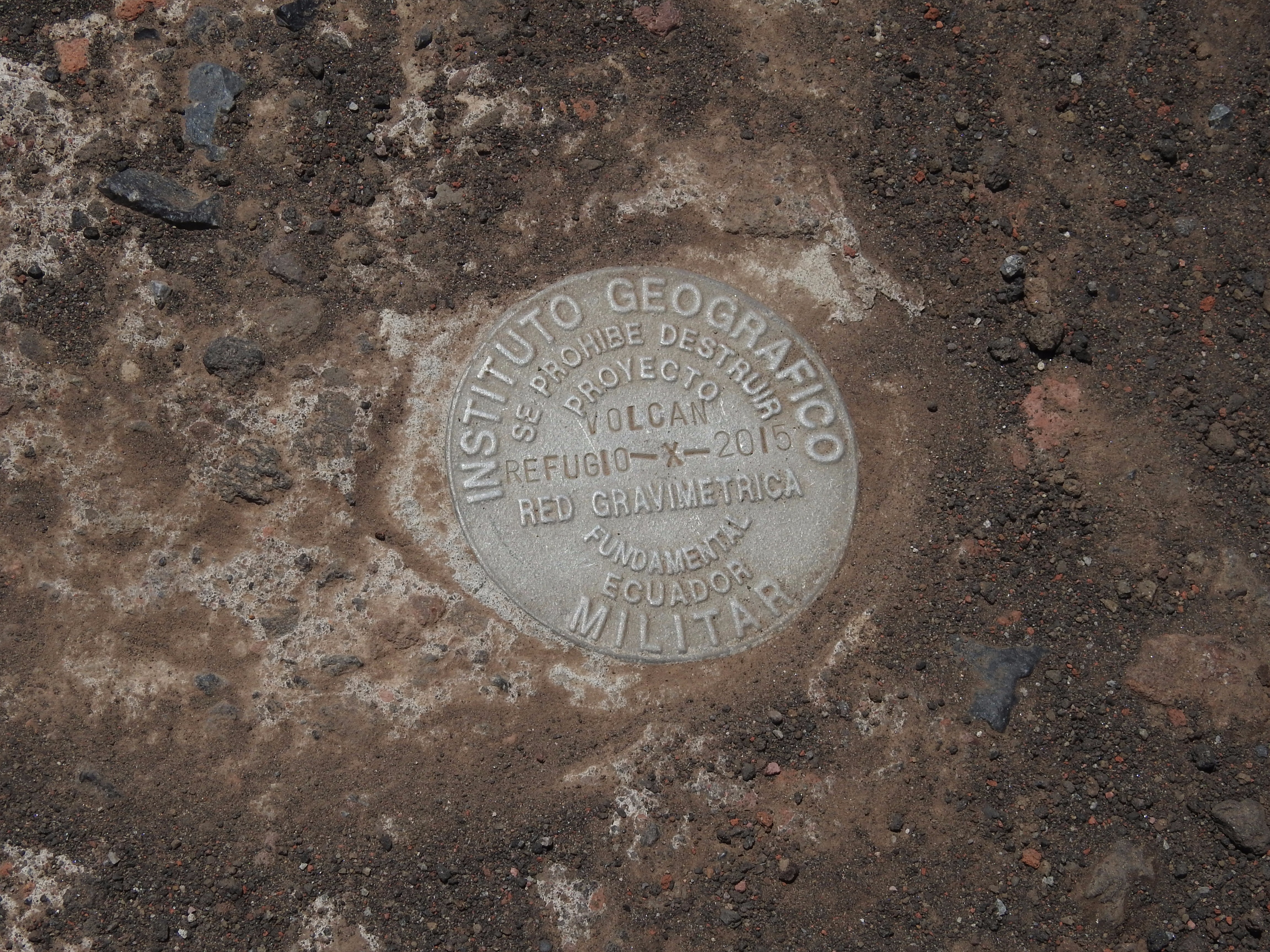
The site was perfect for the 2017 observations. Cristóbal’s team set about installing the commemorative disk near the gnomon, on the opposite side from where the federal geodetic agency IGM had set one in 2005, about the same time the park opened. Nunes performed the Atlas PPP observations while the respective teams gathered for photos and handshakes.
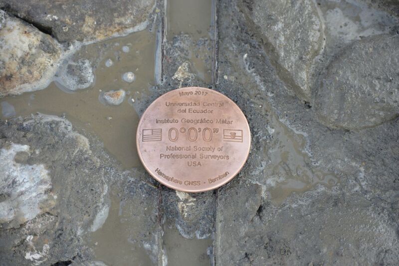
The commemorative brass disk was set along the 3” track denoting the equator at the Quitsato sundial. The disk and commemorative replicas given to the U.S. and Ecuadorian teams were designed, produced, and donated by Berntsen International.
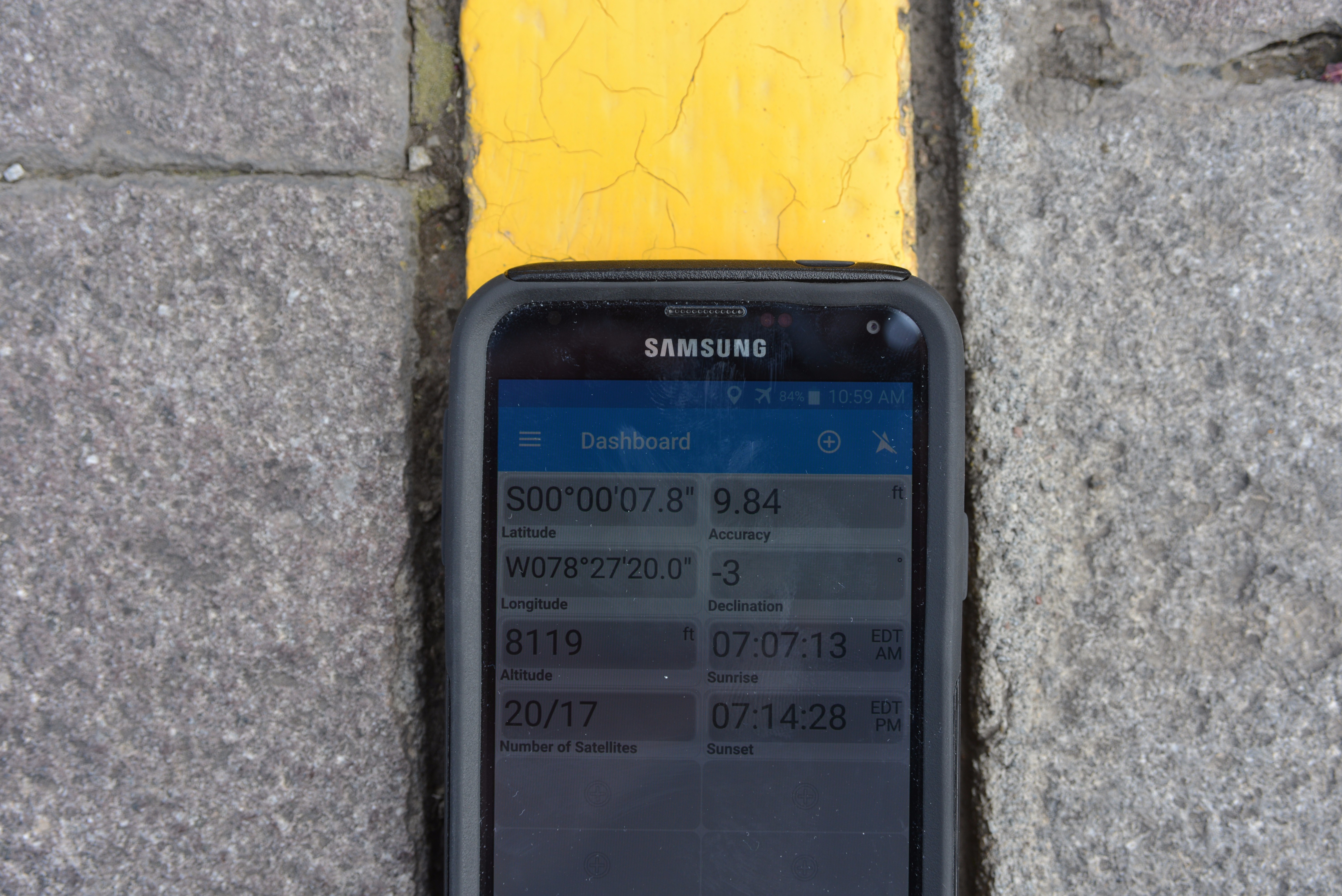
Several members set their GPS handhelds on the line and marveled at seeing so many zeros on the displays. The official position of the gnomon of the Quitsato sundial is: 00°00′00″N 78°10′30″W. Type that lat/long into Google Earth to see the Quitsato sundial site.
PPP and Atlas
Planners for the 2017 Quito trip focused on what symbolic surveying tasks could be performed by the team while in Ecuador. What would best commemorate the 18th-century Geodesic Mission and the Equator, and what would emphasize advances in surveying and geodesy in the centuries since?
I considered that the original mission took nearly a decade to measure the length of three degrees of latitude. The original survey was not particularly precise by today’s standards, but it was far and above any attempts to measure degrees of latitude at the time and was wholly sufficient to confirm the true oblate shape of the Earth.
If one were to measure the length today, even a recreational GPS handheld device logged for a few minutes at both ends of the original survey would be precise enough to match the original survey—and that was one thought floated. Several noted surveyors discussed ideas, including Dave Doyle (recently retired from the NGS).
It was decided to try to contrast the 18th-century methods and technologies using some of today’s more precise and rapid options rather than an historical recreation with antique or replica instruments.
The prevailing idea was Precise Point Positioning (PPP), a rapidly evolving form of real-time (and post-processed) GNSS that is revolutionizing geodetic surveying, precision agriculture, marine surveying, construction, and mapping, and it’s making inroads into land surveying.
The key difference between PPP and traditional GNSS baseline post-processing and real-time kinematics (RTK) is that PPP uses global tracking arrays of GNSS stations to provide highly refined clock and orbits “products,” plus regional models (e.g., ionosphere) to allow a GNSS receiver to compute global positions without a base or network.
The PPP data is relatively small and can be transmitted over wide regions by geostationary communications satellites (e.g. L-band), so none of the challenges of cellular or radio connections for traditional RTK or RTN corrections are present.
Joe Nunes setting up for observations. Credit: Ken Bays.
While we were examining options, I visited the headquarters of Hemisphere GNSS in Scottsdale, Arizona (see our March 2017 article, “GNSS Mission Accomplished” goo.gl/FHehpT). There, the Hemisphere engineering team demonstrated their Atlas GNSS Global Correction Service. Hemisphere uses clock and orbit products from NASA’s Jet Propulsion Laboratory, derived from a global array of GNSS stations (as part of the international scientific cooperative, the IGS or International GNSS Service). Hemisphere then adds data from an array of their own GNSS receivers at various locations around the world. The data is processed at data centers and controlled from Hemisphere’s headquarters.
The clock and orbit data is combined with other regional models and transmitted to subscribed users via three geostationary L-band satellites. The satellites are positioned above the Equator: one over the Americas, one over Europe/Africa, and another over Asia.
Hemisphere has incorporated Atlas capabilities into several of its GNSS boards and rovers, plus those of some manufacturers that use their OEM boards. Atlas is offered in three flavors (at different subscription levels): H100 yields sub-meter precision, H30 yields 30cm or “sub-foot,” and H10 yields 8cm or less precision. Each of these levels of precision is achieved after a convergence time (e.g. 10-40 minutes) or faster by initializing on a known ITRF (International Terrestrial Reference Frame) coordinate. Once converged, the rover can maintain the high precision for the duration of a survey, provided the signal from the satellite is not lost for more than a few minutes.
PPP looked to be a good fit for the 2017 mission. Observations could be made with a single instrument during brief visits to various sites on the Equator, and we could also post-process the data as an independent check. Hemisphere graciously offered to provide gear for the observations, access to Atlas, additional sponsorship, and one of their field application engineers, Joe Nunes.
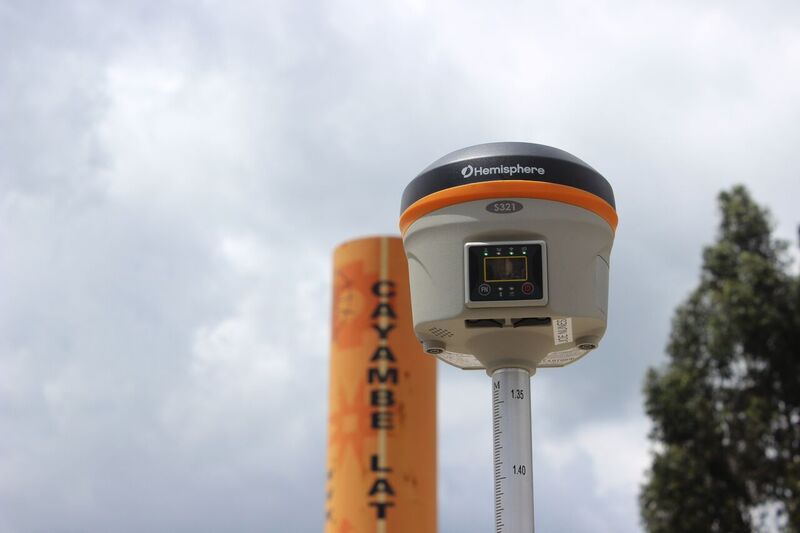
Observations were performed with a Hemisphere S321.
Although the Atlas observations could be performed by a single GNSS rover, Nunes brought along two of the new S321 Smart Antennas (he would also be demonstrating base-rover RTK to local clients while there).
For the observations on the Equator at the Quitsato sundial, Nunes set up one of the S321s on a bipod and acquired the Atlas signal from one of the geostationary satellites. Convergence took about 20 minutes. Nunes left it running to converge while the commemorative disk was being set farther towards the center of the sundial. This is a common practice with PPP in surveying: set up the receiver to converge while you do other tasks at the site, then commence your survey shots once it’s converged.
After convergence, the PPP observations stayed at around 8cm HRMS.
The receiver estimated that the precision was about 8cm, and indeed this concurred with post-processing of the observation data (with classic baseline processing and via several academic PPP services); real-time and post-processed agreed within a few centimeters.
The line marking the Equator at the sundial site is a metal track about three-inches wide and filled with a different colored gravel than the surrounding plaza. Materials with regional significance were used, like obsidian and seashells, to contrast and highlight the features of the sundial.
The team noted that the GNSS observations were offset from the line, which was not a surprise as the entire area is on a rapidly moving tectonic plate. John Hamilton later used published velocity data from a nearby GNSS reference station to conclude that most of the offset was due to effects of velocity because the sundial had been built a dozen years before.
The PPP observations, using Atlas, had nailed the Equator within a few centimeters and in about 20 minutes. Had there been another receiver at three degrees south (for instance, near the southern end of the 18th-century survey), the principal part of the Geodesic Mission could be repeated today in minutes instead of years. The irony in such an exercise, though, would be that the amazing capabilities of GNSS owe their very existence to elements of that bold survey centuries before.


Quito’s Focus on Geodesy
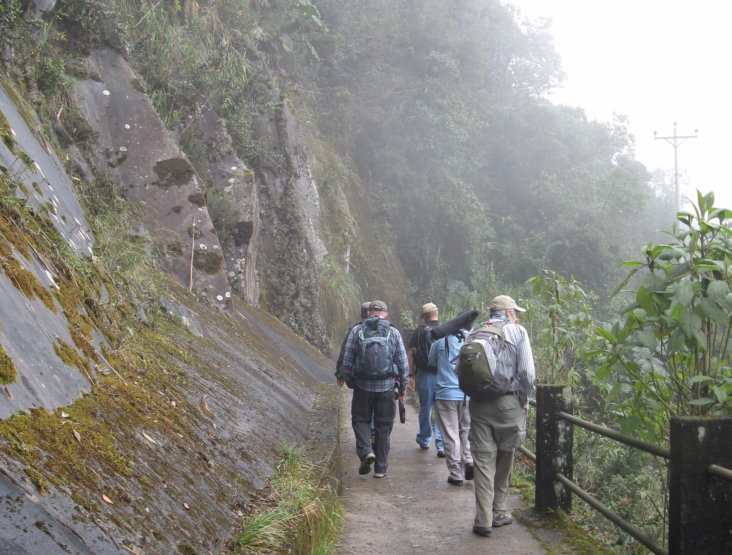
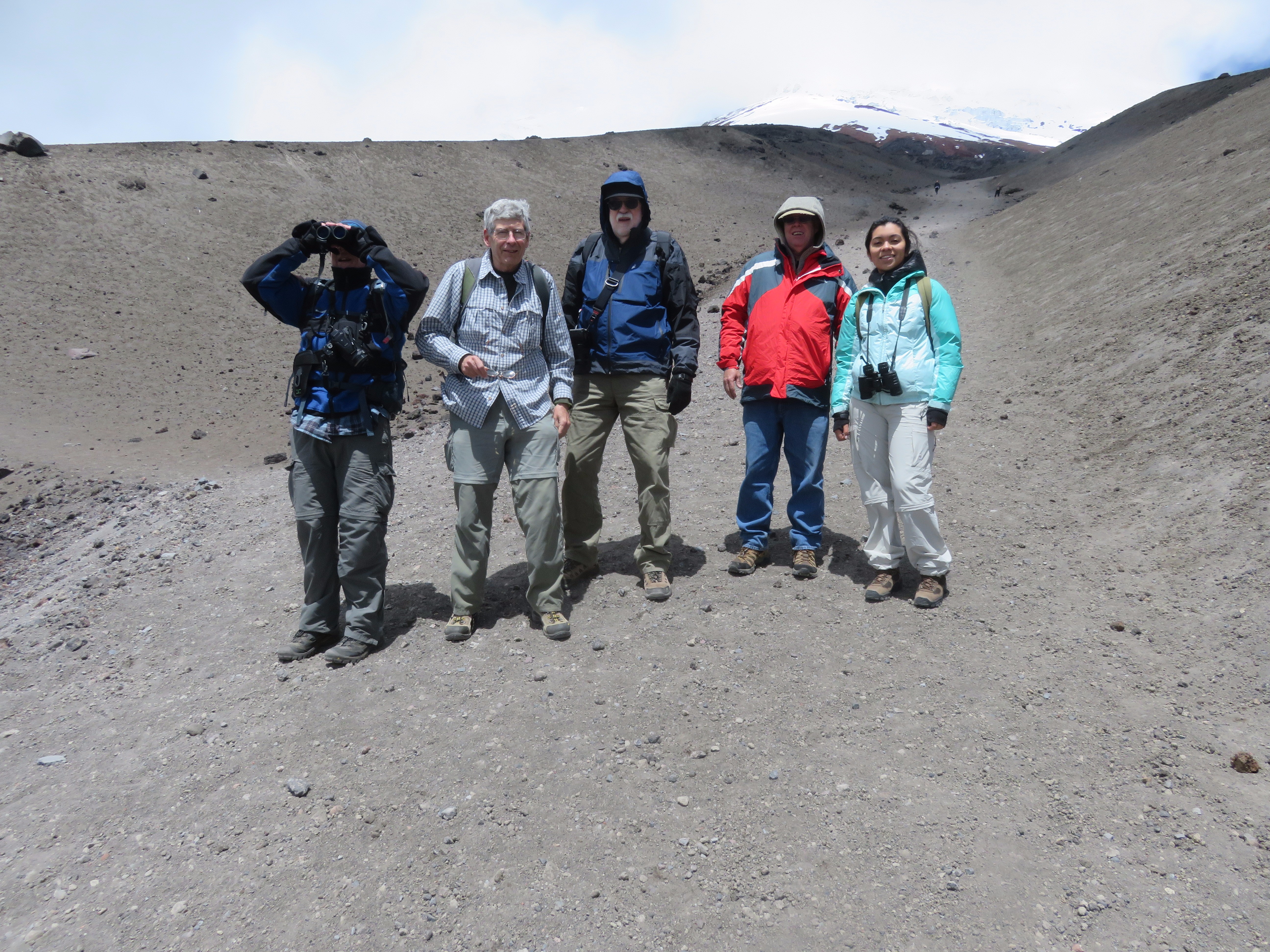
On another day, the 2017 team visited Cotopaxi National Park, an active volcano featured prominently in the original survey. They hiked from a parking area (at about 4,000 meters) up an additional 1,000 meters to a scientific facility (still far below the summit), where they visited a noted gravity station.
Rich Leu said of the altitude, “It seems that to go from point A to point B is invariably uphill, taking a few steps then resting, only to find out that the return to point A also seemed to be uphill.”
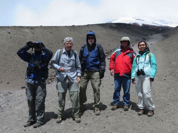
The team scaled part of Cotopaxi (one of many volcanoes the 18th-Century Mission scaled to make triangulation measurements). From left to right: Mark Armstrong, Ken Bays, Rich Leu, John Hamilton, and their guide Anna. Credit: John Minor.
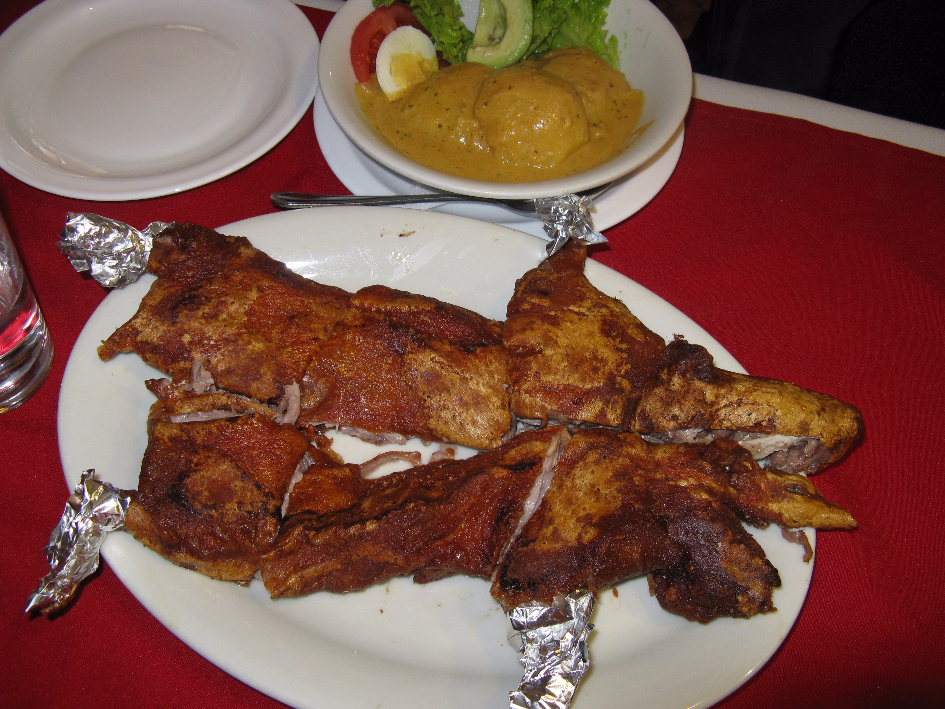
Nunes was amazed by the crowded city of Quito and how long it takes on the jammed roads to get anywhere. But all enjoyed the hospitality and friendliness of the locals and much of the local cuisine, although the cuy (guinea pig) dish would be a one-off experience for most.
Ken Bays was particularly impressed by how much the history of the Geodesic Mission and geodesy have an imprint on Quito. The museum dedicated to the mission has displays and frescoes as well as an educational annex where school children learn about simple geodetic elements and can even pose for photos in cutouts of Condamine, Bouguer, Godin, and others from the mission.
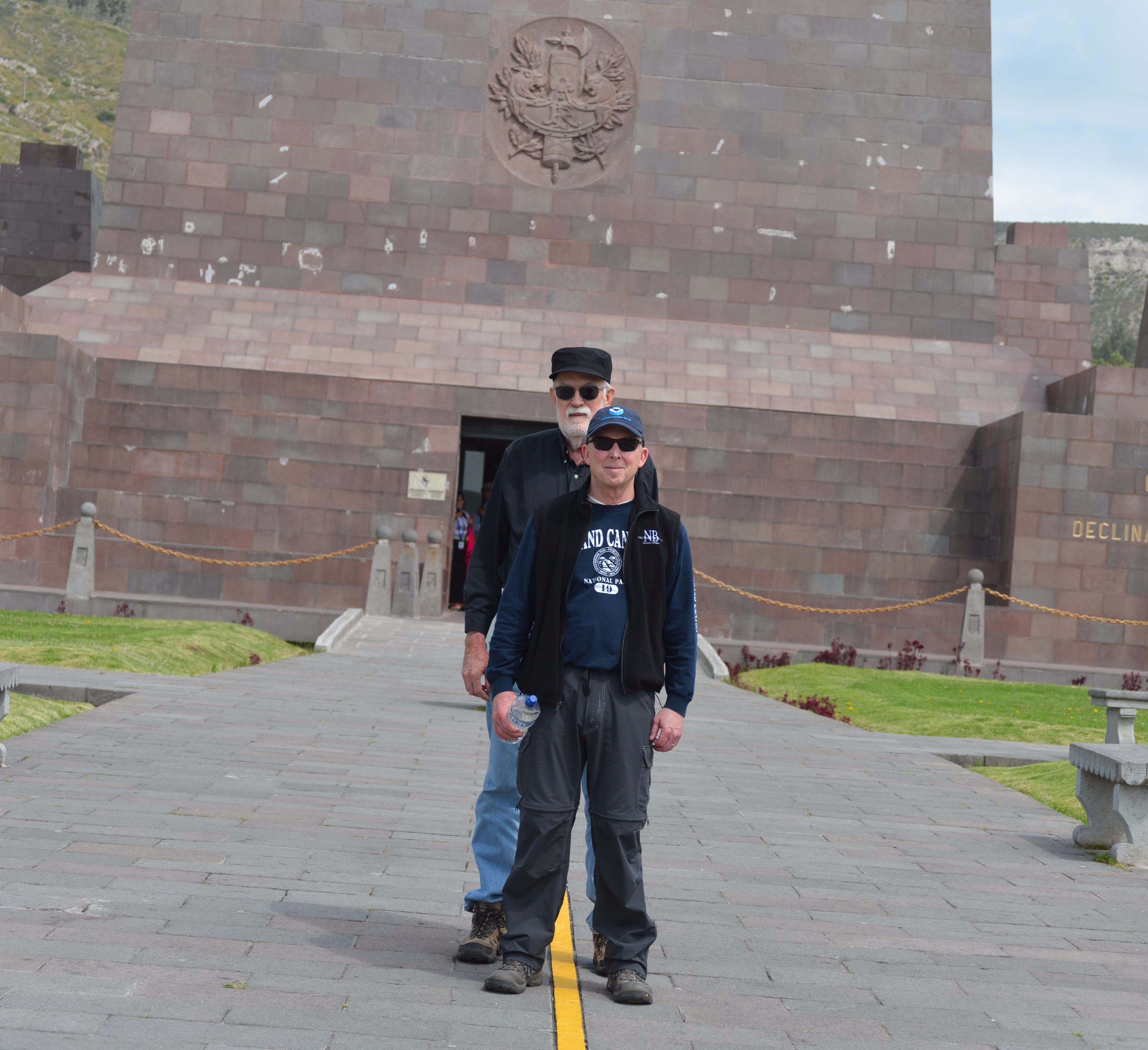
Celestial mechanics have been incorporated into other elements of Quito; the team visited a gilded Jesuit church, La Iglesia de la Compañía de Jesús, with architectural features designed to shine light on specific icons during certain times of the day and on significant days. On one of the closing days of the trip, the team was invited to visit the headquarters of the Instituto Geográfico Militar.
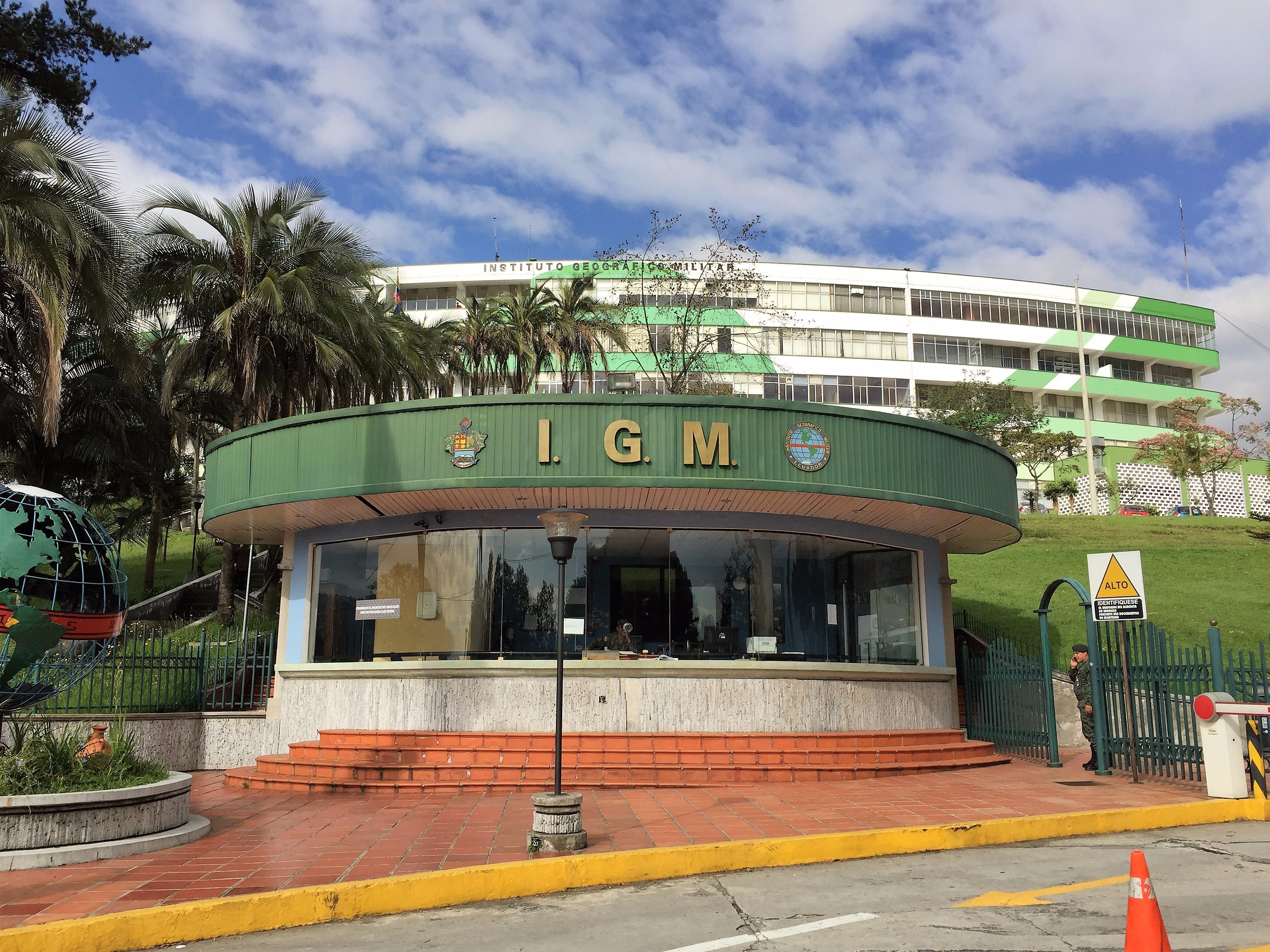
Instituto Geográfico Militar
The Military Geographic Institute of Ecuador (IGM) is under military command. It is common in many parts of world for such important functions as mapping, geography, and geodesy to be viewed as critical enough to both national and economic security to be under that hierarchy. The institute has a broad charter. Imagine the USGS, NGS, NGA, BLM, and several other geospatial agencies combined (read more on their website). The headquarters is in Quito, not far from the old town where the 2017 team stayed.
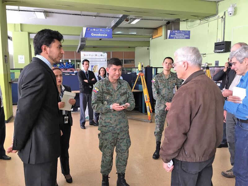
During a visit to the Military Geographic Institute of Ecuador, John Minor (right) presented a commemorative disk to IGM sub-director Colonel Ricardo Urbina. The IGM is the geographic and geodetic authority in Ecuador.
Protocols for visitors to the IGM are formal; it took quite a bit of doing to arrange the visit. The delegation was taken by surprise in the conference room where they were first greeted by IGM staff: the entire room snapped to attention when sub-director Colonel Ricardo Urbina entered the room. IGM staff gave several polished presentations, explaining the role of the institute, not only on geodesy and mapping, but also the keen focus on elements of national pride and economic security—for example, their support of eco-tourism and agriculture.
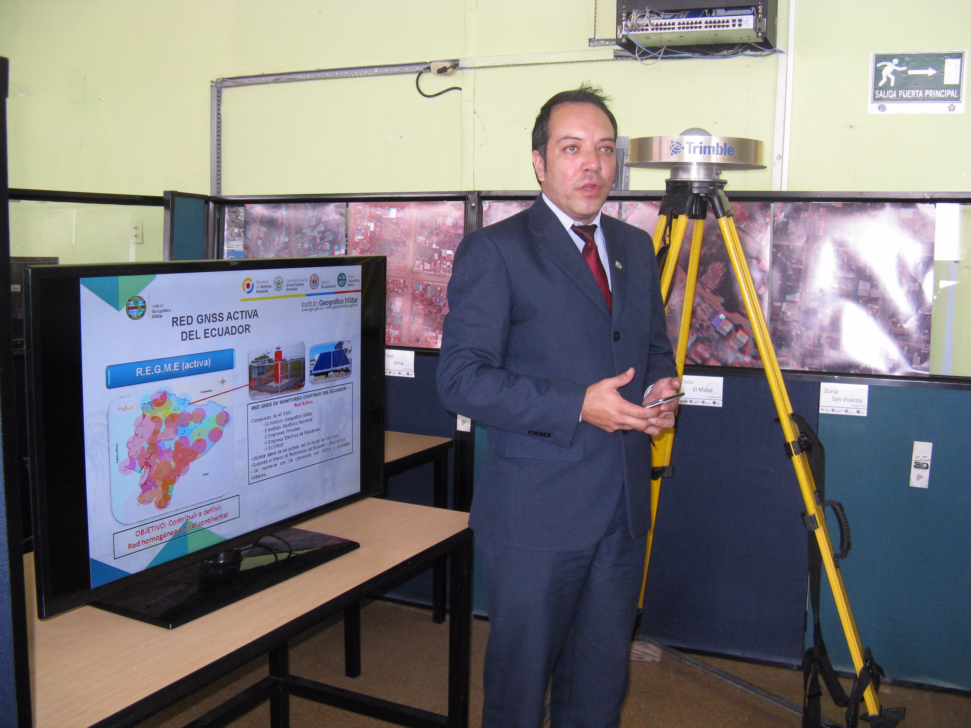
One presentation made a particularly strong impression on the group. The IGM has gained international acclaim for its rapid response to the devastating coastal earthquake of April 16, 2016 (magnitude of 7.8). They used an advanced geodetic control network, GIS, photogrammetry, remote sensing, and drones for mapping, creating virtual reality representations of the affected areas that are invaluable tools in evaluating options for response and relief efforts and their progress.
Mark Armstrong (retired from NGS) began introductions at the visit and apologized for the team’s casual tourist attire as they spent every day touring the countryside of Ecuador. But soon after the perfunctory speeches were completed, the atmosphere became one of peers sharing details of their respective organizations and professions.
The U.S. team was then invited to go into the work areas of the IGM and see the work of each of their teams, including the group that maintains the national CORS network. With geodesy being such an important part of the national identity of Ecuador, it was not a surprise to see that the IGM excels in these areas.
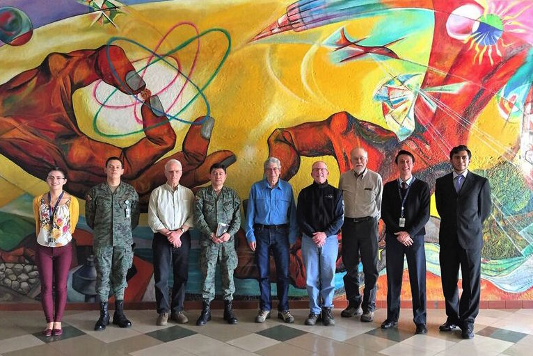
The mural in the lobby of the IGM, depicting elements of science and nature—sources of pride for Ecuador and the IGM—served as backdrop for a photo of the visiting U.S. team and IGM hosts.
A film shown to the visitors highlighting the work of the IGM was interwoven with a popular song about unity after the earthquake, performed by well-known Ecuadoran musicians. One poignant line from the song summarizes the spirit of the IGM and the country of Ecuador: “A country that is not afraid of the future and doesn’t give up.” While in Spanish, the music and visuals convey the post-earthquake solidarity of the Ecuadoran people.)
Each member of the 2017 team had different takeaways from the visit, but most expressed a desire to return; they had only scratched the surface of the wonderful nature reserves, historic sites, and stunning mountain vistas, and they had not had a chance to visit the tropical coastal regions.
When I think about “bucket list” travel destinations for surveyors, there are of course those in the U.S., such as the Michigan Museum of Surveying, the Benjamin Banneker Historical Park and Museum in Maryland, Meads Ranch, Four Corners, the Mason-Dixon Line, and more. Internationally, there is the Greenwich Observatory, the Svalbard Arc of Meridian, and the Great Arc of India (an amazing surveying museum in Dehra Dun).
However, it is hard to compete with the rich legacy of surveying and geodesy in a country named after that most famous of these geodetic invisible lines. Members of the 2017 team will most likely be called upon to recount their adventures at state conferences; perhaps this will inspire more surveyors and geospatial professionals, young and old, to visit this enchanting country.
Quito 2017 Slideshow

Special thanks to the gracious IGM officers, engineers and staff who made presentations to the US team: Colonel Ricardo Urbina, Subdirector; Lieutenant Colonel Rafael Delgado, Chief of the Geoinformation Area; Second Lieutenant Christian Barahona, Chief of the Geodesy Area; Engineer Eduardo Jiménez, Chief of the Geographic Area; Engineer Carolina Valdiviezo, 3D Area; Engineer Fernando Pavón, Database Area; Engineer Maritza Valladares, Restitution Area; Engineer Edison Bravo, Geoportal; Engineer María Fernanda León, Cartographic Area; Technician Javier Benavidez, Geodesy; Engineer Antonio Villavicencion, Investigations; and María José Jiméne, Organization Area.