The next frontier in personal navigation poses both limits and promise.

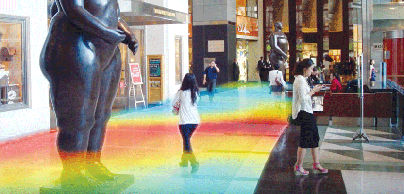
The retail environment is identified as a beachhead for using data analytics and indoor navigation technologies. Credit: Innerspace.
Imagine that you’re disembarking from an airplane at Chicago O’Hare airport. You have a connection to Seattle for an important customer meeting. Your smartphone begins to buzz; you’re informed that your connecting flight is pre-boarding.
But you’re not worried. Your smartphone provides indoor directions to your gate and tells you that the walk will take 10 minutes. Your phone notifies the gate staff that you’re on the way, and your digital boarding pass is made ready for the proximity scan. In fact, you’ve even pre-purchased a breakfast meal in one of the local airport kiosks, which you’ll pick up on the way.
This is one of many applications using indoor positioning, the next frontier in personal navigation. Having experienced the advantages of GPS-enabled outdoor applications, people want a similar experience indoors, where they spend more than 80% of their time. Because GPS doesn’t work inside, researchers, innovative companies, and hundreds of startups are building new indoor positioning systems (IPS) to fill the demand.
At this time, no IPS has emerged as the standard. Let’s explore the emerging technologies that are being developed and their main challenges.

Canadian startup Innerspace creates a hybrid WiFi, Bluetooth, and mapping device to be installed on ceilings and walls.
Infrastructure-based
IPS Wi-Fi Fingerprinting
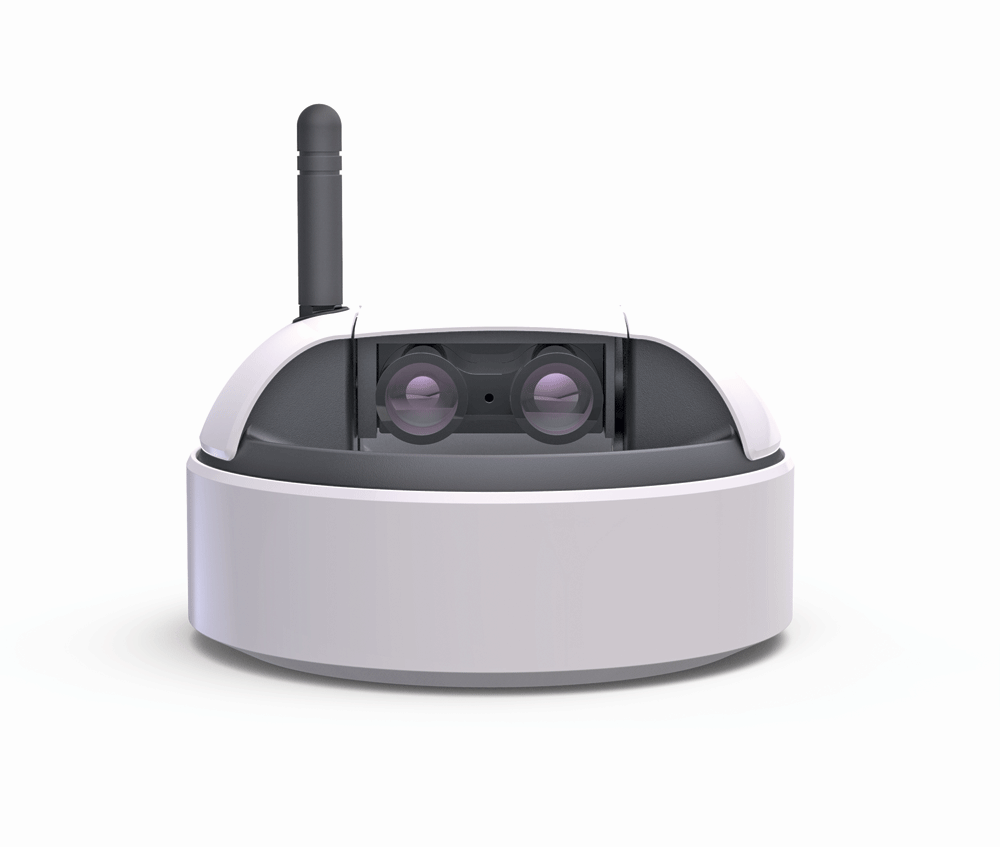
The BrickTracker by Innerspace combines WiFi and Bluetooth radios for indoor positioning, along with a 360° lidar to create and update indoor maps.
In 2014, internet usage on mobile devices exceeded PC usage. People want to communicate and access information from the convenience of smartphones. Fuelled by user demand, businesses, institutions, and consumers have installed Wi-Fi access points in their spaces for public and private use. As a result, Wi-Fi fingerprinting has emerged as an attractive IPS option for a facilities operator. This radio-based IPS takes advantage of the existing infrastructure of hotspot access points, each with signal range from 30-90 meters. Location accuracy ranges from 0.6 to 3 meters.
To enable indoor positioning, Wi-Fi fingerprinting works in two parts: map-creation and positioning. First, a location-based “fingerprint” map is created. Usually, an indoor floorplan is supplied and made into a grid map. For each grid square, a service technician records the received signal strength indication (RSSI) signals from the access points she captures, along with their unique media access control (MAC) addresses. The fingerprint map is complete when the unique signal configurations are known for all grid squares in the floorplan.
To get indoor positioning, the mobile user is required to download the fingerprint map. As the user enters the mapped area, the position of the user is determined by matching the signal characteristics of her mobile device to the grid square she is standing in.
The main challenge with Wi-Fi fingerprinting is that a change in environment alters the location-based signal characteristic. This could be as simple as changing the furniture in a space, having people in the room, or changing antenna directions while making a reading. As a result, the fingerprint map must be frequently updated and monitored, while the computation on the smartphone requires augmentation to be more robust.
Proximity Systems

Newborns wear RFID tags for identification and as chokepoint triggers for security purposes. Credit: Stanley Healthcare and Cisco.
Other radio-based indoor systems include Bluetooth and chokepoint methods; they are proximity systems because positional coordinates are not computed. Bluetooth sensing (the best-known protocols being Apple’s iBeacon and Google’s Eddystone) creates a personal area network between a user’s Bluetooth device and transmitters in its proximity.Positioning occurs when a grid of Bluetooth transmitters is installed with 15 meters between each, and their locations are linked to a map. The user determines her position based on recorded unique identifiers from transmitters. This means she will know her location within a 7-meter radius of a transmitter.
Given the difficulty and cost of installing such coverage across a large area, Bluetooth sensing is preferably used as a trigger for a location-based action. For example, a retailer could promote sales items by sending out mobile alerts when prospective shoppers walk near a sales display that has a beacon near it.
Similar to Bluetooth beacons, a chokepoint transmitter sends an identifier to an end user’s mobile device within its range. This identifier could be transmitted via radio frequency, ultrasound, or infrared. Because this transmitter is linked to a location on a map, the user determines her location based on movement through chokepoints.
For example, a mining company wants to track all personnel inside a mine for safety purposes. A series of transmitters is set up along a tunnel, and each miner is required to carry a unique RFID tag. Each time a miner passes a transmitter, the system logs her location in real-time. If there are any emergencies, first responders will know which area to search.
Non-Radio IPS
Magnetic Positioning
Magnetic positioning is a non-radio, self-contained indoor positioning system. IndoorAltas, a Finnish startup, pioneered a method that uses a mobile device’s compass to measure the magnetic distortion caused by the steel structures of a building. Because these interferences are constant, a map creator walks a floor area to create a magnetic footprint map that corresponds to a floorplan. An end-user with access to the map knows her position by using her smartphone to measure magnetic signatures and matching them to a location on the footprint map.
Magnetic IPS are best used in buildings with reinforced concrete and steel structures, and they cannot be used for dynamic environments such as a construction site where magnetic signatures are changing.
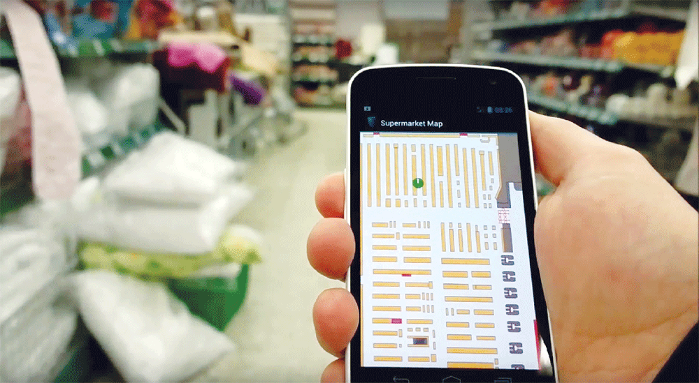
IndoorAtlas’ mobile app tracks the user’s position inside a supermarket.
Light-Based System
Boston-based ByteLight provides indoor location software for LED lighting, targeting mobile marketing and workflow management.
Light-Fidelity (Li-Fi) positioning systems use visible light communication to turn LED light sources into positioning beacons. Li-Fi IPS leverages an existing infrastructure of light fixtures, where the light bulbs are replaced with IPS-enabled LEDs. Undetectable to human vision, each LED outputs a unique, modulated message by switching the current on the LED on and off.
There are two ways to create a Li-Fi IPS: trilateration and proximity. For the former method, a user uses a smartphone’s camera to measure the RSSI from each LED, compute the ranges, and use trilateration to compute the smartphone’s position. The challenge with trilateration is the tedious task of measuring the location of each LED source to the centimeter accuracy and referencing it to a 3D floorplan.
As a result, using Li-Fi IPS like a proximity system may be advantageous, given that the existing light infrastructure is already set up in a close range, grid format. Each LED could be marked on a grided floorplan. A user could easily determine her position by having her smartphone sense an identifier from an overhead LED corresponding to a location on the floorplan. Furthermore, Li-Fi is measured to transmit data 100 times faster than Wi-Fi, enabling other applications to piggyback on the same infrastructure.
General Electric’s LED fixtures use visible light communication to talk to shoppers and help them navigate while providing analytics data to the retailer.
However, there are limitations to Li-Fi positioning. The system suffers from interference from non-LED light sources. Furthermore, it has a relatively short range as compared to Wi-Fi; thus it requires a dense grid to be of use.
SLAM
Image-based simultaneous location and mapping (SLAM) is a non-radio navigation method that is used by autonomous robots. It uses successive, overlapping images to compute a mobile camera’s position and orientation, which is then used to reconstruct the surrounding environment. The advantage with SLAM is that it provides both position and orientation using the inputs from various camera and depth sensors.
However, this requires heavy processing that causes rapid battery use and latency when the mapped area gets too large. SLAM also requires complex multi-sensor calibration and systems integration. Furthermore, SLAM tends to lose tracking in feature-poor areas such as a white wall, requiring augmentation with inertial navigation systems to navigate through outages.
SLAM research and algorithms have existed for decades; however, the advent of cost-effective imaging sensors, powerful mobile computers, and the emergence of robots have made it accessible to more people, which has dramatically increased SLAM adoption.
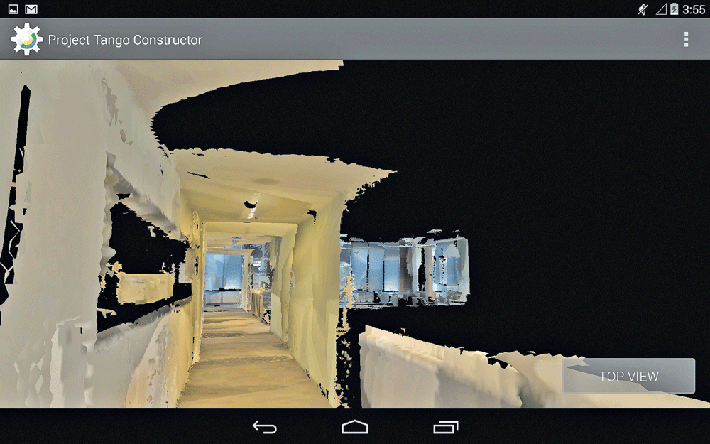
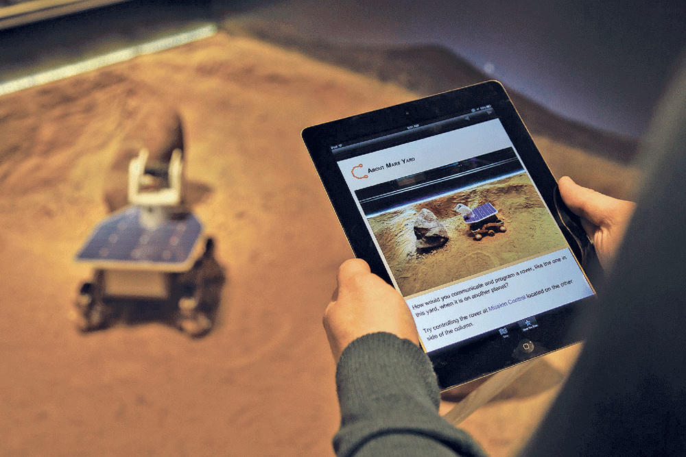
Google’s Project Tango enables users to create 3D indoor maps using the camera, depth, and inertial sensors in a prototype smartphone. Credit: Shapetrace.
Focus on the Application, Not the IPS
A variety of indoor positioning systems has emerged, but widespread personal navigation adoption hasn’t happened. That’s because it’s too early for release as the various technologies are still being developed and market-tested. The reality is that all indoor positioning systems will be hybrid solutions because no one method is strong enough to stand on its own.
EKOOR’s indoor-light-powered beacons are used for location-based marketing, such as proximity-based special offers and coupons.
Thus, all IPS are being developed with integration in mind. Wi-Fi fingerprinting and LED-based systems use inertial sensors to enhance position. IndoorAtlas’ magnetic positioning software integrates with radio-based IPS. SLAM uses a variety of imaging sensors and benefits from higher-accuracy inertial sensors to maintain tracking.
Most importantly, the focus should not be on the IPS but on how to solve the customer’s problem. Even if the perfect IPS were created, it would not be valuable on its own. For example, retail businesses are particularly interested in monitoring and influencing shopper behavior, but the adoption of an IPS will be only part of the solution. Retailers will require old inventory and point-of-sale systems to be upgraded and integrated with it. They need to get consumers onboarded to a store app to create a new shopping experience, which is a challenge given people’s reluctance to download “yet another app.” Finally, the IPS needs to be integrated with a system to track, monitor, and report shopping behavior so that management can make calculated decisions.
In essence, an indoor positioning system is simply a secondary technology, and its adoption will grow only in conjunction with data analytics platforms, both integrated to serve a primary application. This means there will be multiple indoor positioning standards that differ among enterprise, field, and consumer applications.
Finnish startup IndoorAtlas uses a building’s magnetic distortions, a floorplan, and a smartphone’s magnetometer for indoor location.