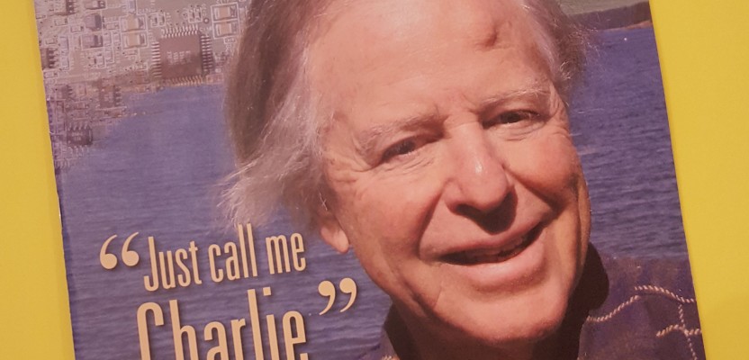
A Conversation with GPS and Technology Pioneer Charlie Trimble
Click here to view a downloadable PDF of “Charlie Trimble Interview”
When asked what the key was to his successes, Charlie Trimble, the co-founder of the global geospatial and navigation company that bears his name, thought for a moment and came up with: “I had a relative advantage by playing the interface between business and technology in a non-academic environment.” Indeed, early in his career Charlie found traditional work environments to be too restrictive for such a free spirited innovator – so he created his own environment – and history was made in the process.
Many of the new wave of positioning and surveying practitioners may recognize names of the pioneers of the modern era of GPS and other geospatial technologies, but they might not know the stories behind those names. In a few short decades, GPS, positioning, navigation, precise time, surveying, and mapping evolved from a millennia-long legacy of purely mechanical technologies, through analog electronics, to digital and space-borne solutions. Many of the great, relatively recent advances came in the pre-internet era, without the incidental digital chronicling of every minor event and accomplishment. Little is written of this heady era of innovation and discovery, and sadly some of what has been written after the fact has been slightly revisionist. For many end users, little is known of the giants whose shoulders they now stand on beyond names on equipment labels or software applications.
To introduce this new geo-generation to pioneers we began by contacting the man behind one of the more commonly known geo-brands—Charlie Trimble—and was honored that he had agreed to a rare interview. I recently traveled up to a small wooded island between the U.S. and Canada to interview Charlie, with one of this new generation in tow: my daughter who had grown up seeing all manner of surveying and GPS equipment scattered around our house. The name “Trimble” was very familiar to her, and she eagerly asked to tag along.
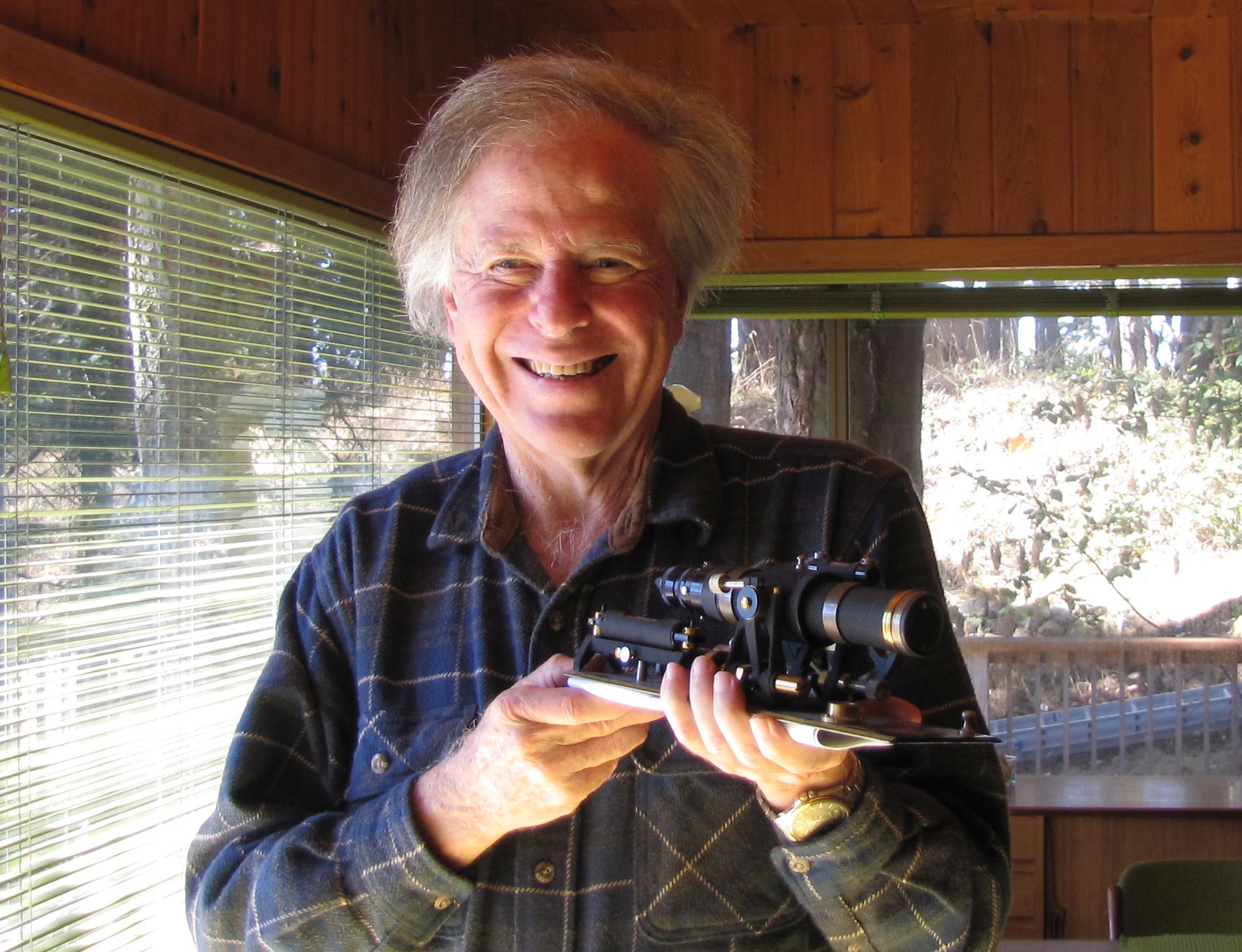
During the interview, we presented Charlie with an antique surveying instrument to thank him for his contributions to surveying and geodesy.
A Rare Interview
In late summer 2016, Charlie and his scientist/engineer wife Liying (Lily) met us at the small ferry dock and drove us to their holiday home on the far shore of the island. The land had been in this family for several generations, and in the 1970s Charlie had sketched a unique house design for his aunt and uncle and they had local artisans craft the comfortable but stylish home out of wood harvested on the island. The home is not filled with technology, photos, or memorabilia from his career; this reflects what I discovered about Charlie during the course of the interview: he is not really prone to self-promotion or to seek the spotlight. He can be both honestly forthright about his strengths and accomplishments but also appropriately humble in acknowledging team efforts and giving credit to others where credit is due.

Our interview with Charlie took place on a small forested island between Washington and British Columbia. Mount Baker is in the background.
We caution our readers that there will be some “deep-geek” terminology to follow; we felt this was necessary when chronicling the subject era of development – and it was how Charlie had hoped we would tell his story. We trust our readers to take this in context and perhaps to be inspired to look up some tech concepts and details they might not be familiar with. Charlie certainly stumped me on many of the details. In addition to interviewing Charlie, we spoke with co-founder Kit Mura-smith (who contributed valuable insights and information for this article), and several other associates from the early days.
The Satellite Age
Charlie opened the conversation with reference to the first of several historical events that would shape his future and the future of his enterprises. “I was a sophomore in high school in 1957 when the Sputnik satellite went up,” said Charlie. That event in 1957—that would have such an impact on Charlie and the world—is viewed by many as the day when science fiction met reality. Charlie added, “There is so much we can learn about the future and what we can develop by looking at science fiction.” He grinned widely as I confessed that seeing 2001 as a kid greatly influenced my own career path.
“As a matter of fact, I probably focused on tech and not law or politics because of Sputnik,” said Charlie, “but I was awfully good at debating.” The effects of the Sputnik event were widespread: “the educational system in this country was turned upside down. I was going to a small rural high school, but there was a very good science teacher and a very good math teacher, and they started teaching to the top of the class. Our senior-year calculus text was the text used by Stanford for science and technology students in their freshman year.”
As a result of this orbiting wake-up call, Charlie noted, “This is the sort of thing that happened, and as a matter of fact, second-year calculus had seven students, and in the class three would get it and four were being carried.” But this new emphasis on science and math, albeit motivated by the space race and the Cold War, would at least make these subjects accessible to a broader pool of students and provided new paths for the top students. Adds Charlie, “The birth of the satellite era absolutely affected me.”
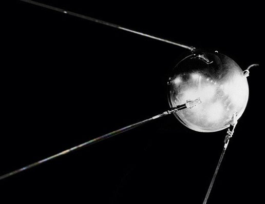
Charlie was a sophomore in high school in 1957 when the first satellite,Sputnik was launched. He said the event “turned the education system upside down” and noted that math and science teachers began teaching to the top of the class. He says this event greatly influenced his future.
Science ran in Charlie’s family. “My father was a chemist, as a young researcher for Shell Oil Company just before WWII he discovered the process and holds the patent for making TNT from petroleum products. Of course, one of the tragedies in his life was that he wasn’t allowed to enlist; they insisted he stay in the chem lab.” He escaped to an avocado ranch in an area south of Los Angeles [in the post WWII era]. He wanted something that had less tension. The plan to start an avocado ranch was seen as a fresh start. He wanted something simpler, and so my grandfather. The same grandfather that bought this property [on the island] was developing avocado property in the Fallbrook [California] area and sold my father on a 14-acre avocado ranch with a used brick house on top of a hill overlooking the Palomar ranch. That’s where I grew up.”
Life takes some unexpected, or at least unanticipated, turns, said Charlie. “My father found out after he got into the avocado business that it took seven years before the trees are productive, so he had to have a day job to be able to support the ranch. He continued working in chemistry in the Los Angeles area until I was in the seventh grade; we would go down to the ranch on the weekends and we would work there. [Dad] had looked at a rural environment as being stress-free, but to make ends meet he became manager of the local water company, because of his chemistry background. Ironically, he had the job of turning farmers’ water off; this was before the second aqueduct was through to San Diego and the ground water was not sufficient. Everybody had to live with the same restrictions, but if you had overplanted your acreage you were not going to get the water.”
Ambitions and Influences
The bright student would soon be studying at Caltech (California Institute of Technology). Charlie said he had done well, but, “I was not sure I could finish a Ph.D. in three years and was very sure I did not want to spend five years as a [research] slave, so instead I decided to move on into business or business school.” But again, technology would sneak up on Charlie and change his plans.
“I took a summer job at HP, hired by a fellow named Al Bagley. He was a Caltech graduate—he was the person that got HP into the digital age.” Charlie, said, “Unbeknownst to me, when he hired me for the summer he had set himself the goal of keeping bright engineers from going to either Harvard or Stanford business school. So at the end of the summer he bribed me into staying by offering me a project. The bribe was to build a special purpose medical computer that pulled signals out of noise.”
This was the mid-1960s when, as Charlie noted, “There was no such thing as microprocessors—the integrated circuit age was just beginning. I can remember being at a seminar where Al had brought in outside consultants to tell us about integrated circuits, and I still remember the comment that Motorola had gotten into integrated circuits with an initial investment of six million dollars.”
Executing his first project was an education in itself. “This computer of average transients required that I learn everything from analog design to working with core memories to digital circuits. I was basically averaging signals. When you average, there is a division factor to have to work out, but actually I figured out that if I would divide by the nearest power of two, I got pretty close.”
This discovery by the new hire was significant. “So, I hold an initial patent on signal averaging using this,” he explained. The environment at HP was great for bright engineers with entrepreneurial aspirations. He said, “The word was out to young engineers to come and work for HP for a while and then start your own business.”
After completing his first project, Charlie was given the right to figure out what the next major product was going to be in the division, sell the idea, put together a team of people, and build it. “My second project was going to be an integrated circuit tester for production line testing. I got to final prototype, and it actually had the second-highest priority in the company. It looked like it was a go. We needed $800,000 to break even. John Young [HP president at the time] had $1M discretionary funding, but between that point and a week later they found an accounting error, and the discretionary balance went from $1M positive to [nearly that] negative,” he said.
“That one got cancelled, so I then did some projects doing very accurate time interval measurements and was involved in the whole ASCII bus thing that came out of HP that tied instrumentation with computers. As a matter of fact, the project leader that worked for me was the architect of that bus.” Working with elements of precise time would later feature prominently in his work on navigation systems.
Charlie continued to manage a range of different projects for HP. “My final job before leaving HP was being engineering manager of a bipolar LSI [large scale integration using bipolar transistors] facility. One last thing I did at HP was to chair a symposium at Stanford on the future of large-scale integration.” This was a period of rapid development in some of the foundational technologies that would shape the digital world that we take for granted. Charlie says of this era, “During this whole period of the late ‘60s and through the late ‘70s, I grew up, so to speak, in the digital age—computers and integrated circuits.”
Charlie was eager to branch out, but sometimes the R&D environments of academia or large firms can hold an eager young engineer back. Charlie said, “It turns out that when you are very successful at something, it is hard to branch out. The economics of a company are set up to maximize profits for this activity, and any other activity you get into is going to be somewhat disadvantaged. An example: [in those days] one manufacturer just about owned the entire oscilloscope market [a piece of test equipment you often see displaying wave forms]. I remember a paper they had given at some IEEE conference outlining why you could not build an oscilloscope to fit into a standard 5” rack, and this about six months before HP announced their 5” rack-mounted scope.
“The long and short of it is: I knew virtually nothing about navigation systems in the ‘60s. There was talk of navigation systems development; in fact Al Bagley [at HP] was a sailor, and he was really big on navigation. He is the one who got HP into the cesium standard [atomic clocks]. He is the one that produced the incredibly expensive crystal oscillator [also used in timing, communications, and eventually GPS]: the 1MHz crystal oscillator standard. He is the one that actually pushed the development of the Loran C receiver [terrestrial radio-based navigation system with roots beginning in WWII]; he got that project going. I was aware of these things, but simply an awareness; I was not making decisions regarding the positives or negatives of one system over another.
Entrepreneurship
The lure of entrepreneurship and a changing corporate environment would bring his days at the electronics giant to a close. Charlie said, “What happened was that I was engineering manager of an integrated circuit facility, trying to figure out what was the next thing to push capabilities. I knew that I had to be looking at product that would be coming to market in the four- to five-year timeframe for me to have an effect. The fellow that went on to replace Al Bagley as division manager had a marketing background, and he was deathly afraid that technology would be warping his view of strategy. He refused to generate a timeline that was beyond two to three years. So there was no way I could make a contribution; I had to leave.”
The question was: What was Charlie going to do? “They had just cancelled the Loran C project at HP, so on a flyer I bid to buy it. Now HP [at the time, typically] never would sell canceled projects; they shelved them. They didn’t want the legal entanglements of what would happen next, and they don’t want anyone coming back to them and asking for something else.”
Much of the development had been completed. As Charlie explained, “The Loran C receiver had been developed to the point of prototypes, and there were working prototypes. They hadn’t done dye castings but had sand castings for the parts. It was unique in the sense that it didn’t read out [like other Loran receivers at the time] in terms of time differences; it read out in terms of latitude and longitude.” This was quite an advancement, freeing users from having to plot with time-difference charts.
“They computed what the latitudes and longitudes should be based on time differences. They realized there were major errors in the overprinted time-difference charts, especially on the west coast; that you were a mile off in Los Angeles, and you were two miles off in San Diego. And that was because radio signals do not travel at the free space speed of light; they travel depending on the conductivity of the medium.”
Charlie explained that offshore from San Diego, for instance, “you are using two Loran signals, one coming down the Central Valley [of California] and one that is coming down the eastern side of the Sierras [mountain range]—one wet and one dry. They had realized that you had to put in corrections; you had go locally and measure the time differences knowing what the latitude and longitude was and apply a correction table.”
Principles that Charlie would need to master for such an undertaking, like signal propagation through the environment, or more specifically the troposphere, would later factor into his work with GPS. The project seemed a good opportunity to Charlie. “I bid, and there was about a four-month standoff. Some advice I was given was that I should provide a deadline: the offer on table only for the next three weeks.” It worked. “I left HP officially in November of 1978; we moved into a remodeled downtown theater in Los Altos. We were in a space designed for insurance companies, so we had 1,000 square feet of space with four doors onto a corridor.”
Founding the New Company
The team was initially small, just Charlie and three other founders. Charlie left HP with two other engineers, Tom Coates and Dan Babitch. The other key founder was especially noteworthy. “A secretary that I had in the IC [Integrated Circuits] department—Kit Mura-smith—very bright, and on top of everything else she was doing also basically did everything the engineers did not want to do – or where not able to. Engineers will always quibble about the value of marketing and brand, but she convinced me and I really believe she did a great job of growing the brand.” As another early employee said “If it had been up to some of the engineers, the receivers would still be in sheet metal boxes – Kit made them consider style to compliment functional design.”
Mura-smith had been instrumental to the success of the IC department long before the founding of the new company. “My predecessor [in the HP IC department] had funded his operation by going around to various groups and asking for little bits of funding. His tin cup—when I took the job I took it with the understanding that I’d get a budget, and that I didn’t have to do that [kind of budget-scrounging], but the price that I’d have to pay was that I’d have to control costs.”
This was not as easy as it sounds, said Charlie. “So, I eliminated the second level of management in the department which spent most of their time giving papers. One of the main tasks I had to do that was non-technical; it was the writing of a manual for the 5GHz bipolar process. What I needed was someone that is bright, that can interview engineers, and that can write. So this was my secretary Kit; she came with the two engineers from HP.” Mura-smith, who was a single mom putting herself through law school at the time proved far more valuable to success at HP and Trimble Navigation than the (rather archaic term) “secretary” title implied.
After the founding, a few more key people joined right away. “A friend of mine was a mechanical engineer; he joined us. My father was retiring at the time, and I said, ‘Dad, could you come in a few afternoons a week and keep the books?’ So he kept the books.”
What was the light-bulb moment to get into GPS? The early days of the company were mainly concerned with the Loran products, but Charlie recognized the limited potential. “I started in 1978, and by early 1982 I had the second model of our Loran C [unit] on the market. We were still starving, in the mode, raising money to cover what we are not making by selling while looking for another product.”

Charlie in the mid-80s and his receiver in a precision time exhibit at the Smithsonian.
Navigation was becoming their forte, as it was so closely related to Charlie’s background in signals, time, and integrated circuits. “We were seriously looking at Transit [an early Doppler based, space-based navigation system developed originally for defense]. This would mean competing with Magnavox in some of the high-precision areas. We had been looking at Transit, and if nothing else had happened we probably would have gone that way. There was a civil marine market for transit.”
News from HP would soon change the direction of the fledgling company dramatically.
Timeline
Trimble during the Charlie era, courtesy of Kit Mura-smith (Most of this timeline also appears in a Trimble brochure called Trimble: Information in Time & Space, created in 1998).
15 Nov 1978
- Charlie Trimble, Kit Mura-smith, Tom Coates, and Dan Babitch leave HP to found Trimble Navigation
1978-79
- First office in Los Altos CA. 1000 sq. ft. on second floor of the old theater building above a chocolate company where, and Kit Mura-smith said, “Every afternoon we had the wonderful smell of chocolate wafting up the air vents. We often benefited from the pieces that didn’t pass the aesthetics test. This is where the R&D on LORAN was completed and made ready for going into production.”
1980-86
- The company moved to Mountain View CA into a 5000 sq. ft. warehouse with concrete floors and heat only in the front of the building. The lobby, Charlie’s office, engineering, sales and admin were located in the front section. Manufacturing operations occupied the other half of the building.
1980
- The first Latitude/Longitude LORAN-C with ASF introduced (HP’s LORAN). “There were several LORAN receivers already on the market when we entered,” said Mura-smith. “We were the only lat/long receiver, both a distinguishing feature and a marketing barrier. Customers used time difference lines (TDs) to “drive” on the ocean like roads and stored all of their important information using TDs, especially commercial fisherman (the largest consumer market). We never did get good penetration into the commercial fishing market but did make headway into the high end recreational yachting market. Educating the market on the value of lat/long was formidable. We also differentiated our product with ASF corrections (corrections for the differences in the paths radio signals took over different terrains) to be the most accurate LORAN on the market. A competitive advantage to racing sailboats and sports fishermen. We also had the most expensive product. HP’s design was not designed with cost in mind.”
1982
- The Model 200 first LORAN Computer with 16-character alpha numeric display in vacuum fluorescent. Product became choice of high-end yachtsmen because of its ease-of-use (“even my wife can use it” as one owner said, though not a politically correct thing to say nowadays), the usefulness of the information provided with a push of a button (which gave the racing sailor a competitive edge), and its distinctive industrial design. All characteristics uncommon in marine electronics in those days and which became expected in all future Trimble products. This was the first Trimble developed LORAN. Cost reduction was an imperative.
- Trimble 200 helps Australia II win the America’s Cup
- All America’s Cup contenders through the 90s had Trimble onboard
1984
- Model 200DL LORAN Computer
- 5000A, first commercial time & frequency standard
- 4000A, first commercial GPS positioning product used by hydrographic survey boats to located previously drilled holes over which to build oil platforms. Even though coverage times were limited to 4 or 5 hours (few GPS satellites in orbit at the time), the cost savings in time, crew and traditional equipment was so great, the 4000A quickly paid for itself.
1985
- The first l-ow cost MILSPEC ruggedized GPS sensor
- 400A, the first ¼ ARINC GPS sensor for commercial aviation
- William F. Buckley Jr. wrote a 4-page illustrated article for Boating Magazine on the LORAN 200, calling it “the greatest invention for the yachtsman since sliced bread.” Mura-smith said, “Every America’s Cup boat had a Trimble on-board, as did most high performance offshore yacht and sport fishing boat. Our 10X LORAN/GPS was used on 220’ tuna seiners, by the Navy Seals, and shipping lines, as well as the high performance yachtsman. In 1990 and 91, Trimble GPS marine products won ‘Best in Industry’ for performance, innovation, industrial design, and ease-of-use. Trimble’s strong brand in marine (yachtsmen are also generally ‘captains’ of their industries) and its GPS education programs greatly enhanced Trimble’s successful public offering in 1990.”
1986
- 10X LORAN/GPS, first integrated LORAN/GPS system with a waterproof control/display unit for marine market. First GPS sold in the marine market
- Navy Seals used 10X during a drug trafficking interdiction
- American Presidents Lines (oceanic shipping company) adopts 10X
- The tragic shuttle disaster; it explodes carrying 3 GPS satellites that would have greatly enhanced GPS coverage worldwide. As Mura-smith recalls, “This event caused many of our strongest competitors in GPS to shelve their projects given the uncertain future of GPS. They had other business opportunities. GPS was our future, so we had no choice but to develop a strategy around this uncertainty. This caused us to add focus on the timing aspects of GPS and the potential applications made possible or enhanced by nanosecond time accuracy.
1986-20xx
- Corporate headquarters established in Sunnyvale CA where additional buildings were added as needed to create a Trimble campus.
1988
- 4000S, their first GPS surveyor instrument
- 4000SD, their first dual-frequency GPS receiver for surveying market
- Trimpack, their first GPS handheld C/A code for military market
- A Trimble GPS receiver is launched into space in and Orbital Sciences rocket
- A 4000A inducted into the Smithsonian Institute’s collections
- Trimble GPS is used to survey Boston’s “Big Dig” tunnel
- 4000SL used to monitor earthen dam deformation
- Trimble solutions chosen for the Japanese quake monitoring system
1989
- The first “Yellow Box” dual frequency, self-contained GPS receiver for the surveying market
- Trimble 4000SLs used to resurvey the height of Mt. Rainier (see sidebar)
- PathFinder, their first GPS receiver for GIS
- TransPak, the first multilingual handheld GPS receiver
1990
- NavGraphic II, the first GPS integrated with CD ROM map database and large graphic flat-panel display (Won industry Best New Product award) for the marine market.
- Japan Carozzeria AVIC-1, first satellite cruising system for in-vehicle navigation
- VTrack, first vehicle/vessel tracking system
- Thousands of TrimPack’s used in Operation Desert Storm
- Trimble goes public. Nasdaq: TRMB
1991
- NavTrac GPS for marine market (wins Best New Product award)
- Acutis, first smart antenna for marine market (other manufacturers could plug Trimble GPS into their products)
- 7990, first FAA-certified GPS-OMEGA system for commercial airlines
1992
- Ensign GPS, first GPS handheld receiver for marine market
- Galaxy Inmarsat-C/GPS first integrated Inmarsat-C & GPS communication system for marine & European long haul trucking market
- TNL3000, first FAA-certified GPS for general aviation market
- 4000SE, the first real time kinematic (RTK) GPS receiver; allows surveyors to do topographic mapping, stakeout, and GIS data acquisition
1994
- NT200D, first GPS receiver with built-in differential GPS beacon receiver
- First on-the-fly (OTF) initialization real-time GPS receiver with centimeter-level accuracy
- Trimble Mobile GPS PCMCIA card, their first GPS receiver integrated on PC card
- Slik-trak, first GPS receiver to track oil spills
- ScoutMaster, their first GPS handheld for land navigation
1995
- Aspen GPS, their first pen-based GIS data collector
- Mobile GPS Locator, first plug-and-play GPS sensor for laptops and PDAs
- SVee-CM3, 3rd-generation GPS receiver for in-vehicle navigation
- 4600LS, the world’s first survey-grade GPS unit powered by standard C-size batteries
- FAA certifies 8100 for primary remote and oceanic navigation – first autonomous GPS certification in the industry
- GPS Cinefx with SpaceCam to offer special effects for the movies
1996
- Sierra GPS family of chip sets introduced
- PathFinder RTK; their first real-time GIS product
- HT9100 receives TSO C129-A and STC approval from FAA on an American Airlines 727
- Trimble forges alliance with Caterpillar to distribute agriculture products
- The Clinton Administration agrees to guarantee GPS satellite access to civilian users [eventual suspension of Selective Availability]
1997
- Trimble becomes ISO 9000 certified
- Thunderbolt GPS low-cost timing product
- 4800, their first cable-less integrated GPS receiver & data collector on a range pole – the era of the “hat” or “bucket” rover begins.
- AgGPS132, first 12-channel sub-meter GPS receiver for agriculture that gives farmers a choice of communications options
- Trimble Lab opens
1998
- CrossCheck, their first product to put GPS and cellular on a single board
- Siemens license represents first example of a reference design for consumer GPS IC
- Royal Air Maroc becomes the first 737 operator to obtain an FAA certification for the HT9100
2000
- Selective Availability is suspended.
The GPS Question
Ralph Eschenbach was an engineer at HP at the time and a true pioneer in his own right. “Ralph Eschenbach’s boss [at HP] came to me on an early June day in 1982,” said Charlie. He noted the Silicon Valley startup environment they were working in: “At the time I’m in an air-conditioned ‘garage,’ and he comes down and says, ‘Charlie, I advised you not to leave HP with the Loran project because I thought you would fail.’”
Charlie’s relative success since leaving HP must have impressed his former colleague who was ready to offer Charlie another opportunity: “He told me that John Young [HP president at the time] has cancelled the GPS project. I had been aware of the GPS project. He told me that John had cancelled it but had given him the right to sell it.” He told Charlie, “I want you to buy it because I know you will do something with it.”
Was the core of the HP GPS prototype the roots of his eventual receivers? Charlie is very forthright about this. “Their core was absolutely the roots of it, and it seemed like a good opportunity. But I got to thinking, why would John Young cancel that project at HP labs?”
In those days the GPS program was under great attack; it cost a lot of money, and the military was not unified in believing it was important. Brad [Dr. Brad Parkinson, an Air Force colonel at the time was the first manager of the NAVSTAR GPS development program] had actually cut the proposed number of satellites from 24 to 18 as a cost-cutting measure to save the system. So there was real question as to the U.S. government actually completing the system.”
And because that happened, HP did something that they typically would never do. As Charlie explained, “They allowed the people working on the project to publish something on the project. So the 1982 article by Ralph Eschenbach and HP labs talking about being able to plot the freeways in northern California generated a lot of interest. Tests were done driving around the prototype in an RV, and using the C/A [coarse acquisition] code to do that. This was an existence proof that the C/A code could be used for that purpose and that it was useful.
At the same time, a Joint Program Office had been set up, and Congress had demanded that services get together and figure out what they wanted to do with regards to satellite navigation.”
A lot of people still believe that the GPS system began with only military goals in mind, but as more details have come out over the decades it is evident that this was not the case. As Charlie explained, “Because each service wanted to pursue their own system [US Army SECOR, Navy Transit and Timation, the USAF’s program 621B], Congress wanted them to settle on single design and added a significant requirement. They said, ‘Hey, military, we are going to fund you, but this has to be a dual-use technology [civilian and military]; civilians have to be able to use this.’” Of course, initially there were limitations, and a number of development teams, including Charlie’s, would have to “sort-of work-around”some of those. Fortunately, the system had been deliberately designed with enough specific, albeit not always obvious, features to enable developers to do amazing things with this new global resource.
There were notable exceptions to initial development by some sectors, but ironically these sectors would later reap great benefit from the GPS system. Charlie said, “In the beginning, Brad tried to get the FAA to be part of this. He knew this was going to be incredibly useful eventually for the FAA. The FAA survives by making sure there are no mistakes, and the easiest way to make no mistakes is to make no change. We all used to complain about the FAA [in that] the problem to solve not making any mistakes is the biggest problem of all. One time, the chief tech guy at the FAA told me that the reason why they kept pushing system reliability to seven-nines is that even if you only have five-nines means you have a near miss over O’Hare once a day. Of course this made sense.”
Charlie talked more about how clever planning of the GPS system enabled more civilian capabilities than some in the military had originally been willing to allow. “One thing Brad had to go through was how bad to make the civilian signal,” he said. “The military was not interested at all in the civilian market. So the C/A code was sold as a guide code to help acquire [other elements of the signals]; it was coarse acquisition. Many in the civilian development fields knew they could do something with it; HP thought this was the case. Ralph picked up a magazine while on a fueling stop for his plane in the middle of the country, and an article talked about GPS. He was intrigued about it, and obviously the dream for GPS in the early days was a navigation system to replace all navigation systems.”
Charlie had heard about Ralph’s GPS project while still at HP. “As a project leader at HP, as were all project leaders at the labs, Ralph was given the right to work on anything they wanted to 10% of the time. This was under the bench activity, so he put together a radio that received signals from the first satellite that Brad launched. And he realized from what he was receiving that he was going to be able to get halfway decent accuracy—didn’t know what it was going to be—but he realized this. That reception allowed him to sell the project within the HP lab.”
Ralph put together a team to be able to build a GPS receiver. As an engineering manager at HP, I was invited to all of the section’s reviews and had followed his progress.” Charlie notes that there was a lot of parallel development at the time, but as most had been done by large aerospace defense contractors, the development at HP was rather unique.
“When [Ralph] published this, it was the first time anyone outside of HP had heard about this project. They had done it in a completely stealth manner. [Other manufactures such as Magnavox and Texas Instruments had developed at least partially on government business].” Charlie notes, “HP had built theirs with all public information. To Brad’s credit he did not classify everything. He did not classify the stuff to do with the coarse acquisition code because he was mandated to be building a dual-use system.”
Charlie still had a major decision to make before purchasing this prototype system. “The question I had when I first heard this might be for sale when I called Al Bagley was if he thought GPS was ever going to be deployed. Al acted as he always did, as a mentor. He didn’t answer my question; he told me just enough to know how to figure it out by myself.”
Bagley gave Charlie two names and two telephone numbers. One was Gernot Winkler, doing time-keeping for the U.S. Naval Observatory.” (Read more about the USNO in “The Clock(s) at the Center of the Universe” in the May 2015 issue of xyHt). “And the other was Brad Parkinson at the JPO [Joint Program Office for the GPS program].”
Charlie talked to them both. “That was my intro to Brad, the colonel in the Air Force managing development of GPS system. Brad was optimistic. An entrepreneur is optimistic by nature; if we knew half of what we would have to go through, we probably would have never started. I got very positive views on the GPS system from both, and the decision was to go for it.”
Piles of Equipment, Books, and Ideas
The two purchases from HP, at similar price ranges, brought contrasting resources, Charlie said. “In the Loran case, HP had spent over a million, and I was getting two prototypes, two racks of instrumentation to test the stuff, and almost a room full of other stuff—this for $50,000. For the GPS project, I got a breadboard that fit on one table that was about twice the size of [a coffee table], and that was what had been driven around the freeways in an RV. A breadboard in electronic parlance,” he explained, “is where you take functional blocks and piece them together to do the measurement you want to accomplish, regardless of cost or size. Clearly the product that you intend to build would need to be nearly completely re-engineered. It was huge, but it was a working thing, and to use it to ask the questions about trade-offs it is incredibly important.”
What did he get? “What I purchased is the breadboard and a 14-foot-high stack of reading materials, which is what HP had accumulated. It included a textbook by James Spilker [another pioneer]; he wrote the first textbook on CDMA [code division multiple access, another foundational element of the GPS system].”
This brought another educational opportunity for Charlie and his team. “Until l had looked into GPS, I had not realized that there was a third way to use spectrum. Historically, we knew we could separate by frequency band [FDMA], which is what the Russians ended up doing; it is a classic way to do it.” But code division, as he would learn, had significant advantages, and in subsequent decades there has been movement by even the Russians towards adding CDMA.
Charlie made a note about the climate for technological development in Russia at the time. “We [the U.S.] were being very effective at limiting their access to electronic components [because the Cold War was still on]. I was able to talk to Russian engineers who were able to travel to the West after the curtain came down, and they said, ‘You get a choice for the values you want for your components?’ They basically had to warp their designs around the components they could buy.
“The whole reason they went to massive rockets was that they could not build the guidance and control instrumentation. They couldn’t make it small, and they could not finesse the problems, so they tended to solve the problems with brute force.” The Russian navigation satellite constellation, GLONASS, had a rocky start and would take decades to catch to nearly match GPS in reliability and function, even though most of its development happened after the end of the Cold War.
Charlie set to taking the prototype from HP and re-engineering it into a viable commercial product, but not without pain. “I built my first prototype with two full-time engineers and 20 consultants. It was the gawdawfulest project management task I could imagine. When I got the HP breadboard, I realized two things …”
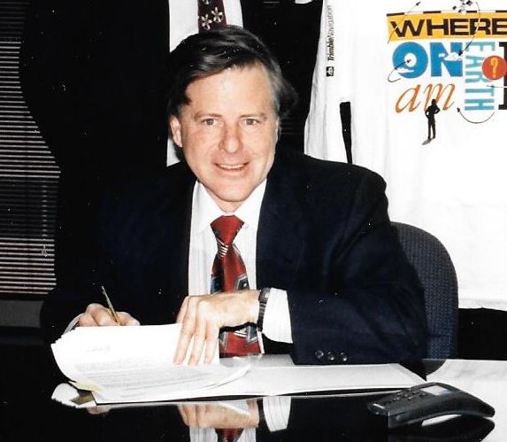
Charlie, circa 1989 at a business agreement signing
Future-Casting and Design
“The first thing we thought was that the big [future] market for GPS was going to be car navigation. Chrysler had shown a concept car in a World’s Fair with a car navigation unit, and it created a tremendous buzz.” Charlie offered another aside: “Science fiction is one of the best places to start when you are trying to predict the future because if you can think of what people would like to have, someday you may be able to figure out how to deliver it.”
The breadboard had the fundamentals, but in many ways components and the technologies that drove them would have to be reexamined and in some cases re-invented. Charlie continued, “We recognized that we had to generate breakthroughs in seven different areas to be able to get to something like car navigation.” And there were other competitive considerations. “The Japanese were eating our lunch—the U.S.’s lunch—in electronics during this period of time.”
The team examined the prospect of a future car-navigation device, both economically and in terms of physical practicalities. “We looked at the car navigation application and said all right, the highest-price standard option for a car at the time was an air conditioner. Auto manufacturers would put options into a car that they thought would really sell at $750. In fact, it wasn’t until the advent of [the now commonly available] four wheel drive that options would come at a much higher number. The car companies at an absolute minimum have a three to one ratio of cost vs selling price, and if you look at a car navigation system the GPS part is only about 40% of that. So, the GPS portion would have to be $100.”
But even then, in the era of GPS receivers, that would cost tens, or hundreds of thousands of dollars; the long-term prospect for a $100 was a realistic goal. Charlie said, “The block diagram of the GPS receiver was definitely ours. What HP gave us was an existence proof and a working model that trade-offs could be tried against—in terms of the development of something that could meet the objectives, the eventual $100 part when the system was complete. And we also did not know when the system would be complete.”
“The only way we saw that we could get there is by using the learning curve with respect to Moore’s law [the observation that the number of transistors in a dense integrated circuit doubles approximately every two years],” he said. “And recognizing the money that was going go into IC and LSI development: that is going to be the key to allowing us to drive down the size and costs. But on the other hand, if we are going to use Moore’s law, an IC the system has be digital. So you have to convert from analog to digital immediately. That was one of the first challenges we faced.”
Up until that point, nearly all development in GPS systems had been analog. “The task ahead would be as significant as moving from tube radios to pocket computers.” Imagine an analog iPhone being the size of a container ship. Charlie added, “In fact, the iPhone has a computer in it that is a million times as powerful as the computer that went up in the Space Shuttle. Life for the electronics industry truly changed in the last 40 years of the 20th century; that was the period I worked and developed in.”
I am not sure that people truly can appreciate that the challenges teams like Charlie’s weathered were quite a bit different than the “breakthroughs” in apps we get excited about today. “Imagine having to innovate not only the applications, but at the same time having to pioneer elements of a huge analog-to-digital paradigm shift.” Charlie is rightly proud of this work and that of his team. “I was on the front edge and moved through.”
The potential for affordable navigation was still many years away but served as a conceptual goal. In there would be other markets his new company would serve—and become a leader in. “There was no question that we would be moving into marine and aviation navigation first. Ralph Eschenbach, the leader on the HP GPS project, was a welcome addition to the team as well.” Charlie said, “Ralph could always be counted on to develop breakthroughs, and there was nothing he could not do if I could convince him that there was no law of physics in the way. Ralph is a private pilot, so that was high on our list. In fact, everything in terms of the future on our list was navigation because those were the markets with the highest potential benefit over legacy methods.”
Precise timing was another area where their products would have a great impact, but so eventually would surveying and geodesy. And while not wholly unanticipated, those high-precision positioning markets would have some of the greatest lasting impacts.
In two short years, they were ready to showcase their new product line. “In September of 1984, I had working prototypes of a GPS receiver. I took two and showed them at an ION [Institute of Navigation conference]. I took two because people might not believe it was reproducible if I had only one. I can remember several people handing me cards saying, ‘Give me a call when you sell the second one.’
“We had this four-channel receiver; we knew the design had to be digital and each channel had its own separate card. The microprocessors that we got to work with were controllers for automotive engines—the 6809 which was better than the original 8086—but incredibly limited by today’s standards.”
The first of a line of receivers and a model number familiar to early adopters of Trimble gear was born. “This was the first 4000, a brushed-aluminum, rack-mounted system. By the time it got into the white case, that was for the survey market.” Charlie’s team had reached a functional, and marketable benchmark. “Indeed, it was a GPS sensor that could establish a position with latitude and longitude.”
Mura-smith summarized the early markets served by Trimble Navigation; “Trimble’s first applications of GPS benefited pursuits that required precise measurements in the land and hydrographic survey industries. Mariners then used GPS location information—precise position points—and calculated real-time velocity to enhance navigation and performance of vessels between points.”
Out of the “Garage”
“We actually sold the first one to Northrup for $100,000,” Charlie said. “They were looking at it with the notion of perhaps re-engaging in the competition for GPS receivers. They never did that, but actually a year later made one of the first real-investments in our company.”
And was their operation anything like the Silicon Valley startup we see in the movies? Charlie said, “This was before the heady days of the dotcom boom; things were different then. But we did starve, and we did run garage operations.” Kit Mura-smith offered the following observations about those days of uncertainty: “Survival during the first 10 years+ before going public was never a sure thing. In fact, there were times it required real heroics—sometimes by Charlie and his dad and sometimes by all of us. LORAN-C was not so sexy a technology that could attract big investors. GPS was but in the early days, its future viability was not certain. We did your basic “bootstrap method.” Once in the early 80s, we were faced with the prospect of a major lay off. We decided to save jobs by asking all executives to take a 25% cut in pay, all other managers 15%, and everyone else a 5% cut. We promised everyone that when we returned to profitability, we would pay everyone back, starting with the 5% employees, then the 15% managers, and lastly the executives. We were successful. Everyone was paid back.”
This was in the years before Silicon Valley became a major focus for news and popular culture, but Charlie likes to tell of the visit to his operations by one particular media figure. The celebrated essayist, William F. Buckley Jr., an accomplished sailor, penned a feature for the New York Times Magazine in May, 1985 entitled, “Precision Sailing.” Buckley had become fascinated by various advances in navigation and how this would benefit not only commerce and public safety, but also all manner of competitive and recreational sailing. Of his visit to Charlie’s lab that year Buckley famously wrote, “It seemed right out of Walt Disney’s seven dwarfs’ workshop. It consists of only a few sheds, a few dozen informal, busy and terribly bright people, computers, a warehouse, microchips and high enthusiasm.”
Many of the pioneering breakthroughs arrived with relatively little fanfare, but this does not bother Charlie much; he was content on increased success and bringing new ideas to fruition. Mura-smith said that Charlie and the team absolutely deserved the reputation they had built; “It was always a struggle growing the company while reinvesting so heavily in R&D, but that is what made us who we were. By the end of our first decade, we had more GPS patents than all of our competitors combined.”
The goings would not be without other types of turbulence, beyond engineering and financial challenges. Whenever you get a lot of great intellects working together, there are often great egos to deal with. There were conflicts—things that could not be papered over, such as cases of engineers getting a wee bit too territorial with their work—un-team-like behaviors.
Team members came and went; some would eventually work for competitors. But Charlie says that competitors “did us a favor. It is always easier to sell against a competitor rather than sell against doing nothing. And if you are the only game in town, doing nothing or looking at only next year is the alternative that everyone else can come to.” Several of today’s competitors were actually, in those days, actively seeking to have Trimble provide them with GPS OEM components. Charlie is happy about the role they played in spawning developers and developments, but also that there was a growing interest among a broader range of players. “If I look back at the old days, we spawned a lot of tech, but there was a lot of parallel development spawned by academia and the military and several [companies like ours] that came up with their own.”
Invention and Re-invention
Getting from the breadboard to product was a matter of engineering challenge begetting further engineering challenges. “We had the breadboard and had to solve individual items.” But fortunately, some of his earlier work and that of his engineers gave them a head start. “My first project at HP was signal averaging, and I learned if you are quantizing a signal with a signal-to-noise ration of less than unity, you can only capture less than a single bit of information. There is no point using a high-value analog-to-digital converter to quantize noisy signals. All you are doing is generating a random-number generator for all of the least significant bits. In the HP design, their front-end was a five-stage analog down converter—traditional radio receiver—followed by a 12-bit analog-to-digital converter. So I knew that I had to deal with the 1MHz bandwidth of the C/A code signal from the GPS satellites. I realized that if I could do a single-stage down-conversion to 4MHz, I only needed a hard limiter for an analog-to-digital converter. Then I could do 1 bit arithmetic in the entire tracking loops for GPS receiver.” As too-deep-tech as that might sound to many of us, that explanation from Charlie represents a rather significant development.
“We had seven different breakthroughs we had to accomplish to build this receiver that we believed we could iterate through time and get to a place that we could someday profitably sell for $100,” he said. “Because, we felt that either we figured it out or the Japanese would teach us how. So car navigation and the Japanese thing set the specter for what I had to design for the first receiver. The problem wasn’t just us building our first receiver; the problem was building a receiver that could be iterated along with Moore’s law to drive size and cost all the way down. And, actually, the factory cost in that first receiver that I sold to Northrup was a little over $3,000.” Charlie then contrasts that with what—as he predicted with Moore’s law—would transform the GPS market. “By the year 2000, the Hong Kong price for GPS receiver function in million-a-month quantities was a buck [in simple GPS chipset capabilities you see in phones, recreational, and embed devices].”
Charlie knew this was going to happen but was still surprised how rapidly things progressed. “It turns out that this projection of the future is really tough because we think linearly. That means we are overly optimistic about what can be accomplished in the near term, and the real world progresses exponentially, so we underestimate what we can accomplish in the long term. This is true of all of us, and it was true of us back then. We did not know when this was going to happen, but we knew that this was the horse we had to ride.”
The liberating “startup” environment was very conducive to innovation, explained Charlie. “We would never have been able to build under the model of planning and budgeting of only a year or two ahead.” Where a lot of otherwise progressive-tech companies have gotten into a bind is when a business model of quarterly goals is forced across the board; one cannot innovate by being able to look only three months forward.
The new company quickly grew into a navigation and positioning powerhouse; Mura-smith said “More than 100 patented advances followed, making GPS viable and extremely useful in dynamic situations and commercial markets. [Later]; Trimble’s real-time kinematic technology allowed moment-by-moment GPS updates. More highly integrated chipsets significantly lowered manufacturing costs and power consumption. And materials engineering, industrial design, and applications software adapted to the needs of the users in diverse environments and applications.”
History and Direction
Another event in history influenced the plans for the company: the tragic shuttle disaster of January 1986, as Charlie explained, almost brought development to a grinding halt, but it also brought new considerations to the fore. It rightfully spurred a re-examination of many elements of aerospace, civil aviation, and related technologies.
Charlie explained, “When the tragedy occurred, we were at the time just days away from selling receivers into the high-end civil aviation market. Clearly, when the disaster occurred all of that went out the door [with the loss of 3 new GPS satellites on being carried by the shuttle putting the future of the GPS program in question]. Once we had created the first GPS sensor (4000) we chose the timing market as the first addressable market. You only needed one satellite to transfer time across a continent. That was the time Ron Hyatt joined.” The events would also spur development in surveying products” said Charlie; “It was the shuttle disaster that [resulted in] us putting most of our eggs in the survey market basket. This was the only market which could be addressed with 7 satellites in the sky that was large enough to sustain the growth of the company.”
The team began to concentrate on other markets. “A year earlier we had begun seriously looking into using the carrier phase to do land surveying. But to do land survey you need, at a minimum, a centimeter per kilometer [to meet first order surveying standards]. There were at the time codeless GPS receivers [many low-precision and consumer GPS receivers still use codeless solutions] and there was a famous quote [along the lines of], “This is the most accurate thing known to mankind, and if you go out and make a measurement and if you get the same answer two nights in a row, it is right.”
Charlie knew such an assertion would not pass muster with surveyors and geodesists. “There is a problem with that because Ron Hyatt [also joining the team] had a receiver at his home, and we had obviously a receiver at our shop. These were seven miles apart, and we could get two stable answers 11 cm apart. We were not yet making 1 cm per km.”
Meeting the surveying requirements would spur the next level of development. “We actually had an order for eight or nine receivers for Caltrans [California Department of Transportation] pending, with delivery at the end of the quarter. We had built the receivers, but we got to the end of the quarter and made the decision not to ship because we could not meet the 1 cm per km first order survey requirement. I guess it was three weeks later—I was in a situation where that held shipment made things difficult with our banks. We were nearly out of money. This was in April; we solved the problem in May. We did make it through.” This was carrier phase in May of ‘86. That was the big white survey boxes, like the ones carried up Mount Rainier years later.
Big Boxes on the Mountain
Charlie is proud of the role his gear played in all three successive Mount Rainier height determination expeditions, joint USCAE (U.S. Army Corps of Engineers), and LSAW (Land Surveyors Association of Washington) expeditions. As Charlie recounts, “This huge backpack with the 4000 receiver and a car battery in the bottom was hauled up the 12,000-foot mountain by some local surveyors. This was tailgate surveying but on a high and dangerous mountain.” Trimble had loaned the gear for each expedition, and Rob Hyatt traveled up to Washington to train the teams on the 4000. In 1989 three of the bulky 4000 units were used and required a small army of support staff communicating with HAM radios to perform the measurements over a period of several days.
Trimble supported the 1989, 1999, and 2010 Mount Rainier measurements. Volunteers in 1989 (left) took turns bracing the antenna for high winds on the summit. Trimble’s Ron Hyatt (right) was on hand to support the 1989 Mount Rainier GPS measurement. The backpack with a 4000 receiver and batteries weighed 55 pounds. All three sets of observations agreed within a few inches.
The mountain was re-measured in 1999 with the Trimble 4800 (hat receiver/antenna), but this time only a handful of climbers was needed. It was re-measured once more in 2010, using the compact Trimble R8 GNSS receivers (and using real-time VRS as well as static observations). The three expeditions yielded results all within a few centimeters of each other both horizontally and vertically.
A 4800 receiver/antenna was also used to measure Mt Everest


Another name that would become familiar to early adopters of the early models of GPS receivers—and especially in the surveying community—was Ron Hyatt. “I brought Ron on relatively early when I knew that the first market for GPS would be in time transfer. He was the section manager at HP in the cesium standards area, and he understood the market for the HP cesium clocks, which was a replacement market for the flying clocks.” Ron went on to lead the surveying operation, and surveying added a whole new level of complexity to implement.
Charlie said, “It was a product-manager role, and when I think about the ungodly stuff he had to go through to compute stuff, the things you had to go through to come up with good numbers, it was absolutely absurd. To think that you could create a market with that class of user interface is something that is mind boggling.” I related that surveyors were hungry for such solutions; they would fundamentally change surveying and geodesy. Charlie grinned and responded, “The fact that you were hungry it … we recognized that it was such a productivity enhancer we based the price on what you would price a manufacturing tool. You had to be able to pay for it in less than a year. We sold them in sets of three [the minimum set to perform networks of observations] for $250K. We found leasing companies that would front the cash; this made it affordable for surveying outfits. The survey outfit would go on a three-year lease, make money, pay the things off, and go on to the next generation.” The ubiquitous white (and then yellow) Trimble 4000s became emblematic of the first wave of GPS use in surveying and geodesy. [The author still has one].
The popularity was not lost on the team, and they knew they had to continue to innovate. Charlie said, “We were designing for the survey market, and we were being disruptive about it. The initial competition was not working all that well, and some of their research was directly from government contracts. We had been developing independently and had something that actually worked. There are a number of examples of aerospace companies having trouble moving into a commercial market.”
Precise time was another key market for his receivers. Charlie said, “The precise timing community [official time determination, science and academia] still uses some of those early receivers. Part of what I did to get a high price tag for my original GPS sensors was to use the 1MHz standard. It was $1300 for this 1MHz crystal oscillator; this is the same crystal oscillator that is in HP’s cesium standard [atomic clock]. This was one the technologies that I did not change in the original unit. Figuring out how to use GPS to control a cheaper crystal oscillator was clearly a breakthrough that would happen much later and would be significant, but at the time I used the time standard, and if someone is interested in precise time it still is a great receiver to have.” I have seen some of these units still in service at various timing facilities; scientists appreciate the refined models they have, their longevity, and the oscillators.
Dual Frequency
Dual frequency was the next Holy Grail. Charlie explained that the global economics of the ‘80s had an interesting role in pushing this next development. “Due to the trade deficit of the ‘80s, the Japanese trade delegation was under real pressure to buy more from the U.S. We had sold quite a few L1 receivers in Japan for their seismic network, and I can remember being involved in tests in cold rice paddies while Ron Hyatt was collecting data. So they decided they would buy more GPS receivers.”
The next order would up the ante not only technologically, but it would come with a pretty serious make-or-break deadline as well. Charlie said, “The way that Japanese government procurement is supposed to work is that during the summer they decide what they want; at the end of the summer they put in a purchase order; and delivery is the first of April. And if you fail to meet delivery you are forever barred from selling to the government again. We had to get things solved. I picked the brightest engineer with no ego to work a team to solve the problem: Timo Allison [who hailed from Leeds University in the UK and is still an engineering project manager at Trimble].”
“The Japanese government decided they wanted these receivers for seismic work but insisted on dual frequency [L1 & L2],” said Charlie. “Our agent running our office over there calls me and tells me they are wanting these and, ‘Are you willing to bid on three of them?’I said, ‘Yeah, we should be able to build three of anything—we’ll do it.’ Two weeks later he comes back and says, ‘How about 10?’ I absolutely groaned but said, ‘All right. Now, okay, we’ll make that gamble.” Two weeks later the number was 25. This was 1987 and our first workable carrier unit that could meet 1 cm per km was only a year earlier. We were not even sure when the Air Force was going to get the next satellite up.”
It was a calculated risk. “So, we decided that taking on a known technological risk was still better than being in the position of not knowing if there would still be seven satellites in the sky a year from now. So we said, ‘Okay.’ We said, ‘We’ve never seen [sufficient] data from L2 energy from space and can’t give you anything better than simulator data,’ but they were not going to settle for simulator data. Timo at the time was working on another project but was going to be able to start looking for L2 energy from space the first of July [1987]. So we went along and thought it should only be a week or so, and he should be able to find it.
“We did not have the information for L2,” said Charlie. “This was not something that was handed to us. Everyone had to figure it out for themselves; we had to recover the L2 information from the carrier phase itself. At the time the only way we could use L2 signal was totally codeless. There was no other way we could use it without really affecting the military’s equity in their system. There were other ways to get the code, but we were not going to do it.
We’re not finding it and we are getting into August and our agent is coming back; they want data! So, ‘Okay, send us simulator data,’ they said. It is simulator data and they want real data. He says, ‘We absolutely have to have data by Friday or the deal is off.’ On Thursday Timo saw his first satellite data and pulled the L2 carrier. What we were going to be able to see on the signals is the variation of its frequency and variation of its phase.” Disaster was averted, and a new era in high precision for the company was born.
L2 makes a tremendous difference. As Charlie notes, “The reason the data is so important is that we get to use the gold codes to do the signal-to-noise enhancements; there was no gold code enhancement yet. The military had it, but we could not use it as it was part of the military system, so we had to go directly to the carrier, and we had to make phase measurements. On the survey receivers, we had been doing this, but reason it took so much post-processing was that you had to figure out what part of the L1 you were on. There is one every foot for 10,000 miles, and once you do you can measure on the phase. We had to do this on the phase. In any event, it is a devilishly hard thing to find, and the Japanese were quite happy.”
But now how to implement it and put it into a product in a hurry? Charlie explained, “The problem is how we go from this knowledge and to modify the equipment we already have to put this into it. So we bring Jim Sorden in to deliver the units. Jim is someone who joined HP within days of me joining HP in 1964. I am a starter and Jim is a finisher; I needed a finisher. We ended up with 74 packages stacked up and took a photo just before they were shipped to Japan.” The modern era of high-precision survey receivers, for a great many users, really began with that development.
Another reason why his team focused on the survey market had to do with the stage the GPS constellation was in for its deployment at the time. As Charlie explained, “We needed a product that could take advantage of the fact that the five satellites [at the time] that could be viewed [initial orbits for the early GPS satellites were designed] to provide coverage for Yuma testing range in Arizona for the testing of user equipment for the GPS system. The idea was to prove that geodetic positioning could be done eventually on a worldwide basis. The fact was we wanted to expand the market rapidly. Many surveyors and geodesists saw this as a quantum leap over the legacy methods of providing geodetic references over wide areas. The setting up of observation towers, large triangulation and trilateration, latticework’s of level run—the costs to do this with GPS were a fraction even considering the high receiver prices of the time.”
When some surveyors heard we might be interviewing Charlie, they encouraged me to present Charlie with thanks and a token of appreciation from the surveying community. In the interview we presented Charlie with a 1950s expedition-style surveyor’s alidade, which was the technology for mapping in the era just before laser and GPS technologies. He was very pleased.
Charlie expanded into other markets as well. “We made our money in the survey business and we branched out. I just needed to be profitable in some of the other areas; I didn’t need to be highly profitable in those.” The nature of the products and the markets they served would change rapidly, and in part this was due to the resources available. “With integrated circuits the cost of your circuits is very volume-dependent. I didn’t know it at the time, but the simple answer is you find out what the minimum amount a semiconductor company is willing to live with to do business with you and divide that by the number of circuits you are going to take, and that is what the circuit costs. Now, in ultra-high volumes you get down to worrying if it’s the latest generation which is going to cost you a quarter a square millimeter, or it’s one generation back that is going to cost you 5 cents a square millimeter. But that is only in ultrahigh volumes.”
The Gulf War
In addition to developing for the surveying market, Charlie said, “We did have a very good high-end marine business that was quite profitable. We had a very good handle on commercial markets but not so much for the consumer markets.”
Another historic event shaped another of their lines of business. “We supplied handhelds to the military. We did not initially get much traction with the U.S. military but did with the Israeli military. [They] were quite willing to take a commercial product, try it, give it back, and if you fixed what they wanted—over several iterations—it would be good enough to deploy. So, through this process we learned how to make a hardened navigation unit that could be used in a variety of military application. .
“At the time the [U.S.] Army had felt largely disenfranchised from the joint program office, and at the time the [GPS] man pack was supposed to go to the soldier: a large backpack single frequency.” Charlie said, “One of our engineers came from defense, and he started working with the Army on what form factor a new, smaller receiver should be. Should it be a box you strap on to your upper arm, or should it be something you hold like a pair of binoculars? They settled on the binocular form, and we learned with them on what they wanted in toggle switches, displays, battery life. We built three for them to see, and they really liked it. One problem was how could they do a competitive procurement and keep the big players in the aerospace industry from buying the procurement? What they figured out they ought to do (and did do) is put out a procurement like this, ‘How many receivers would you supply for $4M?’ We did a thousand. That’s how we got in.”
Deployment went well. As Charlie noted, “We delivered the 1,000 a day early, and the Army started testing it in the field in Germany. And they found that the squad with the GPS always beat the squad without one. Four months later Saddam invades Kuwait [August 1990]. I get a phone call asking if we can produce another 1,000, and this number kept increasing over the fall. We had delivered about 3,000 units by the time of the pincer movement that went through western Iraq (first Gulf War) a few months later. So, indeed, it was our receiver that coordinated the French, English, and U.S. forces.”
Charlie is proud of being able to make a difference, but it was bittersweet. “We had warped our design to make maximum use of cell phone parts, and suddenly Japanese parts supplies hit production limits as cell phone sales took off. So we were facing real parts shortages while we were focused with supplying the military and could not go into the consumer markets that some of the other companies could. I think it was a loss overall financially but a win in how we were able to make a difference in the war effort.”
What’s in a Name?
Charlie had originally never intended to name the company after himself. He said, “We went through two advertising agencies, and in those days everybody had a Z and an X in company names. The final one that came back that caused me to punt was ‘zodiac’ spelled with an X. And you know, I said I really did not want to do it, but this is the easy way out. Navigation was in the name from the beginning and so was the sextant symbol. We changed in the late ‘80s; we went and dropped the navigation part of the name as survey became the dominant part of the operation.”
Charlie summarized developments after the L2 breakthrough: “The progression of new things we were doing in the ‘90s had to do with user interface and productivity: the reduction of the need for post-processing [RTK, real-time kinematics], the weatherproofing, making things smaller. The two pictures I took when I left Trimble was of the original Loran C receiver and the GPS hat receiver, the first one that went to the top of Everest. That book-ended my period at Trimble.”
Spectral Battles
Charlie has often been called on to weigh in on various matters within the PNT (positioning, navigation, and timing) community and policy advisories. He said he is a bit exhausted by controversies such as the broadband-over-powerlines (BPL) issue a decade past and more recently the broadband versus GPS issue that is raising its head again.
Charlie is quite attuned to the desire to develop alternate PNT, complementing GPS and working in places GPS will not. Much of the emphasis on alt-PNT and improving resiliency comes from experiences of the battlefield and not from the domestic corn field; the hazards and stakes are quite different. Charlie said, “Something found out in the battlefield was that cellular was being used for IED’s and rather than jam topically, often broad-spectrum jamming was used. And there goes the GPS. So that is an example of why there is so much effort going into complimentary PNT.” But as for domestic issues with GPS, the focus on the adjacent spectrum really frustrates and disappoints Charlie, and he is a bit bored of fighting the battle even though he knows the battle really needs to be fought.
He adds an important observation to the dialogue on the issue: “We created a major problem for large-systems companies by making GPS free. So, it is extremely difficult to make money off GPS. You do not actually see the technology anymore; it is buried down deep in things like your iPhone. What you are now seeing as a GPS user is the NRE [non-recurring engineering] for productivity, and that is really computer software—it isn’t hardware.”
He adds, “Indoor GPS can be solved with a 150,000 gate IC, and the stuff that is in your iPhone is above 10 million.” There are policy and structural issues to consider. As Charlie explains, “There are factions in the military that are still involved and that is where a lot of the noise is coming from. The problem with the FCC is that the Telecom act of 1996 stripped the FCC of its technical capabilities, and they were supposed to use the tech capabilities of their clients. Many proposals would go to the FCC about dividing up spectrum with ideas like using just the noise floor to do so and to re-purpose spectrum.” As Charlie notes, “There wasn’t someone at the FCC that said, ‘Way back when I was in college, I understood that there was something called Fourier analysis and that the time domain and frequency domain are mathematically tied together.’” This was an example of what Charlie sees as technical issues being decided without technical expertise.
But how to feed the need for bandwidth? Charlie said, “The whole drive for re-purposing the spectrum is that the needs for WiFi and streaming video, etc. are insatiable. But if you are faced with an insatiable need for bandwidth, you are not going to get it in the below-2GHz range; you are going to go above 3GHz,” which is where things like 5G are looking. Charlie continues, “The adjacent band issues [putting terrestrial in the MSS band next to GPS that some proposed and some still do] was not so much an issue of direct in-band jamming; it was the dynamic range problem in the adjacent band that was causing intermodulation problems in the front end of a signal detector. They look at the GPS spectrum and think, ‘Hey, there is nothing going on in there; there is no noise.’ Well, that is exactly why it works! We have preserved the quietness. On the side bands it had been agreed to originally that you would use those for satellite communications.” This was not an arbitrary decision; he noted that the specific range of spectrum that GPS landed in was by design in part for its abilities in that range to penetrate atmospherics.
Charlie had helped make the successful case for preserving the spectrum. “When I was working on the problem, we observed that the military understood that preserving civilian needs benefited the military.” He laments that people continue to look for quick spectral fixes when he sees the long-term future and way to feed the insatiable needs is to look in the much higher ranges and not squander those ranges best-suited for satellite comms.
GPS, the 9th Utility
Co-founder Kit Mura-smith provided us with her own summary of the company in those early days.
“The term ‘GPS, the 9th Utility’ we coined in our early GPS Primer [the popular pocket reference books shipped with early products, many still in circulation today]. The complexities of a networked world presented new challenges in how to integrate GPS with other technologies. As communications standards, computer technology, and applications software rapidly evolved, Trimble kept pace, marrying GPS information to other data sources and types, with the goal of making GPS data as pervasive as electricity. GPS was an essential utility at the heart of a host of everyday applications. Trimble was a true information technology pioneer in pursuing other technologies to integrate with our own in order to maintain our position at the forefront of the Information Revolution.”
“As early as 1982, Trimble defined its business strategy around this vision: By being able to determine the location of every object, person, or event—at any given time—we could change the way we use information to solve complex problems by essentially shaping new models of the world.”
“Trimble recognized GPS as the critical technological tool that would enable the world to solve a breadth of problems. By blanketing the planet with a universal grid that can be used to locate people, objects, and events to centimeter-level accuracies—and then adding atomic time to synchronize, track or fix in time those same people, objects and events, GPS provided a robust frame of reference for mapping and managing more useful models of the world and its activities.”
“Trimble envisioned a range of new applications made possible by GPS. Industries of enormous potential had emerged, and some older industries had been revitalized by our efforts. Over the years, Trimble staked hundreds of key technological claims, with the goal of decreasing cost, weight, and power consumption while increasing the speed and performance of GPS-enhanced products. In this way, markets as diverse as marine navigation, land surveying, aerospace, civil engineering, mining, farming, asset management and personal safety could expand through the efficiencies provided by GPS information.”
“Trimble leveraged its leadership position in GPS technology and its ability to integrate other state-of-the-art technological advancements, by focusing on applications that provided customers with solutions that kept them at the competitive edge of their industries. Quick to adopt new technologies and platforms and to recognize their potential in accelerating the evolution of GPS into an invisible, intrinsic technology, Trimble continued to invest in engineering and partnerships that advanced widespread industrial consumer applications of GPS. Timing to the hundredth nanosecond, unforeseen geodetic accuracy in real time and repeatable performance in hundreds of applications are the fruits of millions of GPS-based R&D hours. Trimble solutions save hundreds of thousands of dollars in productivity enhancements and efficiency for customers all over the world. Trimble solutions redefined the ways we did business, stayed safe, managed important assets, and related to our planet.”
Moving Forward
Charlie has not been directly involved in the operations of Trimble since 1998; he has moved on to other pursuits on corporate and academic boards and mentoring other innovators. He said, “I’m a technologist who gets excited about building things that have not been done before. I’m interested in change and really changing the way people live and work.”
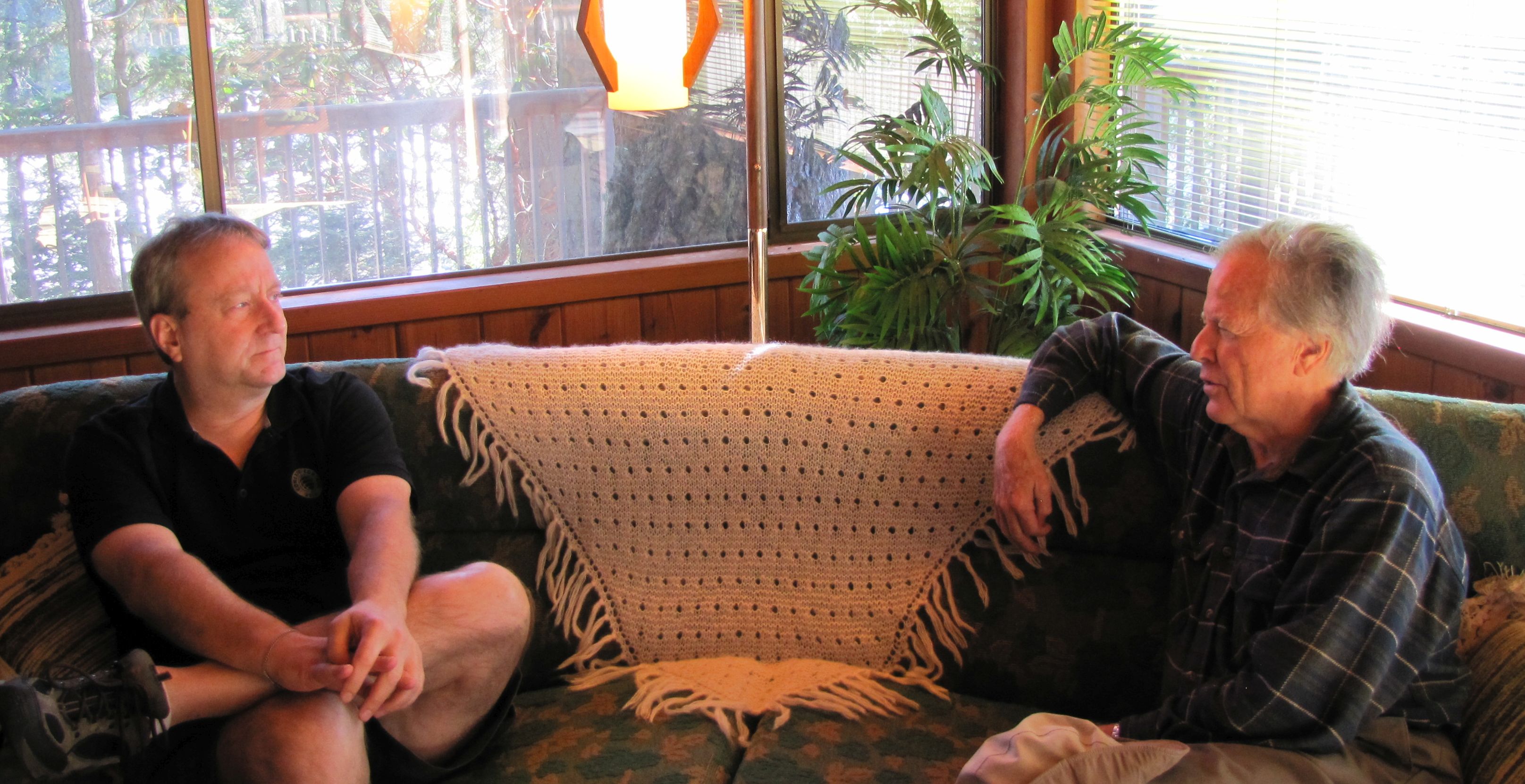
Charlie with the author at the unique island home he designed 1970s for his aunt and uncle’s property.
Charlie spoke of his current passions and pursuits. “What I have been doing over the past 16 years is mentoring a small biotech company, Arbor Vita that has a true cancer test for cervical cancer. Clearly the established incumbents that have screening tests are not happy to see this see the light of day; we are in the mode of trying to break through. I am convinced that long-term, the test will make a huge difference with regards to cervical cancer in this world, but whether this biotech company is going to go public or go bankrupt is still up in the air.
“I got to move to Texas after I wasn’t showing up on a daily basis at the biotech company,” he said. “I got to escape from Silicon Valley. What I do now to amuse myself is invest in pre-peer review research at Caltech. It turns out that Caltech professors have an easy time getting grants—if they write a grant for money to investigate a problem they already know the answer to. But that is a waste of time; the really interesting problems are the ones to be found between the stovepipes, and those are found when you do not have peer review committees. In fact, professors sort of perpetuate the peer-review process as it will be their grad students who will be on future peer-review panels.”
Charlie has kept his hand in positioning and navigation, being on the board of KVH, a company that is a leader in navigation, VSAT communications devices, and IMUs. Charlie’s wife LiYing is also quite busy managing engineering for a cyber-security company. They both travel a lot, although they find time to take the Lonely Planet travel books and explore along the way.
Is he proud of his time at Trimble, the accomplishments, and the direction of the company since? He said, “Yes” on all counts. ”My time at Trimble was really about making the company synonymous with GPS, entering and pushing every market where GPS could be a disruptive force.”
How is the company doing post-Charlie? “They are doing a really good job with a track record to be able to survive and thrive. I got the company from $0 to $250M, and since, the company has grown by an order of magnitude. His assessment of the current leadership was also positive. “
The company and the name have become nearly a household name, certainly for anyone involved in navigation, high-precision positioning and timing, and it has enabled a whole generation of practitioners in such fields to cut-their-teeth on GPS. There is most definitely a place in history for this fellow who was inspired by satellite and went on to revolutionize the work that many of us do.
He wants to be called Charlie, but he’s way more than just Charlie: On November 17, Charlie will be honored by Caltech with the International von Kármán Wings Award for his visionary leadership contributions to the aerospace industry and distinguished service to the nation’s defense and aerospace programs. This prestigious award follows a long list of lifetime awards including the NASA Technology Medal; American Electronic Association’s (AEA) Medal of Achievement; the Kershner award by the Executive Committee of the IEEE Position Location and Navigation Symposium (PLANS); and many others. He also serves in many advisory capacities: he is a member of the National Academy of Engineering; on the Board of Trustees of the California Institute of Technology; and a member of the Council on Foreign Relations. He also served on the NASA Advisory Council (NAC); the Board of Governors for the National Center for Asia-Pacific Economic Cooperation (APEC), and on the Council on Foreign Relations. Throughout his career, he has published articles in the field of signal processing, electronics and GPS; and he has contributed to a number of technology initiatives in Silicon Valley and Washington, D.C. Just Charlie?
On the ride back to the ferry, we stopped for a photo on the shore near his island home. I pointed out a spot where many years before as a young surveyor I had lugged one of his 4000 receivers across the island to set up for one of the observations used in a re-survey of the international boundary markers that are scattered around those islands. He got a kick out of that, as did my millennial daughter who (uncharacteristically) wanted to talk tech history on the long drive home (she also took some of the photos used in this article).
I did have to ask one more question: Does he consider his time at Trimble and those early days of development as being as groundbreaking as many of us end users do? He paused pensively. Then his trademark grin spread across his face and he answered, “Absolutely, there is no question that we helped change the world.”
An abbreviated version of this article appeared in the November 2016 print and online issues of xyHt magazine.