Timely Delivery of Data and Products, Marine Spatial Planning, Increased Trusted Partner Resources
Here’s a frameworkfor hydrography’s future. Start with the vision of a survey fleet, assisted by unmanned platforms, permanent seafloor installations, remote sensing, and trusted partner data collection. Nothing is limited by budget, only by the will and the imagination of our stakeholders (or the unique use of available resources).
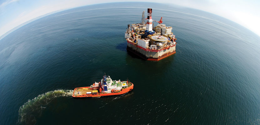
Imagine an integrated variety of data collectors. A limited worldwide oceanographic fleet has proven that critical processes occurring on temporal and spatial scales cannot be adequately observed from the traditional fleet of oceanographic surface ships. Persistent, periodic, or aperiodic events cannot be effectively sampled, observed, or studied using traditional methods of systematic surface survey.
To complement and augment the traditional means of data collection, the Integrated Ocean Observing System and Ocean Observing Initiative are establishing constant and persistent monitoring of ocean processes through permanent seafloor installations. Trusted partners’ data collection and networks of crowd-sourced data collection will also complement the collection efforts.
Users Will Set the Timing for Distribution
Prompt and on-time delivery of data or products can be one of the most maddening aspects of our profession. For so long it was normal and acceptable for products to come months or years after the survey was completed. Customers were taught to believe that it was okay to wait and wait and wait for the chart or data set that they had requested. Now that wait is no longer acceptable or necessary, and our customers should expect that we will deliver data and products on their timing.

Aquaculture is enhanced and optimized by good Marine Spatial Planning.
To be effective, essential hydrographic data—weather forecasts, support for military operations, monitoring of disaster effect and delivering relief, and optimized ship routing—must be collected and distributed in near real time. Computer models dealing with the issues of weather and sea conditions for the various operations depend on the collection, analysis, and delivery to users of accurate and timely data from as wide a variety of sensors and as soon as possible. These vary from wide-area data supplied by satellite systems, fixed observation stations, surface survey, human intelligence, to other remote sensing. Currently, satellite and other remote sensing require ground truthing to maintain their accuracy, which is why none of these components can stand alone, but they all complement each other when integrated.
The call to act is in these statistics. Across the land—1/3 of the Earth’s surface—there are around 30,000 autonomous fixed sensors, but there are less than 10,000 (including Argo Floats, drifters, and Ships of Opportunity) covering the remaining 2/3 of the globe.
Not all users need near-real time distribution of data. In the short to medium term, improvements in development of Marine Spatial Data Infrastructure (MSDI) will bring greater understanding of the oceans themselves, and thereby the impact that human activity has on them can be more accurately assessed. The vision is to expand the depth and quality of the MSDI. An integrated collection approach with traditional and trusted partner resources will potentially add thousands of new eyes on the sea. It will thus reduce the required investment and accelerate the delivery time in specific
surveys or general data-
gathering studies associated with the marine environment.
This data will be publicly available for longer-term uses, including ship design, resource stewardship, and actions for climate change, sea-level rise, bio-fouling mitigation, ocean dynamics, and biological impacts. Benefits will be gained through the development of research programs aimed at identifying improvements to physical structures by reducing fuel costs, manning and maintenance requirements, and emissions and improving the safety of those operating on and in the environment around those structures.
Maritime Global Trade Figures
- 70% of the world’s surface is covered by water.
- 80% of the world’s megacities are beside the sea.
- UN figures put 44% of the world’s population in coastal areas.
- 90% of the world’s goods come via the sea.
- Seaborne trade figures have increased more than threefold from 2.5 billion tons in the 1970s to over 8.7 billion tons today.
- The world’s cargo-carrying fleet in 2010 comprised over 54,000 ships, and construction completions in 2010 totaled over 2,500 more ships with similar growth predicted for the coming years.
Marine Spatial Planning
Marine Spatial Planning (MSP) is an adaptive, integrated, ecosystem-based spatial planning process based on sound science and good data. It is developed for analyzing current and anticipated use of off-shore, near-shore, and coastal space. The most effective MSP will come from a mature and growing Marine Spatial Data Infrastructure, which will come from traditional and new data sources and will be complemented by trusted partners who will contribute data to the greater purpose.
Corporate Social Responsibility
As consumers’ awareness about global issues continues to grow, so does the importance these customers place on corporate social responsibility (CSR) when choosing where to shop. In the industries that deal in the global ocean, a CSR policy that includes a formal and published approach to issues such as corporate governance, IMO compliance, safety, economic responsibility, environmental responsibility, and social responsibility must be developed. The return on this investment will be long remembered.
Trusted Partner Resources
Growing reliance on trusted partner (sometimes termed “crowd sourcing”) and social media is the way of the future, enabled by a connected world and everyday 21st-century technologies. There is hardly an application better suited to crowd sourcing than bathymetry, considering that every commercial vessel is equipped with a very capable GPS and echosounder.
An organized effort for on-board trusted partner data collection would mean a tremendous growth of a survey fleet transiting the world and complementing planned and systematic survey operations carried out by hydrographic offices and other surveying organizations now.
We need to think about how we might be able to shape our future development in the sense of a framework that we can apply to the kind of work we want to do, the kind of products we want to deliver, and the kind of profession we want to represent.