The following is the editorial for the July print issue of xyHt magazine:
If we completely dismiss a notion as unthinkable, we might find ourselves ill prepared should the notion become an eventuality. This applies to how we might view the status of our professions and how we fit into the markets we serve.
Is it wise to assume that things like licensing will assure us our statuses forever? Likewise, is it wise to assume that the development of the solutions and technologies we employ have reached a plateau? This issue’s articles take a bold look at several “unthinkable” things that have (or might soon) become “thinkable.”
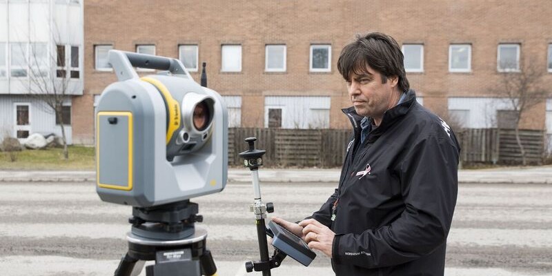
Among the most popular features we have had the honor of publishing are factory tours of the engineering centers of various manufacturers. Hearing directly from the developers and manufacturing engineers provides a whole new level of perspective and appreciation of the technological wonders they spend many years perfecting for us. I had been planning to visit the famed Danderyd, Sweden, facility of Trimble for several years (just as we have visited the facilities of other manufacturers). As a user of many types and brands of instruments, this was definitely a bucket list item for me.
As I was planning, I was informed that my visit would need to be delayed until this past spring; the factory was being expanded, modernized, and refitted (presumably for new rumored products). We now know that this activity was centered around the development of the new SX10 scanning total station that was announced at INTERGEO 2016.
Since robotic total stations were first introduced more than two decades ago, have we been on a development plateau? Total stations have not become obsolete or in any way less essential to the work of surveyors. In fact, quite a few noteworthy innovations have come along over the years, including the addition of imaging and limited scanning capabilities.
After my visit to Danderyd, we decided to break tradition to put a product on the cover, a decision we didn’t take lightly. We found enough design innovation going on inside that “bug-eyed monster” to identify the SX10 as a significant milestone in the development of terrestrial surveying instruments.
Likewise, there have been profound leaps forward in the development of geospatial software and the ability to incorporate massive data sets—lidar and images in particular—for design and analysis. Our Europe editor Nick Duggan examines this in “Multipurpose GIS.” Regular contributor Al Butler looks at an uncomfortable subject this month in the first of six columns on what is (and might be) happening to professional licensure for surveyors and others. By examining several landmark court decisions, Al presents the otherwise unthinkable as a prospect that could be so potentially disruptive as to warrant the examination of contingency plans, namely an alternative that is more certification-centric than the current license-centric plan.
Furthermore, are current anxieties over the numbers of people being licensed and the aging of the profession distracting from plans to address the shortages of qualified surveying technicians in many parts of the country? While we do not agree or disagree with such a treatise, we do encourage open dialogue about these subjects. Everything should be thinkable.