
How often do you ask yourself, “What is land surveying?” Is land surveying a narrow field of specific expertise or a wide expanse of overlapping skills joined together in a common cause? Is a surveying license the only way to demonstrate competency, or can one have skills that lie outside the commonly tested criteria?
More to the point, have you heard other surveyors say (or have you even said), “If it isn’t boundary surveying, it isn’t really surveying”? Do you need a license demonstrating your proficiency in boundary surveying to be considered a “real surveyor,” or is that answer much broader in scope?
To answer this question, xyHt has solicited the responses of surveyors and professional surveying societies and associations from across the United States and internationally. A sign of how contentious this discussion can be is that some of the panel asked not to be identified for fear of reprisal.
We live in a time of stark contrasts in the world of surveying. The number of new licensees declines in some areas of the globe and increases in others. Some surveying tasks have been automated and crew sizes have been shrunk, yet at the same time, the amount of surveying (and in many instances the overall numbers of practitioners) increases with rapid growth in urbanization and a global infrastructure boom.
Is it the time to ask: “What does it mean to be a land surveyor?” That answer will vary from state to state and country to country. Some regions seem to have a definitive answer, but for many, it is a tug-of-war between traditional practice and the ever-shifting lines of capabilities fueled by technological innovations.
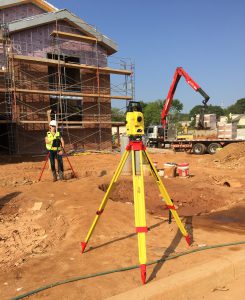
Robotic total station for construction layout. Credit: Leica Geosystems.
Unnecessary & Counterproductive Alienation
These are true stories. The names and details have been altered to protect the innocent, but the events and the emotions are quite real.
John is a construction layout surveyor of the highest caliber. He laughed when he saw that the field crew was not placing umbrellas over their tripod legs and instrument. “All your measurements will be out by about six hundredths in that direction by noon,” he said, pointing casually.
He was right! John is a man in his element in the world of high-precision construction layout – like boundary surveying, a discipline with high stakes, risks, and high value to clients and the public. When asked about getting licensed, John laughed. “Why would I do that? I’m a construction guy. I don’t care to learn about boundaries and deeds, and you can’t get licensed any other way.”
Months later, John showed up at a state surveyors meeting, attending a presentation on machine control. Before long, heated words were being thrown around about “real surveyors” and “unlicensed practice.” John quietly sat and observed. At the meeting’s end he sadly and quietly shared, “That is why I don’t come to these meetings.”
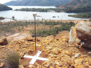
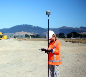
GNSS established ground control points for UAS flights in New Caledonia. Technologies and tools may change, but surveying fundamentals and goals have not. Credit: AB Concept.
Mary was invited to speak at the state surveyors meeting. She was providing a presentation on the GIS her team developed for sharing environmental boundaries. Mary was proud of the time, research, and ingenuity that went into assessing and delineating all the environmental features in Anywhere County. After speaking clearly and professionally, Mary beamed. She knew she had given a great presentation.
Then the floor was opened to questions. Most were polite, but not all. “What gives you the right to make an environmental boundary?” Another: “Do you have a surveyor’s license? You can’t do this without one. You are affecting people’s property values.”
Mary left feeling defeated and surprised at the passion with which she was challenged. The details of her work were not called into question, but her right to perform the work was. Where had her presentation gone wrong?
Clients and the public might recognize the value of the respective work John and Mary do far more readily than other surveyors. These are essential tasks, and clients seek experts. Is a license a substitute for that?
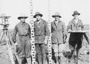
All-female surveying crew, Idaho, 1918
Some will say that a license is there to provide assurance for the client of the qualifications and skills of the surveyor. Others may view that the license has become a mechanism to assure surveyors of a certain market share. The intention and reality might be a combination of both.
Seeking Understanding
The feeling that land surveying is facing death by attrition is permeable in the United States, perhaps globally. Therein lies the uncomfortable question that all licensed surveyors must address: Is this an attrition of our own creation? By adopting an elitist attitude regarding a narrow portion of land surveying, have we alienated our fellow surveyors? Is it too late to embrace the construction layout specialist, the geographic mapper, the photogrammetrist, or the lidar specialist, and welcome them back as geospatial brethren – and surveyors?
This leads us back to the xyHt questionnaire sent to surveyors around the world. The goal was to determine what was considered surveying and to answer what regional licensing practices encapsulated the scope of surveying.
Ink sketch of young George Washington surveying the area around the Popes Creek plantation. Credit: National Park Service Historical Handbook Series No. 26 (1956)
Controversy and Non-controversy
While the questionnaire we sent to surveyors and surveying associations included questions about the respective regulatory aspects of surveying, we asked the respondents to add their views on the following: “What would be your reaction if a surveyor said, ‘If it isn’t boundary surveying, it isn’t really surveying?’”
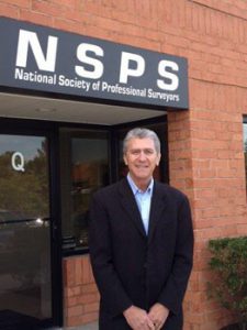
Curt Sumner, Executive Director, NSPS
Curtis Sumner, LS, executive director for the U.S. National Society of Professional Surveyors (NSPS), offers a broad and inclusive position.
NSPS represents professional surveyors regardless of which sectors within the profession they choose to engage in. If one looks at the definition of surveying within the respective state licensing laws, it is evident that the practice of surveying encompasses an extremely broad set of activities. It is incumbent on NSPS and the state societies to focus on that entire spectrum of work on behalf of all professional surveyors.
The Youngs Surveyors Network of the U.S. National Society of Professional Surveyors (NSPS YSN) submitted a joint response from several of their board and membership:
A majority of the members of the YSN aren’t old enough to understand the reasons a surveyor might say, “If it isn’t boundary surveying, it isn’t really surveying.” We can infer from what we’ve heard and have been taught, but we don’t truly know.
Boundary surveying requires skill and practice earned over many years; the journey morphs you into a jack of all trades. You become a historian, a botanist, a dendrologist, a geologist, an archeologist, a lawyer, and, most important, a surveyor. Who would want to give that up?
Those skills and experiences have provided value to the profession and the lives of the individuals who earned them. If it weren’t tough enough becoming a good boundary surveyor, the market is asking more, telling a generation of surveyors, “Thanks for all that you’ve done, but it is not good enough anymore.” What kind of response would you give?
Focusing on a specific task, boundary surveying, can narrow one’s view and cause a wake of missed opportunity. A byproduct of missed opportunity is misunderstanding, which results in isolation. The members of the YSN don’t want to be isolated. We are exploring opportunities to expand our network and encourage surveyors to step into larger roles.
As surveying continues to grow in isolation, the profession views itself through the lens of boundary surveyors. It is what we’ve known, and it is what we’re comfortable with. After all, it is the foundation of the profession.
Why venture out and try something new? The fear of diversifying yourself to a point in which you may be incompetent may scare a few of us. It’s hard to disagree with that. However, an argument could be made to the majority of vocal boundary surveyors who have needed to expand their scope of work to accommodate a changing public. If you didn’t, you maybe didn’t weather the last economic storm very well.
Surveying is on a collision course with other professions. What are we doing as a profession to make sure we survive the wreck? Saying something like, “If it isn’t boundary surveying, it isn’t really surveying” is one sure way to end up left behind.
Surveying needs to be open and welcoming to new experiences and relationships. We won’t exist without them. In conferences and meetings across the country, surveyors can be heard criticizing engineers, architects, or GIS professionals. The common argument is, “They just don’t understand,” but what have we done as professionals to help them understand?
In many states, boundary surveying is exclusive to surveyors. In those same states, that’s all surveyors are licensed to do, but surveyors are not one-trick ponies. We offer unique perspectives and solve problems (more than just boundary problems). We help others position and measure what they find important. There isn’t a need to marginalize what we do. Instead of dividing our profession, we need to focus on building relationships and expanding the definition of surveying to include what we can truly offer.
“If it isn’t boundary surveying, it isn’t really surveying” is nearsighted and severely damaging to our profession’s future. A “dying” profession is not the image we want. By degrading the other disciplines of surveying, we take away the opportunity to grow together and continue the perception that the only way to “protect the public” is through their boundary lines.
We’d like to thank David Anderson, PLS; Dan Kvaal, LSI; Denver Winchester, PLS; Samantha Tanner, PLS; Evon Silvia, PLS; and Christopher Glantz, PLS for their input.

Christopher Glantz, PLS. President NSPS-YSN
David P Acosta, LS is the president of geospatial services at a multi-disciple firm, has served as president of New Mexico Professional Surveyors (NMPS) and has been honored as one of xyHt’s 40-under-40 outstanding geospatial professionals. We asked David for his views on the subject for his perspectives on a state level.

David P Acosta, LS
I feel like surveyors here in New Mexico have had ‘tunnel vision’ when it comes to the services that they provide because other services were not thought of as ‘real surveying,” said Acosta. “Our company, CSTi, has challenged ourselves to be different than the status quo and has been successful in providing services outside of boundary and construction staking. I actually changed the name of my section from Surveying Services to Geospatial Services in order to separate ourselves from other survey companies and also to describe that we do more than just boundary etc.
The next thing that comes to mind is that, in order to receive a surveying license in New Mexico, you have to pass a NCEES test which is at least 75% boundary-law related. What if you want to start a surveying company that provides laser scanning, UAV, 3D modeling services and don’t care to do boundary? We have played around with the idea of having licenses for separate disciplines similar to engineers. There could be a separate endorsement for highway surveying, UAV photogrammetry, geodesy, boundary and general construction staking. In college courses, you could touch on all subjects but then be able to be more specific when it comes to obtaining a license—similar to engineering.
David H. Widmer, PLS
David H. Widmer, PLS, had previously served as a board member of Pennsylvania State Registration Board for Professional Engineers, Land Surveyors, and Geologists for more than eighteen years and past president for the National Council of Examiners for Engineering and Surveying (NCEES), and a past governor of the American Society of Civil Engineers (ASCE) Utility Engineering and Surveying Institute (UESI). Widmer does not mince words:
I would say bulls**t, and that is coming from somebody who prides themselves in being a top-notch boundary retracement surveyor.
Widmer believes there is another way to view the issue.
Personally, I think there should be two types of licenses: boundary survey licenses and what we have come to know as engineering surveying licenses, which covers everything except boundary surveying.
[There are successful examples of this in other countries, like Malaysia that has four main classes of license: geomatics and land; quantity; property; and building.]
We have heard from other surveyors in the U.S. who seem to agree with Widmer’s views. The United Surveyors of Arizona (USOFAZ) provided responses from several surveyors who wished to remain anonymous. Among the responses:
I like to think of a land surveyor as being well versed in retracing and creating boundaries. All of the other, more technical measuring tasks are what is referred to as geomatics in nature and are not surveying.
And:
It is my understanding that some of the tasks defined as land surveying, by Arizona statute, are allowed under the direction of a civil engineer. This would seem to support a difference between geomatics and surveying professionals.
International Insights
Melissa Harrington, current vice-chair and incoming chair of the International Federation of Surveyors (FIG) Young Surveyors Network offered the following response on behalf of this rapidly growing international organization for young surveyors. Harrington’s response also appeared as a guest editorial for the March 2018 issue of xyHt:

In May of 2018, the fourth FIG Young Surveyors Conference will be held prior to the FIG Congress 2018 in Istanbul (FIG is the International Federation of Surveyors). The title and theme of this year’s Young Surveyors’ meeting is Beyond Boundaries: The Changing Role of the Surveyor.
xyHt recently reached out to the FIG Young Surveyors (and multiple surveyors and surveying associations worldwide) for comments on a subject that dovetails with the theme of the 2018 meeting: the diversity of surveying disciplines and their important role in society. The simple question asked was what our reaction would be if we heard someone state, “If it isn’t boundary surveying, it isn’t really surveying.”
This is a very narrow-minded view, and, if we continue to undersell our skillset as geospatial professionals, it could mean the end of our profession.
Surveying is more than just boundaries and always has been. Traditionally, surveyors were explorers. They were first to map new territories, identify occupation, define new boundaries, and design and supervise the construction of utility services, roads, drains, and new additions to townships.
Yes, defining legal boundaries is at the core of what we do, but we also do much more!
Our role has developed significantly over the past 20 years, and as technology and consumer expectations continue to change the way spatial information is collected, stored, and shared, surveyors will continue to play a key role in our spatially enabled and global community. While we must, of course, preserve elements of our legacy, we must also be the stewards of progress.
The statement raises two topics that members of our profession are constantly discussing. What is in a name, and what is surveying? These topics that are better discussed another time, but both are valid as we try to promote the importance of surveying in a spatially enabled society.
When someone asks a surveyor, geomatics engineer, or geospatial professional (whatever the preferred label) to describe what they do, I bet that they struggle to piece together a concise elevator pitch. Why? Because we are more than just boundaries.
Most commonly, a surveyor will describe himself or herself as a professional who measures the land. Yes, but more. We are generalists, and we are experts. We map all facets of the Earth’s surface; we determine boundaries, locations, and topographic features and assist with the construction of outstanding manmade structures. We manage data, and we dabble in law. We are more than the maps we create and the image of a theodolite on a tripod!
The sooner everyone within our profession recognizes, this the better.
Melissa Harrington (New Zealand). Current vice-chair and incoming chair, FIG Young Surveyors
Canada
Chris Chiasson, ALS, CLS, president of Velocity Geomatics, and a former council member for the Alberta Land Surveyors Association, put it this way:
It would be pretty closed-minded to exclude other surveying (I would classify this as construction, GIS, mapping, topographic surveys, laser scanning, and drones) from your practice and only concentrate on land surveying. There are much larger markets for survey activities, and they tend to be less commoditized.

Chris Chiasson, ALS, CLS (Canada)
Licensing in Canada is managed (authorized by government acts) by self-regulating professional associations in each province, but all require the famed “12 or 13 exams” on a wide range of surveying subjects to open the door, plus an educational assessment – not an easy path.
For non-boundary work, there is no license requirement, but there are some murmurings on the provincial and national level of ideas for a professional license or certification for other disciplines of surveying work.
Belgium
Belgium has an interesting system for cadastral surveys, explained Christof Lambrecht, a surveyor with a multidiscipline surveying and engineering firm.
Property surveys can only be done by registered surveyors, plans must be signed and mention the registration number of the surveyor. (Mine is LAN05.1xxx LAN from ‘Landmeter’ = Land surveyor in Dutch, 05 = registered in 2005, surveyor number. 1xxx) In Wallonia, our French speaking part of Belgium that would be GEO05.1165 with GEO from the French ‘Géomêtre’.
Most surveyors here run their own one-man business; some own a surveyor’s office with sometimes multiple land surveyors and/or topographers. In most cases, one land surveyor and some topographers. Others work for engineering companies, DOT (roads and rivers), DOD, the national railway company, and The Cadaster (which is part of the Dept. of Finance). All these surveyors may do boundary if they have their LAN/GEO number. To obtain the registration you must:
- Have at least the topographer degree,
- go to court once for the ‘swearing in’ before a judge, and
- deliver a copy of your survey insurance.
To keep your registration, you need 20hrs/year of continuing education. Concerning education, we have the 3, 4, and 5-year degrees: 3 years = topographer, 4 years = industrial engineer (abbr. “Ing.”), 5 years = geodesist or civil engineer. (abbr “ir.”).
I was one of the last old-school land surveyors who took a federal exam for a central examination commission, then 2 years as a trainee and then finally a second exam (theory & practical) for the same federal ex. commission. No lessons were given; you could order the questions from the past years, search for your books, and study. Most started then with (in these years) a 2-year degree in topographics.
It may sound strange, but the cadastral surveyors do not do the real boundary surveys; we have a financial cadaster, not a legal one. Our main task is to identify the owner of the parcel and the value of the property so the government can collect taxes. This was originated by the well-known Napoleon Bonaparte. The cadastral maps are updated by the cadastral surveyors who obtain their survey data from the other surveyors who deliver their plans to a notary. In some cases they perform their own surveys, but that is more a topo survey, without boundary research. So, if no poles or monuments are present, you only find notes of fences and ditches on their sketches. These sketches are well archived, and land surveyors can consult them at the Cadastral offices.
You only need a registered land surveyor to make a plan for mutation, when new parcels are created. When an existing parcel changes from owner, strictly spoken you do not need a surveyor. The notary can describe the property with the cadastral division, section, parcel number, and the cadastral area. (that area may vary from the real area) From time to time we work on agriculture parcels with primitive numbers – these are the original numbers/parcels from the first Napoleon maps. It means that none of the boundaries of the parcel did change since 1835.”
Both functions of surveying and estimating require a licensed surveyor (though many of the regulations have only come about since 2003). Non-boundary surveying and non-property assessment functions do not strictly require a license, as in many countries. Lambrecht says to become licensed you need a degree, to be sworn in by a judge, and to show evidence of surveyor’s insurance. Such education requirements are prevalent worldwide but not in some U.S. states.
Do the boundary/property surveying and other surveying disciplines in Belgium get along okay and have mutual respect? Lambrecht said, “I hope; but I guess not. For me there is (in Belgium) a big difference between a land surveyor who can operate an instrument, do boundary research, and make a final map—and the land surveyor who does value estimate of parcels and buildings.
As a side note: now the title of a land surveyor is ‘landmeter-expert’; before 2003 it was ‘meetkundige p schatter van onroerende goederen’ which translates a: ‘geometric – estimator of real estate’. Both disciplines require a surveyor in Belgium, I never did one job as estimator of real estate, and I hope I never have too. But that does not mean we can’t live together.
Christof Lambrecht (Belgium)
South Africa
There are varying degrees of harmony among the surveying disciplines in different countries. Though we caution that views might vary, we have individual feedback. For instance, one construction surveyor in business for decades, wishing to remain anonymous, explained challenges he has experienced in South Africa.
Boundary surveyors here in South Africa run a tight ship. Their new Geomatics Act, implemented in 2015, ties up GIS (and anything to do with measuring the Earth) for them and their registered members to share amongst themselves. I have had conflicts in the past, due to being excluded from quoting on civil engineering work, or other surveyors reporting me to the South African Geomatics Council. After a few brushes and recent conflicts, I generally fly under the radar and just get work through word of mouth.
United Kingdom
Perhaps though, the very act of licensing alone may or may not might lie at the heart of some of the issue. As Nick Hampson, vice-president of TSA, a council member, and managing director of Malcolm Hughes Land Surveyors Ltd. shared,
There is no cadastre in the UK, where we work under a law of ‘general boundaries’ (on that subject of which one could write many pages, but still leave you confused!), so there is very little boundary surveying.
Boundary disputes generate some work for land surveyors, but these can be undertaken by anybody in professional practice, qualified or not, although a court will favor a chartered surveyor (RICS member).
Chartered Surveyors may feel superior, as achieving membership of that organization is not easy. However, within the UK land surveying profession, there is very little one-upmanship and general respect across the profession. There is a divide between those that work principally within the construction and civil engineering industry and those that provide more general surveying services, partly as result of potentially lower fees for much construction-related work, with the exception of more specialized dimensional control, monitoring and high precision work, which is well rewarded.
Most survey businesses will undertake a mix of work including topographical, measured building, laser scanning and engineering survey, and many now undertake utility mapping survey. Hydrographic survey and aerial survey tends to be the domain of more specialized survey business, although there is growing interest in drone operation.”

There is no licensing system in UK” said Hampson, “Chartered Surveyors, and perhaps members of other professional institutions have more kudos but no other specific advantage.”
TSA of the UK is an interesting and unique professional association that promotes the services of commercial surveyors (of all disciplines) but also publishes many technical papers and guides that explain surveying services to clients.

Nick Hampson (UK)
Scotland
William Kelly (Scotland)
Some areas, such as hydrographic survey, are sometimes seen as a bit of a dark art to other surveyors, but I’ve generally found that surveyors in different disciplines do respect one another. They are usually from similar roots, after all, and a good land surveyor would most likely be a good hydrographic surveyor, etc. The various surveying disciplines are also recognized by our accreditation bodies, CICES and RICS, which is positive advancements.The only thing I have noted regarding ‘real’ surveying is not between surveyors themselves, but towards others not from a surveying background who offer geospatial services. Advancements in several areas enabled more work done by non-surveyors, lowering the entry level (education and price) for such as services offered by drone operators.

Germany
One of the largest professional surveying entities in the world, and with a long and august history, is Germany’s DVW: Deutscher Geometer Verein (Surveying Association), now the Society for Geodesy, Geoinformation, and Land Management. The DVW also publishes professional and scientific journals and organizes the annual INTERGEO, the world’s largest surveying-specific conference and exhibition.
Dr.-Ing.Jens Riecken, vice president of the DVW, provided a detailed explanation of the system of state-level cadastres and the rigid education and experience requirements for “publicly appointed surveyors.”
In addition, Riecken offered these insights on non-boundary surveying:
In principal everybody can do surveys. But in practice, only qualified engineers (with university education) are working. In addition, in some German Länder (states) engineers are required to be a member of a chamber. The members of DVW do work in the disciplines of geodesy, geoinformation, and land management. My estimation is that about one-third of our members are directly involved to do boundary/cadastral surveys.

Riecken responded to many of our questions in a direct A\Q&A format:
xyHt: Are property surveys performed by only government surveyors (as in Sweden) or by any qualified surveyors?
Riecken: Government surveyors and public appointed surveyors are allowed to do property surveys. Both have the same educational qualification!
xyHt: Is there a national cadastre, or is it by state or localities (e.g. city)?
Riecken: The national cadaster is in the responsibility of the German Länder (states). There exists a common standard. Often (not always) the cadastral offices are integrated into the municipality / or county offices.
xyHt: Does boundary (cadastral) surveying require a national/state/or local license or certification? Are there minimum education requirements before obtaining licenses/certifications? Are there ongoing education requirements and/or retesting to keep licenses/certifications?
Riecken See the answer to the first question. In general, 5 years university study (master) + 2-year state trainee program + additional state exam. Public appointed surveyors have to apply for a license.
xyHt: For non-boundary/cadastral surveying (e.g. construction, hydro, engineering surveying etc.) are there licenses or certifications required? Minimum education and ongoing requirements?
Riecken: A minimum of 3 years study (bachelor)
xyHt: Do boundary and non-boundary surveyors join the DVW? Is there a mandatory requirement to join such an organization? Is the DVW involved in regulating the activities of surveying?
Riecken: The objectives of DVW are to promote the disciplines of geodesy, geoinformation and land management in science, research and practical experience. DVW wants to contribute to the education, further training and professional development of its members, and in this context, to promote national and international co-operation. DVW co-operates with technical and scientific associations as well as with universities and other institutions. DVW contributes to legislative proceedings at federal level as far as the concerns of geodesy, geoinformation and land management are affected. DVW addresses the achievements and the importance of geodesy, geoinformation and land management to the public.
On an annual basis, DWV organizes the INTERGEO consisting of a professional congress and a comprehensive trade fair. The INTERGEO is the most important and largest event of this kind in the world, covering all disciplines of geodesy, geoinformation and land management.
DVW has been publishing the Journal for the Surveying Profession [Zeitschrift für Vermessungswesen (zfv)] since 1872. It covers topical issues of science and practical experience. The advertisement section provides a comprehensive insight into the current labor market situation for surveyors. Moreover, the DVW-Report (DVW-nachrichten) provides bi-monthly information on DVW activities.
Seven DVW-study groups deal with current surveying and land management issues on both a scientific and practical level. Their findings are presented at conferences, seminars, in DVW-Publications and in zfv, the Journal for the Surveying Profession. Moreover, these findings are referred to in comments on legislative draft bills.
xyHt: What is the relationship with the BVDI – Bundesverband Deutscher Insolvenzberater (an association of cadastral surveyors). I understand that the BDVI has in its membership many publicly appointed surveyors. Do the publicly appointed surveyors have an official role in non-boundary surveying or cadastral-only?
Riecken: All members of BDVI are also members of DVW. BDVI-members do cadastral surveys (question 1) – on average may be 60% of their work. In addition, the could provide all other tasks in the field surveying (even land evaluation).
xyHt: Surveying and geomatics degrees at Universities: are these all classified as Engineering degrees? (e.g. we see the prefix of Ing. and Dipl. Ing). Are there surveying-only degrees with other designations? Are there non-degree surveying certifications (e.g. 2-year programs, and at trade schools or apprenticeships)?

Dr.-Ing.Jens Riecken, vice president of the DVW (Germany)
Riecken: In former times yes (Dipl.-Ing or Dr.-Ing), today “i.g.” Master of Science, the non-degree surveying certifications exists in the field of geoinformatics, e.g… as an “add on” qualification).
As for the view of fellow surveyors among disciplines, Riecken noted that there may be somewhat of a hierarchy of such views based on respective education requirements. In a country with a long history of exacting standards and requirements, this is understandable.
[Ed. based on our exchanges with the DVW and speaking with surveyors at INTERGEO, xyHt plans to expand on the subject of the DVW in a subsequent article in the near future with feedback from members; surveyors working in various disciplines.]
Australia
Australia, at each state level, has, like many countries, demanding education, experience, and examination requirements for licensing. But again, this is for the most part boundary/cadastral-centric. There are formal cadasters in states, and South Australia was the pioneer in Torrens land registration systems. Australia has also seen great booms in mining and infrastructure surveying.
Franco Rea, LS, director at Alexander & Symonds Surveying Consultants, Rea: responded to many of our question in a Q&A format:
xyHt: Are property surveys performed by only government surveyors (as in Sweden) or by any qualified surveyors?
Rea: Only licensed surveyors are allowed to undertake property surveys.
xyHt: Is there a national cadastre, or is it by state/region or localities (e.g. city)?

Franco Rea, LS
Rea: Yes, we have state cadastres that are put together to form national cadastres and managed by state and federal agencies.
xyHt: Are private surveys updated in the cadastre only by government surveyors?
Rea: No, all certified surveys performed by licensed surveyors feed back into updating the cadastre; the updating is done by the government.
xyHt: Does boundary (cadastral) surveying require a national/state/or local license or certification? Are there minimum education requirements before obtaining licenses/certifications? Are there ongoing education requirements and/or retesting to keep licenses/certifications?
Rea: Yes, the license is state-based and managed by local state-based surveyors boards. The minimum requirement is a degree in surveying and then experience and a project. All states recognise each other, and they have a reciprocating surveyors board that looks over all states registration of licensed surveyors.
xyHt: For non-boundary/cadastral surveying (e.g. construction, hydro, engineering surveying etc) are there licenses or certifications required? Minimum education and ongoing requirements?
Rea: No requirements. Some places insist on some qualifications, but most don’t.
xyHt: Do boundary and non-boundary surveyors join a surveying association or organization? Is there a mandatory requirement to join such an organization? Is said organization involved in regulating the activities of surveying? Please provide a short summary of the role of said organization (and/or web link).
Rea: There are no mandatory associations; there are voluntary associations: Surveying and Spatial Sciences Institute. All land surveyors are required to be licensed through their state surveyors board. This is a legislated requirement and the surveyors boards manage the licensing, education and continuing professional development programs. Payment of their license renewal does not give them any “membership benefits.” Surveyors are free to join membership associations that offer professional industry-related membership benefits.
xyHt: Are there publicly appointed (government) surveyors? Do the publicly appointed surveyors have an official role in non-boundary surveying or cadastral-only?
Rea: Very few government surveyors are left. The South Australian Government employs 14 licenced surveyors which represents 10% of our overall licences (148 2017-18 licence period).
xyHt: Surveying and geomatics degrees at universities: are these all classified as engineering degrees? e.g. we see the prefix (for example in Germany) of Ing. And Dipl. Ing. Are there surveying-only degrees with other designations? Are there no-degree surveying certifications (e.g. 2-year programs, and at trade schools or apprenticeships)?
Rea: No, in Australia we are one of the only few remaining countries that have pure surveying degrees. The master’s degree delivered by University of South Australia offers modules in a variety of surveying related subjects. At the point of practical training (further 2 years under supervision), Registered Surveying Graduates are required to provide practical training and reporting in the categories of Urban Land Surveying, Rural Land Surveying, and Engineering.
xyHt: Are all disciplines of surveying recognized and respected equally? Or, do (for instance) cadastral/boundary surveyors feel their work is the “real” surveying?
Rea: Yes, in Australia all cadastral surveyors are licenced and regulated. The profession overall promotes the benefits of using licenced surveyors, and each state co-ordinates annual recruitment activities focusing on ages 18 to 24 years. The different state boards provide financial assistance to their nominated committees for recruitment. In South Australia we have the Surveying & Mapping Committee SA (SAMSA). This committee works with the SSSI – SA Young Professionals, and together they provide activities promoting careers in Surveying.
In response to our main question, Rea said, “Yes, it is all surveying and we all get along fine. We generally need to do all types of surveying to make money, so we are all doing real surveying. We discriminate between non-cadastral and cadastral by using the term, ‘licensed surveyor,’ and you need to be licensed to use that term.”
Netherlands
Of interest may be our examination of surveying the formal cadastre and the “driving judge” in the Netherlands from the September 2017 issue of xyHt.
Commonality amid Diversity
Land surveying is a profession as wide and varied as its practitioners. The common thread is the measurement of the land. The differences lie in the approach to those measurements, sometimes the precision of those measurements, and absolutely the final use of those measurements.
Rare is the surveyor who only performs measurements for the purpose of determining legal boundaries, yet that is the focus of the licensing exams in most regions. This is for good reason, as the governing bodies usually have a vested interest in the land ownership.
Less rare is the surveyor who does not perform boundary surveying at all but earns a livelihood measuring topography or laying out complex construction sites. These surveyors may use an unmanned aerial system to determine stockpile volumes, a 3D laser scanner to capture and model historic sites for future generations, or a geographic information system to analyze the impacts of sea level rise. Most importantly, these are professionals providing a valued surveying service.
Many U.S. surveyors have become resistant to change as the profession grays and they near the end of their careers. There is much talk, and no small amount of consternation, regarding our shrinking numbers.
Perhaps the issue is not as big as it seems if we reconsider the breadth of surveying and open our arms to fellow surveyors who will never retrace a boundary or seek a license but are professionals nonetheless. They may go by other names, such as construction specialist, GIS professional, engineer, geographer, cartographer, UAS pilot, or photogrammetrist.
This does not make them lesser surveyors. This does not mean they need to be licensed. (Certifications for demonstrated skills, perhaps.) Cooperatively, we can learn from each other and lift each other up to provide better services for our clients and the public.
There is a vibrant community of land surveyors just waiting to be included. Throw open your professional organizations’ doors. Replace confrontation with acceptance. Be proud of your license but recognize it as a symbol of competence in a specific area of practice. Allow others to shine in their areas of practice.
Surveying is still relevant – and much more exciting – when we take it all in.
Below are additional responses from U.S. surveyors (courtesy of the United Surveyors of Arizona – USOFAZ). A thank you to Kent Groh, PLS of the USOFAZ for soliciting and compiling the following responses:
“I think the common thread in the thinking is the measuring. We measure, often with common equipment. Is a carpenter using a pocket tape a surveyor? He measures! Our first act and impression by others is our measuring. Not all boundary surveyors (that measure) can complete construction surveying. Not all construction surveyors (that measure) can complete boundary surveying. Not all non-surveyor drone mappers (that measure) can complete boundary or construction surveying. Not all GIS mappers (that measure) can complete construction or boundary surveying. Etc., Etc.”
“In the preservation of the vocation of land surveying, defining land surveying as “measuring” must end. Anyone can measure, and measuring tool types are abundant, and the next future measuring tool now sits in the mind of some non-surveyor somewhere in the world, just ready to join our “spatially referenced” cell phones.”
“[respondent], RLS – completing boundary, construction, and topographic land surveys.
Limited by my measuring tools! I don’t use a plane table, I also don’t use a drone, but satellites are my radio corrected RTK friends. Not sure if I am a “real surveyor,” but I practice a few of the many branches, not all, but I measure in all that I practice.”
“I don’t think there is unity. Surveyors, by definition, are an independent lot.”
“A land surveyor is an expert at measuring. He can specialize in one area of expertise or have knowledge of many facets of land surveying. There are those that feel like construction staking is not the purest form of land surveying, but it is for nothing gets built without a Land Surveyor. For ALTA surveys a land surveyor must have some legal expertise. For aerial mapping a land surveyor must have some survey control experience. Topographic design surveys require knowledge of what the design team will need.”
“Everything a land surveyor does has more liability in it than the cost of the survey. So those who view us as a one trick pony do not understand the depth of knowledge and experience that a land surveyor must have to perform his various duties.”
“Although boundary surveying is an important part of my skillset and workload, it is by no means the only measuring or surveying I do that requires the same accuracy, research and precision. The fact is that every measurement I take, estimate or present to a client takes nearly if not more) care and diligence as all parts of my surveying tasks. Measuring a stockpile, mapping an area using 3D drones/software to track and record quantities, planning earthwork balances and mass-hauls are just a few of the items our clients require to be performed by a licensed surveyor. As far as co-existing with the other parts of engineering, design, etc. Our company relies on the survey department to be skilled and knowledgeable in a large array of all the fields we use to plan, design or manage the project, and many times our surveyors have a greater knowledge and capacity to do the work than many of our clients or in-house ‘engineers’. In my experience, surveying is an amalgam of many different pieces of measuring skills, and most surveyors are well beyond just being boundary-chasers. Surveying is not able to be defined in a single spectrum or broad definition anymore (not if they expect to work in the field very long, anyway) and must be viewed as a menagerie of many different disciplines and methods of measurement.”
“In my experiences, the relationship between the different disciplines of surveying have usually been segregated. As in the construction staking crews only did construction staking type jobs and the boundary/RW crews only did boundary and RW type jobs. It always created a “line in the sand” for the survey dept. that was not always healthy. I have heard guys on the Boundary crews refer to the Construction crews as “point stakers” and say that construction staking isn’t “real surveying.” I never agreed with this. I thought that construction staking was more labor intensive and forced you to make critical decisions on the spot to field fit bad designs, then you have the stress of being blamed for everything under the sun. A “real surveyor” can throw away the plans when they’re wrong and make things work. A “point staker” will drive back to the office and say it can’t be done. Before the recession there were a lot of point stakers. After the recession, things changed a bit. If you wanted to keep your job, you better be able to do both. It forced a lot of guys/gals to be more versatile and not so one sided on their skills. Today I see a lot more “jack of all trades” type surveyors. They have been forced to learn both sides and it has made them more well-rounded and better in the long run.”
“My opinion about what is and isn’t “real surveying” is this. First, there are numerous laws that govern over boundary surveying specifically and require that only an RLS perform that work, but that, in my opinion, is not the only thing a land surveyor can or should do in their career.”
“Boundary surveying isn’t necessarily fully divorced either from other categories of survey work. A boundary determination could easily propound planimetric information along a line, or manipulating geographic information from GIS or other geodetically tied cadastral datasets (e.g. GDACS data) or tie an NSRS benchmark for a flood boundary determination, etc.”
“I have also often heard that some functions ‘can’ fall into the sub-professional category, namely some of the mapping efforts (including hydro, topo, remote sense, drone operation) and some technical efforts (including construction layout and machine control). These ‘may’ in special cases have no full requirement to be cadastral or geodetically referenced, but the ability to determine when a special case does or does not exist most certainly is still well within the professional realm of responsibility. Put simply, performing some functions may not be professional actions, but knowing when to perform them (or omit them) is.”
“My opinion of what a professional surveyor should be well versed in is as follows. First, an understanding of the geodetic tools that are commonly used (namely GPS) and a full understanding of the NSRS they are tied too. Second, an understanding of the land boundary, built on top of a geodetic base. Lastly, having the two foundations just described, all the other components of surveying can be professionally built. This last part most certainly includes construction, topo, mapping, etc. Put simply, my opinion is that all topo, construction and mapping, etc. requires the knowledge of when the geodetic and cadastral functions apply (or are correctly omitted). The omission of geodetic and cadastral parts of those tasks is a professional decision.”
“My opinion is there is no “real surveying” or “sub-discipline.” There is a full understanding of how all the component parts are related and how they interact. Without possessing a full understanding of the entirety of what surveying is, determining when the rules (either of science or law) apply or may be correctly omitted may not be known. A laymen or even a junior level technician may perceive no notion of much of what is the science and art of surveying, but their limited perception does not govern nor should we continue to kindle the notion that there is “real” versus “sub-professional” activities. All facets of surveying, built on the geodetic framework and confined by a webbing of cadastral rights gently blanket all the other components of the one single discipline that, in its entirety and full completeness is “real surveying.” They are all one in the same, applied or omitted by the “real surveyor,” who is a well-rounded, educated, experienced and a registered professional.
“The topic of professional (“land” purposely removed) surveying being limited to “boundary” surveying ONLY is at the crux of our identity problem and professional recognition deficit. Professional land surveying exams, appropriately, test the knowledge of a surveyor in subjects beyond boundary surveying. However, we have let state laws erode our jurisdiction over topographic, aerial, hydro, construction, geodesy, etc. Some of this is self-inflicted by our lack of education (and requirements thereof) providing our profession with the tools to better understand the more complicated surveying tasks such as geodesy. The remaining infliction is from other groups having stronger lobbying power and fighting hard to keep any surveying that is “not related to a land line” away from the requirement of being supervised and stamped by a professional surveyor. Some states specifically exclude “topographic surveying and photogrammetry” from our jurisdiction. I would argue that the public can be (is being) harmed in a similar fashion by performing negligent topographic surveys, whether performed by traditional survey methods or “photogrammetry”. It is ALL surveying. Using a different tool (such as a laser scanner, lidar, airplane, or drone) does not preclude it from being “surveying”. Speaking as an engineer, I took one basic surveying class as an undergraduate. This one class did not provide me with the knowledge to perform any kind of “real” or “professional” surveying. I would argue that having one class fools many into believing they have enough knowledge to perform surveying. Engineers are typically careful not to practice beyond their specialty. For example, an engineer who specializes in structures is not typically capable of providing hydraulic or hydrologic services or vice versa (probably more common). However, many engineers believe they are capable of providing topographic surveying because it is “just math.”
“In many places around the world, there is less separation between a boundary surveying and all other surveying. Many countries have a federal registration that carries a much broader and respectful title. Having said that, they are careful, as we should be to recognize that boundary surveying does require local knowledge and thus, is well suited to a state licensure to protect the public. However, that should not limit us to ONLY boundary surveying. I am a proponent of state specific land surveying licensure, but for it to fall under the same context as any other engineering profession. “Land” (or better called boundary or property) surveying would be a specialty within surveying and license as a “professional surveyor” and potentially have a specific license accreditation for boundary, just like structural engineering falls under engineering, not vice versa. Many states require an additional license for to be a structural engineer, we should do the same.”
“We used to have the market cornered with regards to precise measurements. That is no longer the case. Measuring is now one of the easiest tasks for a land surveyor. Its so easy, many registered land surveyors hand that task to field personnel with little experience. The manufacturers of precise measuring devices make it real easy for the layperson to operate. The layperson may be performing land surveying tasks per state statute, but enforcing those statutes is not an easy task and land surveyors are about the only people who are aware of such statutes.”
“Determining property boundaries on the other hand probably represents the reason land surveyors are licensed. I witnessed “surveyors” trained by engineers and working in engineering firms survey all sorts of things in Canada. If those “surveyors” followed a practical model with adequate redundancy and checks, they provided an adequate service for their needs and the needs of their clients. If they didn’t, their efforts eventually caused problems at later stages of the design and construction processes.”
“Every non-registered surveyor I encountered while in Canada new the difference between the type of surveyor they were and the “legal surveyor.” The “legal surveyor” is of course the surveyor licensed to determine boundaries.”
“In summary, I like to think of a land surveyor well versed in retracing and creating boundaries as a surveyor. All of the other, more technical measuring tasks, are what is referred to as geomatics in nature and not surveying. It is my understanding that some of the tasks defined as land surveying by Arizona statute are allowed under the direction of a civil engineer. This would seem to support a difference between geomatics and surveyor professionals.”