Leica Geosystems’ high-profile launch of the “MultiStation” is just part of the story of the potential for new products to significantly enrich workflows for surveyors.
Three related developments in workflows caught our eye recently because they may serve as a harbinger of things to come in workflow optimization, from the activities of the individual in the field, to the operation of a site, to the management of an entire jurisdiction or utility. One development was heralded by a huge marketing campaign, another arrived with less trumpeting, and the third is a significant but perhaps overlooked milestone. All could significantly impact surveying and related geomatics sciences.
The MultiStation
The unveiling of the Leica Nova MS50 MultiStation was the single most heavily promoted surveying product in recent memory. Five years of hush-hush development and months of teaser mailings, direct email invites to the launch event, and a thundering action-movie-trailer-style ad featuring race cars and a jet succeeded in generating a lot of chatter, but at the risk of a possible anti-climax.
It appears that the news did not disappoint, and it appeals to a broad market. The build-up culminated in a champagne toast by a crowd of over a thousand attendees on June 4, 2013 at the HxGN Live user conference held at the MGM Grand in Las Vegas. HxGN-Live (we are told the acronym stems from Hexagon global networking) drew 3,500 people to Las Vegas and another 5,000 online.
In short, the MS50 is a hot robotic total station with imaging and scanning capabilities. Many people have pointed out that this idea of bundling such features on a total station is not an entirely new idea, but others have pointed out that the MS50 has surpassed certain thresholds. There is a big difference between the less than 20 pps (points-per-second) scan data capture capabilities of other “hybrid” systems and the 1,000 pps of the MS50.
Is this just an increment in manufacturer “product-feature-leap-frog,” or will it, as some on hand speculated, completely change workflows for those who adopt this technology? This article is not a product review (you can learn all about the MS50 and see the cool videos on the Leica GeoSystems’ website: http://www.leica-geosystems.com/en/Leica-Nova_103587.htm), but in light of other developments—at Leica Geosystems, in the positioning industry, and in the surveying profession—this is a fairly significant development.
The basics are that this is a very good 1-second total station: 10,000m reflector and 2,000m reflectorless, the long-range capabilities due to an approach called WFD (Wave From Digitizing). An off-axis camera enables terrestrial photogrammetry, and it has many features you’d expect from a newly released total station (it is also available as a TS50 robot without the scanner and as a TM50 for monitoring).
The “piezo” drive makes for fast turns and low power consumption. Piezo drives are an interesting development that have been implemented for a few years; several small slivers of piezoelectric material flex when a charge is applied and they “nudge” a plate much in the way an inchworm would shift its fore and aft, except this is done a dizzying speeds. A piezo drive is designed for high speed, precision, and none of the friction and wear of legacy servos and gears, and that there is no power draw unless activated. In fact, the drive starts/stops precisely as current is switched. Another touted advantage is that it should be much more immune to magnetic interference than motorized and magnetic drives.
Add a 1,000 pps scanner and you have a “MultiStation”: not a full scanner, but one where you can easily initiate selective scanning. And, in a major break from the workflow of traditional scanning, you can register the scans right on the gun and do further analysis such as calculating volumes on the spot. Operation of the Nova is essentially like for an upgraded Viva: you can use the same controllers, and there are some new tools to handle this new mix of point, scan, imaging, and GNSS data.
What Can You Do with It?
Johannes Schwarz of Leica Geosystems HQ in Heerbrugg, who along with Leica’s Jürgen Mayer oversaw the design and manufacturer of the MS50, explains some of the many ways this merged data can be utilized and how easy it might be to use. “[There is the new] Leica Infinity and MultiWorx, which sits on Cyclone. Those familiar with Cyclone have no learning curve at all.”
Ken Mooyman, president of Leica Geosystems NAFTA (North America), adds, “If you are an existing customer of Leica Geosystems [and are] using Viva, the workflow for the extension of scanning is very minimal. We had a training class that I went to myself a few weeks ago, and within a couple of hours I was able to add scanning information to the traditional surveying information and develop an ALTA type of survey map.”
The characterization of some new technologies as “disruptive” (in that adoption might necessitate creating whole new workflows with steep learning curves) is not the story of the MultiStation. Disruptive can be a good thing; think about the introduction of GPS or early EDMs. Enrichment, rather than disruption, was definitely on the mind of the developers of the MultiStation, as Ken Mooyman explains. “A really exciting point that came across clearly in the keynote [presentation] was that [early adoption of] scanning was disruptive, but scanning with the MultiStation is more of an extension of traditional workflows.”
Although the MS50 comes from a decidedly surveying lineage, there is definite value added for other markets. Mooyman notes, “The MS50 comes out, and certainly the surveyors are excited, but [also other] segment managers are asking if they can take the MS50 into their portfolios. [This includes] forensics, BIM, machine control, monitoring …” Schwarz adds “We have also seen [adoption] into other corporate verticals through Intergraph… we have heard [in the keynote] about H2O (Hexagon Hydrology Overall Solution, a specific monitoring and asset management solution for water infrastructure: http://www.intergraph.com/assets/pdf/Product-H2OInteroperabilityPlatformv5.pdf) and plant assembly and operations; there is this type of intelligent scanning… just what you need when you need it. Every time we [speak to] customers from the regions we hear of new [ideas and applications]. This is really fantastic.”
“The question was very obvious,” says Schwarz. “When would a scanner be added to a total station? We think that clients are more and more demanding 3D.” Schwarz adds, “We have heard also [in the keynote] about [scanning in] plant assembly and operations. Now there is this new type of intelligent scanning … just what you need when you need it, you can use that amount, and bring on board many other applications like volumetrics.”
These selective scans can also be used for deformation monitoring through the GeoMoS software launched as part of the Nova. Mooyman speaks of his example of ALTA surveys, “This is a fantastic tool for doing ALTA-type surveys. You can have all of the benefits of a robot[ic total station], and you can get the eaves, [visible] utilities in easements, complement with the imagery, and bring it directly into AutoCAD through [the] MultiWorx [plug-in] or into MicroSurvey CAD.”
Schwarz and Mooyman are forthright about the fact that the MS50 will cost more than a typical top-shelf total station (however, it does cost less than a separate total station and laser scanner combined). It is a doorway into scanning, but, says Schwarz, “This does not replace scanning. This really goes beyond scanning … this intelligent scanning of only what you need. For the one[-person] shop that wants a robot, with a very small increment in cost they can supplement with scanning and imaging for all of these other applications” like pre-design survey, monitoring, volumes, utilities jobs, etc.
The team muses that from a marketing perspective a small shop could now say that “they do it all.” Mooyman notes that the fastest-growing segment in their surveying product line has been robots, and one advantage that he sees of robotic work, especially for the small or one-person firm, is that the person with the most experience who will then be working directly with the data is out making the decisions and judgments right there in the field.
No one is trying to sell the MS50 as a panacea but rather an example of, and perhaps harbinger for, changes to come: a versatile option for those who can and will enrich and streamline existing workflows or who wish to pursue expanded markets for their services. That is the punch line—it is not just the tools, but what you do with them.
A Mobile Development
Unveiled at the same event but with less fanfare is another significant product, the Pegasus One mobile mapping system. Again, this is not an entirely novel idea, but it does show how far mobile mapping has come in acceptance and development. The hardware is a combined scanning and imaging product in a package that can be transported as one unit and snapped on to almost any vehicle. Check their website for details: http://www.leica-geosystems.com/en/Leica-PegasusOne_103551.htm. Some notable features include the ability to snap on different scanners and integrated imaging. Leica Geosystems has also added a Novatel GNSS/IMU to the same portable unit.
“We decided to go to market,” says Mauricio Jaimes, Leica Geosystems’ GIS business development manager, “not at the same time as any others, but instead to take our time and do it properly.” He adds, “What I mean by this is that we have always focused on accuracy, simple workflows, and flexibility. We didn’t want to just collect technologies and try to integrate in a fast way and just go to the market. I think we have exactly what we want.”
To help avoid “holes” in data collection, this mobile unit can use the imaging and scanning to validate each other and backfill when one or the other might be challenged. “This is about productivity,” explains Jaimes. “For example, in those cases where you have a scanner shadow, you can use the photogrammetry. They are linked; you can go back and extract features.” Jaimes touts the simple workflow and the ability to deliver 3D for asset inventory/management to packages such as Esri’s ArcGIS.
Big BIM Boom
 As mentioned earlier, one of the other key segments interested in implementing the MultiStation is BIM (building information modeling). BIM has been talked about and implemented for 10 to 15 years in the architectural world, but now it’s gaining heightened awareness stemming from the availability of integrated solutions.
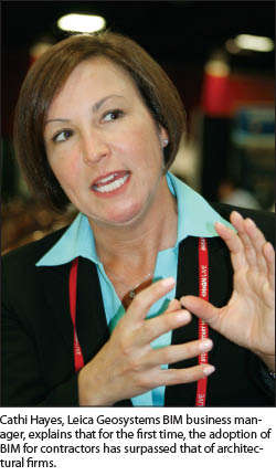
“BIM is a process with enabling technologies and an intelligent model at the core,” explains Cathi Hayes, Leica Geosystems’ BIM business manager. “It is not just a 3D model. The wall knows it is a wall, a window knows it is a window; it knows the materials, the associations.” Hayes outlines the convergence of data-gathering tools and software and various modeling packages like Revit, “It is about matching intelligent data to processes and workflows, like building construction, management, repair, operations.”
“BIM has had a strong penetration in architecture in the U.S., then Europe, then Asia,” says Hayes, who is an architect. “So what has happened is that in the U.S., as of December [according to a major market report], for the first time contractor adoption has surged past architecture adoption of BIM.” This is the significant news; as BIM moves into all types and phases of construction, so will the need for increased use of the advanced positioning tools and for persons qualified to make optimal use of them.
Hayes outlines what Leica Geosystems calls the “BIM Field Trip” and the three elements of “Inform, Enrich, and Validate.” Inform is the predesign measurements, enrichment is a work phase (the layout and installation), and validation is measurements to validate the installation/construction. Hayes points out that “3D allows for interdisciplinary coordination. Instead of the different drawings for mechanical, electrical, structural, plumbing [and so on], you can see where they fit together.” She adds, with legacy workflows, “How do you take the design and get it installed accurately? Working directly from an intelligent 3D model” is the best practice.
Will These Live Up to the Hype?
The verdict will ultimately be up to you. Some surveyors in attendance noted that features like the scanner in the MS50 might not be such a big deal to a cadastral-only surveyor, but that the “hot total station” might. I joked with the folks demonstrating the MS50 that it might be like the Green Lantern’s ring (that would make a great nickname if it weren’t for copyright fears); the ring’s power can reach full potential only if worn by someone with extraordinary willpower. Likely, the same kinds of users who kick butt with a robotic total station are going to be able to absolutely kick butt with something like the MS50.
As for mobile mapping and BIM, these have hit the big time, and people are needed who have experience working in a 3D environment and are completely aware of the ramifications of precision and accuracy. I can think of a profession that has just those folks, if they decide to accept such a mission.