It’s no big secret, anyone can make maps. Esri even had some children showcasing their abilities at the user conference this year. So why employ a GIS specialist? Well, apart from getting the cartography right, the specialist can advise on the legalities of map & data production.
With data becoming ever more available and online maps being the norm, there is now more copyright infringement than ever before. In some workplaces it is common to see Google Earth imagery & Streetview imagery put into reports as screen grabbed images. You do know that this is a breach of use?
With everything being so accessible nowadays it is easy to see something relevant and screen grab it, then make it available to others, but have you ever stopped to think about whether you can?
It doesn’t seem like a large number but 13% of all Government Google Removal Requests have come from court orders for copyright offenses (figures here) & there have been over 27,662,690 URL removal requests to Google due to copyright (figures here). Okay, so a lot of the URL removals are music related; music piracy is a huge problem. But this highlights the breadth and size of the issue at hand and the rate at which companies are being reported and fined.
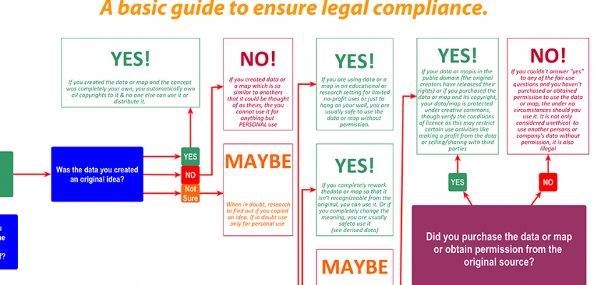
Law is a complicated beast, so to help simplify things I put together a flowchart to help end users come to the right decision.
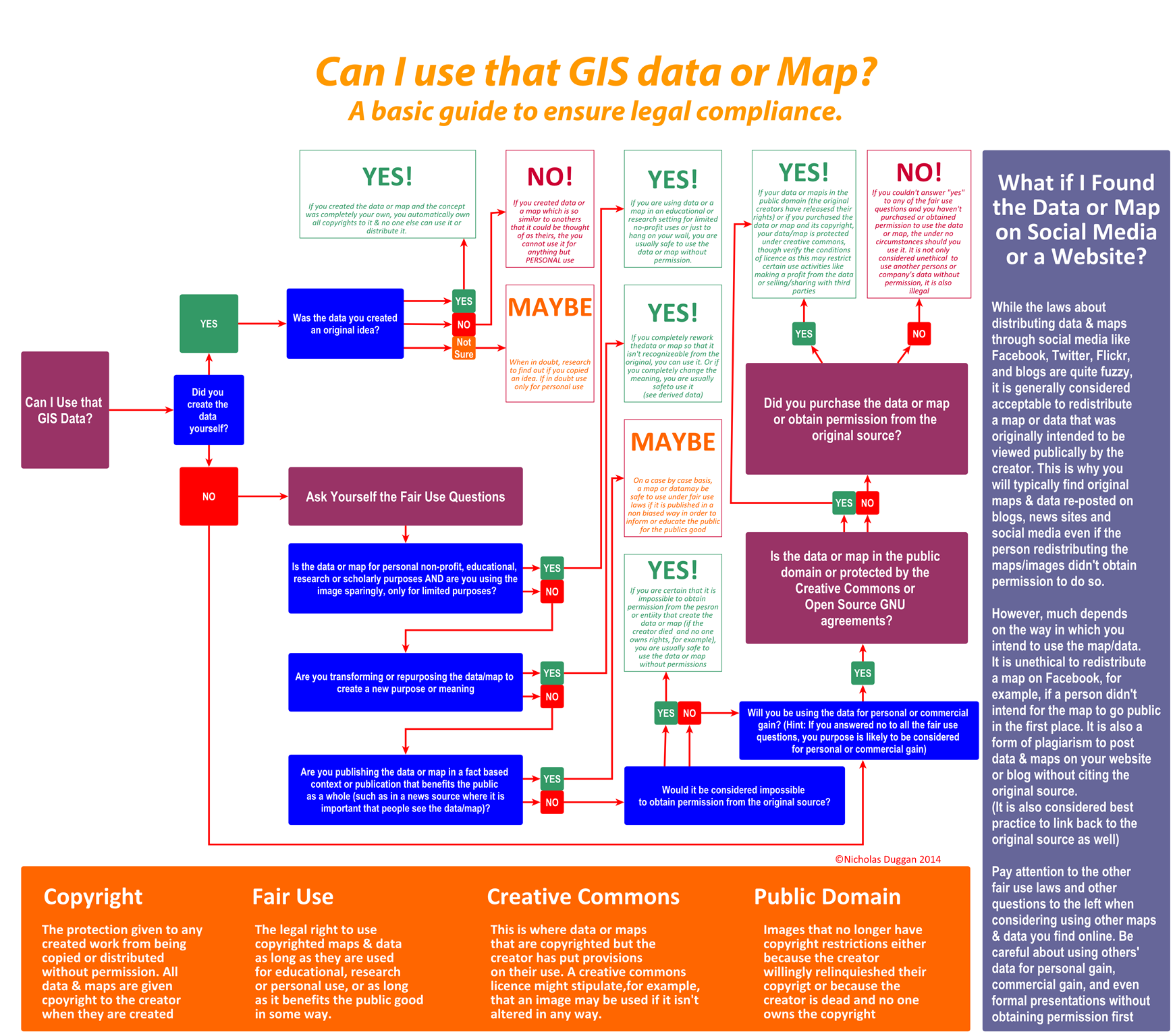
Simple guide to the legal pitfalls – based on Curtis Newbolds original ©Nicholas Duggan 2014
Although it does not cover the plethora of data or map license types, this chart provides an easy reference as to whether you may or may not use the material you intend to use. Of course this may vary from country to country and on a case by case basis; also this does not serve as a legal document; legal advice should be obtained in case of dispute.