Purpose and Origin of the Program
Many states have adopted the National Council of Examiners for Engineering and Surveying (NCEES) model law that sets definitions for what constitutes surveying. In 1999, the North Carolina Board of Engineers and Land Surveyors (NCBELS) examined the issue and officially adopted it as part of the state’s general statutes in 2001. Since that time there have been a number of measures pertaining to the Geographic Information Systems (GIS) professionals’ work in regards to the definition of surveying.
That definition, as put forth by NCEES, generally states that anyone offering services to the public that involves the collection of authoritative, or data that has a stated accuracy, would fall under the definition of surveying. Both NCBELS and the GIS community have worked hard at finding a way for this to work for everyone. The examination of this issue was in response to reports of firms, or individuals, collecting data in such a way that would constitute the practice of surveying without a license and figuring out exactly what types of GIS work constitutes surveying.
GIS professionals maintained two basic points of contention with the new law. One was a general disagreement with a ‘blanket statement’ that all GIS is considered surveying, and another was that there was no exam in place to test for GIS-related work. Both of these aspects were resolved when the area of photogrammetry was assimilated under the definition of surveying. This included a grandfathering provision that allows for the inclusion of photogrammetry professionals but relies on them to practice in their area of competency: an aspect that NCBELS can enforce (it should be noted that the grandfathering provision(s) do not allow photogrammetrists to practice boundary surveying).
So what about GIS? In order to adapt to a whole new contingent (GIS), NCBELS formalized GIS Inclusion/Exclusion Guidelines for what GIS work fits under the definition of surveying in 2008 and created the Mapping Sciences Exam in 2009 as an alternative exam that focuses on areas of the surveying profession that GIS professionals would work with.
These two measures helped set the structure for how the GIS professionals would fit into a licensing program for surveying, but did not address a grandfathering provision to accommodate the fact that the law changed and effectively shut some people out of being able to practice their profession. This was corrected in 2013 with the amended legislation to include a grandfathering provision.
The Legislation
Since legislation can often be a contentious process, NCBELS conferred with the geospatial community in order to ensure support for the program. Many different groups and agencies were engaged prior to introducing the legislation as a measure to gauge support and to fully develop the legislation itself.
These groups included government agencies such as the NC Secretary of State’s Land Record Management Section and the NC Geographic Information Coordinating Council (local government committee) as well as professional trade associations such as the NC Society of Surveyors, NC Property Mapper’s Association, and the Carolina Urban and Regional Information Systems Association. Discussing the legislation, the need for said legislation, and the grandfathering process with these groups not only assured the geospatial community that it is needed, but it also provided valuable input as to how the grandfathering program should be shaped.
With the geospatial community’s questions answered, feedback received and support given the legislation was eventually introduced as House Bill 301, which made several changes to G.S. 89C, among which was waiving the examination requirement for practicing GIS professionals who could meet specific education and experience criteria. This waiver, or grandfathering, involves a lengthy application process administered by NCBELS and expired on July 1, 2014. The bill was signed into North Carolina law on June 12, 2013 by Governor Pat McCrory.
The newly introduced legislation paved the way for GIS professionals who are already practicing surveying as defined by the NCEES model law to apply for a license without having to take the examination. However, the lengthy application process ensured that potential licensees would need to provide proof of applicable education, industry experience, professional/character references, and relevant sample work.
Most GIS professionals are accustomed to this process as they are currently governed by a similar program through the Geographic Information Systems Certification Institute (GISCI), which created a program to oversee a certification process for GIS professionals. The GISP certification requires documentation of education, experience, ethics, and contributions to the profession. While the application processes are not entirely dissimilar, the NCBELS application for PLS requires two requirements that some GIS professionals may have difficulty fulfilling.
One of those requirements is to provide five references, at least three of which must be from established professional land surveyors. Some GIS professionals have extensive experience within their core competency but may never have worked for (or with) a PLS who can vouch for their character or quality of work as it pertains to surveying activity.
Another requirement of the application is to provide samples of surveying work to include a report and map. In most cases, this will consist of GPS work completed by the GIS professional, but the report must state the methods and equipment used, accuracy of the data, purpose of the project, etc., and this information may not have been properly retained due to the sometimes short-lived nature of GIS projects.
So Far, So Good
The legislation was enacted last year, and NCBELS quickly implemented the application procedures, preparing for a potential influx of new applicants over the next year. In addition, NCBELS personnel gave presentations at various local trade groups and professional development seminars to help get the word out and explain the legislation to both surveyors and GIS professionals.
Professional licensure and grandfathering provisions can often be controversial at times, and this instance has not gone without a fair share of healthy debate. For this reason, the overall success of the program will be looked at in a following article. The reception of the new surveyors, their experiences throughout the application process, and what it ultimately means for the profession will be discussed at length.
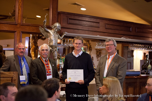
In the photo above, left to right: President David Palmberg, LS Member of the CT Board of Examiners for the Dept. of Consumer Protection Raymond Redniss, Newly Licensed Member Samuel Stietzel, LS Member of the Board of CT Examiners for the Dept. of Consumer Protection Curt Smith