Contrary to popular belief, it was neither the UK government nor Britain’s national mapping agency, Ordnance Survey, who started the UK open-source movement. Although open source was present and used in the UK before 2006, it was The Guardian newspaper that started a campaign called “Free Our Data,” which called for the raw data collected by Ordnance Survey and local authorities to be made freely available.
Data: Government or Private?
So effective was The Guardian’s campaign that, in the first quarter of 2007, cabinet office minister Hilary Armstrong commissioned Ed Mayo (secretary general of Co-operatives UK) and MySociety director Tom Steinberg to draft a “Power of Information Review” on how the government could serve the public’s information needs better. The resulting report led cabinet minister Tom Watson, MP to create a Power of Information Task Force.
Although the National Public Transport Data Repository (NPTDR) described itself as Crown Copyright, investigations showed that this database is not actually government data and that the NPTDR charges significant fees for use. The report suggested that there should be a presumption in favor of information that has been created by public sector bodies being available for re-use.
They also suggested that there should be clear and consistent copyright and licensing rules applied, making it easy to work with data from multiple sources in the public sector. They recommended a Crown Commons style approach with a “highly permissive licensing scheme that is transparent, easy to understand and easy to use, modelled on the ‘Click Use’ license.”
Claiming a victory, in November 2009, The Guardian ran an article stating that prime minister Gordon Brown had announced that “mid-scale” data from Ordnance Survey would be made available for free reuse, including commercial applications from April 2010.
data.gov.uk
Soon after, in January 2010 a new government web service, data.gov.uk, was unveiled that would “offer reams of public sector data, ranging from traffic statistics to crime figures, for private or commercial use.” The aim of the project was to “kickstart a new wave of services to find novel ways to make use of the information.” The U.S. had recently launched data.gov, and London mayor Boris Johnson had created the London Data Store the same month.
Two months later, Gordon Brown announced that the National Public Transport Access Node (NaPTAN) dataset was to be immediately made available from the data.gov.uk site as open data, as well as confirming the impending release of Ordnance Survey data.
On April 1, 2010 Ordnance Survey released the product OS OpenData, under an attribution-only license compatible with CC-by-SA. The files have been cached on the MySociety website for convenient download and they can be found on the OS website alongside their commercial data.
However, various groups and individuals had campaigned for this release of data, but some were disappointed when some of the profitable datasets were not included—withheld for the counter-argument that if licensees do not pay for OS data collection then the government would have to be willing to foot a £30m p.a. bill to obtain the future economic benefit of sharing the highly detailed mapping produced by the UK’s national agency.
Viewing and Using Free Data
Following the release of the data, the general public suddenly started looking for ways to view it. With the proprietary GIS being priced well above what the average citizen could afford, the public started looking towards open source systems. At the start of 2011, the popular QGIS 1.8 “Wroclaw” was released, an open-source software with the capabilities of a proprietary system yet easy enough for the average non-GIS user to pick up and use.
By 2012 OS Opendata was being used on a wide-scale basis. With its 50m DEM, a 1:15000 scale vector topography, vector administrative boundaries, and basic postcodes data, it was ideal for basemaps and basic commercial mapping. Many other important sectors also started to release data under the open government license, such as Natural England, the Crown Estate, and British Geological Society—all core data for many businesses.
The popularity of open data was increased by the UK recession when many businesses and government departments looked for ways of cutting services and saving money. With the increasing cost of proprietary software and little business case for it, eyes started turning to alternate solutions such as QGIS and QGIS Server, Geoserver, Mapserver, and even GRASS. Twitter and Google+ started to see open-source groups grow in numbers.
User Group Meetings
Matt Travis and Simon Miles, two local-authority GIS technical leads, were looking at QGIS and PostGIS as ways to serve data within their respective departments. Seeing much talk of QGIS and open source on Twitter, one day halfway through 2012 they had a great idea to run a QGIS User Group as a way to get some of the UK open-source people together.
It took them until July 2013 to get things in place to run the first meeting in Maidenhead; in September, the tickets went out, and within 24 hours they were all gone. The event, which coincided with the release of QGIS 2.0, was a success with talks from many of the most respected open source advocates in the UK.
A couple of weeks later FOSS4G came to Nottingham for the first time after a year of campaigning. It spawned a flurry of excitement within the UK open-source community and those eager to learn more about it.
Suddenly, open source was every-where: the UK government was using open data, the top national mapping agency was providing open data, and a strong network of open-source users in the UK could help and support one another with new groups appearing all the time. QGIS user groups popped up in Scotland, Wales, London, and the south west and also smaller, local open-source GIS groups appeared.
Rapid Spread
In the earlier part of this year, flooding caused communities and towns to be cut off in the UK, and heavy rainstorms left many people homeless. Many were struggling to obtain up-to-date data on the areas affected near them. Eventually, the UK Environment Agency released some of its flood data under the Open Government License. Upon release of the data, Google held a hackathon where the released data was merged and linked with other known flood data to provide help, advice, and quality information to those affected.
Data research experts will make you believe that looking for quality information within open data is like “looking for a needle in a haystack,” though this is already being addressed and overcome through the Open Data Institute (ODI) that now provides certification and advice on open-data standards.
Currently, much of the UK governments’ basic demographic, geographic, and statistic data is now available under an open government license, and where this isn’t the case it is common to find the data being prepared for release or available through an FOI request. Through the increased use of open source by government, Ordnance Survey, and a majority of public sector departments, there is now more trust over the reliability of open source and IT departments within companies, allowing open source software as part of the infrastructure, whereas it had previously been refused due to lack of support.
Ordnance Survey has seen such a positive response from the use and integration of open-source software and data that they are now using open data to design and style their products as well as providing data in open-source software formats.
It is safe to say that the UK has caught on to the necessity and potential of open data, with conversations underway on releasing UK offshore data, further improving the current offerings. The UK may have been slow in understanding and developing its open-source data infrastructure, but it is more than making up for it now.
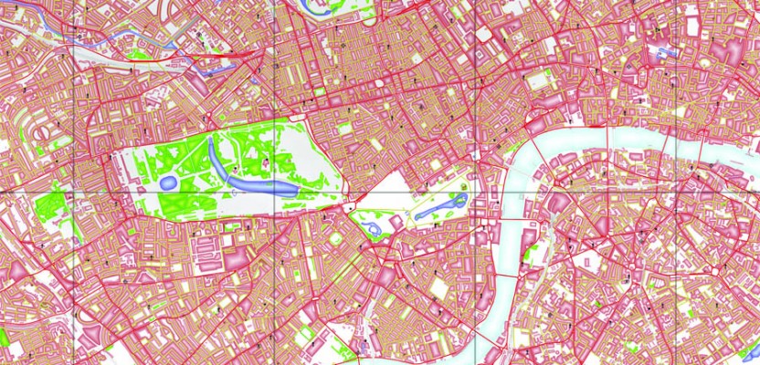
Caption for above picture: This map uses Ordnance Surveys’ standard colors with a QGIS special fill technique. Ordnance Survey data © Crown copyright and database rights 2014