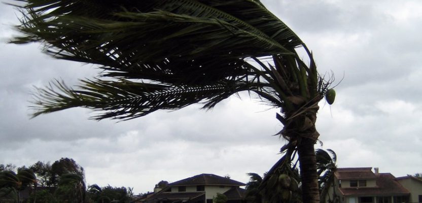
In view of recent weather-related events, we’ll take a quick detour from our series on AR (augmented reality) to cover RR (real reality): the catastrophic 2017 hurricane and wildfire season. The Caribbean islands, Florida, Louisiana, and Texas are reeling from the effects of hurricanes Harvey and Irma. As of this writing, Jose is only brushing past the Northeast U.S. with (hopefully) only minor effects, and Maria is stomping Puerto Rico and the Virgin Islands with the question of landfall on the continental U.S. unanswered. When I see images of the devastation these hurricanes have wrought, words fail me. Likewise with the wildfires in the Pacific Northwest.
Donating to the support and recovery efforts is easy and much needed. I found in my recent shopping experiences that it’s well-nigh impossible not to be presented with easy opportunities to donate at checkout stands. What’s more, the National Society of Professional Surveyors (NSPS) Foundation Disaster Relief Fund is offering financial assistance for surveyors affected by the recent disasters and seeks donations.
We take a moment to recognize the first responders and all disaster recovery teams, including the Red Cross, National Guard, military, and so many others. The geospatial profession is also providing and, will continue to provide, valuable assistance to the recovery and rebuilding efforts. Here are just a few examples:
Aerial views. Nearmap deployed aircraft with camera systems to the affected areas in Corpus Christi, Rockport, Houston, and nearby towns devastated by the hurricane. For examples of before and after imagery captured, check out Nearmap’s website. (Move the slider on the images to see the change from Oct. 9, 2016 to Aug. 31, 2017.) The full collection can be accessed by contacting Nearmap directly. For a more robust account of geospatial firms contributing to the disaster recovery effort, check out the Located section in the October issue of xyHt.
Drones go mainstream. Although UAS have been employed for years in disaster rescue and recovery efforts, the technology is reaching critical mass. FAA administrator Michael Huerta commented: “I don’t think it’s an exaggeration to say that the hurricane response will be looked back upon as a landmark in the evolution of drone usage in this county.”
The Air National Guard used UAS that are normally tasked for combat operations to perform aerial surveys. The drones allowed the Guard to assess disaster-stricken areas rapidly and prioritize those most in need of assistance. Likewise, U.S. Customs and Border Protection sent UAS craft from Corpus Christi to Florida to help map areas in Key West, Miami, and Jacksonville and survey geographic points on infrastructure such as power plants for FEMA.
Many private entities, including survey firms, are employing UAS in the effort as well. The FAA, for their part, has expedited the authorization of drone use by providing statewide, blanket COAs in Florida and approving many individual UAS operations within minutes.
Rebuilding. The recovery and rebuilding effort from this year’s hurricane season will take years, perhaps decades. The services of the surveying and related geospatial professions will be in great demand as the Herculean effort of rebuilding the areas devastated by these hurricanes goes forward.
Disaster preparation. If you’re not thinking, “What if a disaster happened in my area?” then frankly you’re not thinking. Abraham Lincoln once said, “The best time to make friends is before you need them.” This goes double for disaster preparedness. A good place to start is Ready.gov.
Stay safe my friends!
![]() This article appeared in xyHt‘s e-newsletter, Pangaea. We email it twice a month, and it covers a variety of unusual geospatial topics in a conversational tone. You’re welcome to subscribe to the e-newsletter here. (You’ll also receive the once-monthly Field Notes newsletter with your subscription.)
This article appeared in xyHt‘s e-newsletter, Pangaea. We email it twice a month, and it covers a variety of unusual geospatial topics in a conversational tone. You’re welcome to subscribe to the e-newsletter here. (You’ll also receive the once-monthly Field Notes newsletter with your subscription.)