Geospatial Engineering Program
By Dr. Francelina A. Neto, PLS
The Cal Poly Pomona College of Engineering offers 11 undergraduate and five Master of Science degree programs housed in seven departments. Serving over 5,000 students, the college is the 17th largest in the nation. The civil engineering department currently has two programs: Civil Engineering (CE) and Construction Engineering Technology with approximately 1,300 undergraduate students and 140 graduate students.
Its growing graduate programs make the department one of the largest undergraduate programs in the nation, with a wide range of capabilities. The civil engineering program has three options, one being geospatial engineering.
The CE department at Cal Poly Pomona is currently supported by 21 full-time faculty and additional adjunct faculty. All faculty are required to have industry experience. In addition to a doctorate degree, almost all professors have obtained a professional license in the area of expertise is required before tenure was granted. The goal of this requirement was to ensure that graduates receive an education that prepares them to pursue research opportunities with practical applications for social infrastructure as well as the expectations of the industry. Additionally, all adjunct faculty must have field experience and licensure in the technical area of the course they teach as well as post-graduate education.
Geospatial Engineering Program
The geospatial engineering program (GeospEng) is embedded in the Bachelor of Science in Civil Engineering (BSCE). The BSCE at Cal Poly Pomona currently requires completion of 98 quarter units (132 semester units) for graduation. Of these, 68 quarter units are general education (GE) courses mandated by the state’s educational code and set by the campus.
The GE program enhances the students’ education in communication and critical thinking, mathematics, physics, natural sciences, humanities, arts, literature, social sciences, and awareness toward the importance of lifelong self-development. As all engineering programs, CE includes mathematics, physics. and chemistry courses as support of their own program, leaving 73 quarter units of core, specific department courses to prepare the students for a successful career in the technical area of their choice. This requires good curricular strategies to keep up with the demands of an evolving world and a good quality program that prepares engineers ready to tackle increasingly more difficult societal infrastructure problems.
An important aspect of the engineering curriculum is to make the graduates aware of their role in society and the impact of their work in the world’s infrastructure sustainability. The BSCE at Cal Poly Pomona combines a wide range of theoretical and practical engineering aspects, technology, and its impact in society, resulting in a comprehensive, quality education.
The BSCE at Cal Poly Pomona has three options: general, environmental, and geospatial. All three options are ABET accredited under the civil engineering criteria. The geospatial option is additionally accredited under the surveying engineering criteria. Since the late 1980s, graduates from the GeospEng program have credit to seat for both the PLS as well as the PE license exams.
The BSCE options have about 75% of common course work. All undergraduate students in the program follow similar GE curriculum as prescribed by the campus and have a set of common core classes. The common engineering core includes mathematics, physics, chemistry, statics, and dynamics.
All students in the BSCE program take common courses in drafting, surveying, transportation, materials, structures, geotechnical engineering, and environmental and water resources.
Students in geospatial engineering complete the program with advanced courses in specific curriculum: Advanced Surveying, Surveying Computations, Highway Design, Photogrammetry, Remote Sensing, Geographic Information Systems (GIS), Global Position Systems (GPS), Geodesy, Public Land Surveys, Boundary and Land Survey Descriptions, Legal Descriptions, Subdivision Design, Digital Mapping, and Laser Scanning.
All students have a nine-month capstone Project Design, a comprehensive project involving all aspects of an engineering real-world assignment, involving several technical areas, including the geospatial aspect.
From Elementary Surveying to Laser Scanning
All students in the geospatial option in CE have to take drafting and surveying courses as freshmen. The drafting courses include theoretical and laboratory courses on the fundamentals of drafting plus gaining experience in Autodesk and Bentley support software. In the course sequence, all CE, CET, and GeospEng students advance to surveying curricula that includes theory and a large amount of “learn by doing” field experience.
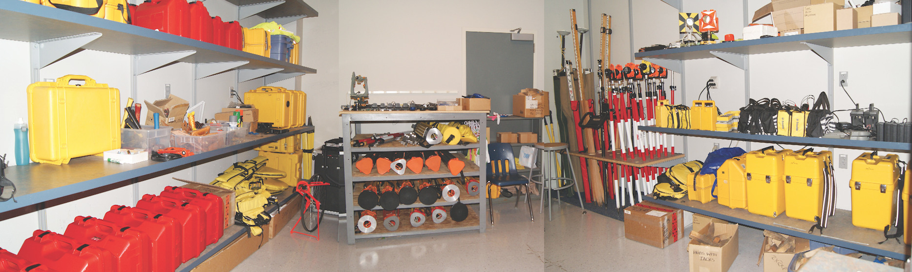
Cal Poly Pomona has three laboratory spaces dedicated to support the geospatial engineering program and surveying courses. Two of these labs support the field training courses, and the third lab supports the high-tech, computer-based courses.
-
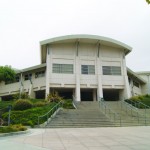
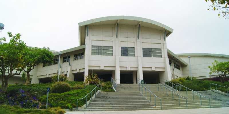
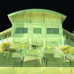
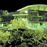
- A photo of CE building 17

-
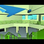
- A model of 17 created by students and faculty for the digital mapping course

-
- another view of the model

-
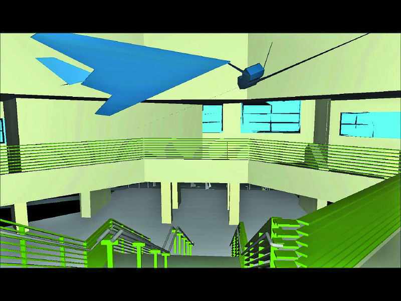
- Students scanned the interior of areas of CE building 17 and generated 3D models
The surveying equipment for laboratory and field includes eight Trimble GPS receivers, three Topcon theodolites, seventeen total stations, four robotic stations, six levels, and a Trimble GX laser scanner. All students in CE, CET, and GeospEng use the levels and total stations in their first two surveying courses.
At the end of the first surveying course, all students know the principles of and have conducted distance and angle measurements, leveling, traversing, staking, and data collection. Working in surveying teams, the course experience culminates with a final topographic map of a small area of the campus from each group of students.
The basic surveying understanding is further expanded in a second course where students improve their skills with precise leveling and engineering surveying, learn the fundamentals of GPS and robotic surveying, and design a go-cart race track alignment based on the acquired knowledge. These courses are gatekeepers for all other geospatial students and give the basics for the construction and engineering design courses.
Geospatial engineering students take courses covering engineering applications of surveying, courses supported by current technology as applied to surveying and engineering, and courses in more classical land surveying areas. In the surveying computations course, students are introduced to the theory of measurements as it applies to surveying work, and more specifically in error propagation in horizontal and vertical positioning and in rectangular coordinate systems. They learn least squares adjustments of triangulation, trilateration, and traverse networks, as well as the use of computer software that support such adjustments.
Students are taught the principles of remote sensing, interpretation of aerial photography, stereoscopy, and photogrammetric modeling. They learn the application of aerial surveying to engineering problems and mapping. The geodesy and satellite surveying curriculum covers spherical trigonometry, Cartesian and curvilinear coordinates, transformations between geodetic datums, major control network extension, and satellite and terrestrial positioning systems. Students receive basic training in GPS, including mission planning, field surveying with a variety of GPS techniques and receivers, and post-processing of GPS data.
The GIS course covers the theory of spatial information systems, maps, and data-capture models. Students gain experience in generating databases, designing data display methods and output models, designing data storage and data manipulation processes, and designing data dissemination models. They also gain knowledge in the application and design of spatial information systems in engineering and surveying practice.
Students also take a hydraulics and a hydrology course, followed by a subdivision design course covering engineering and surveying methods in land-use planning, design, and construction of subdivision development projects.
To support these classes, the GIS lab is equipped with 31 digital photogrammetric workstations used for photogrammetry, GPS, GIS, and laser scanning modeling. Intergraph, Bentley, AutoDesk, Esri, ArcGIS, and ERDAS software is used for courses in 3D modeling and visualization as well as spatial position and manipulation.
The GE program includes courses in land survey descriptions, public land surveys, and California land and boundaries law. Students learn the history of ownership and transfer of title, types of documents of land conveyance, forms of legal descriptions of public and private lands, and the interpretation of maps and documents for the physical survey location of land boundaries.
The curriculum also covers the principles of writing precise land boundary descriptions, the study of easements, and the value of monuments. In the public land surveys course, students learn the history of the general practice and rules for the survey of the public lands, the system of rectangular surveys, and public lands monumentation procedures. The course also covers the principles of restoration of lost or obliterated corners, subdivision of sections, special surveys and instructions, field notes, plats and patents, meander lines, and riparian rights as pertinent to public lands.
All GeospEng students take a course in California Land and Boundaries Law, which is classified as a general education synthesis course at Cal Poly Pomona. In this course, students study the historical, social, political, geographical, and economic aspects of real property and boundary law in America, with an emphasis on social and historical aspects of the extent and limits of property ownership. The course is a synthesis of the principles and process used to establish property boundaries per California land and boundaries law.
Digital Mapping
All students in the geospatial option in CE have to take the digital mapping course. As many as 24 students take this course per year, and some students use this acquired knowledge in their final comprehensive design project.
The digital mapping course covers data collection systems for 3D surface modeling. Students learn to integrate robotic and laser scanning technology into visualization and animation for engineering projects. Over the course of their education, students are introduced to the theory of electronic data, data transfer, and 3D modeling and interfacing in a variety of settings.
Both Leica C10 Scanstation and Trimble GX scanning equipment, and Leica Cyclone software and Trimble Realworks are used in data modeling.
Applications identified by students during the courses and projects include topographic analysis, forensic crime scene investigation, public safety, homeland security, bridges and tunnels modeling, volumetric calculations, and pipeline recognition.
Cal Poly Pomona teams of students further explore the use of laser scanning modeling in several senior projects. They use laser scanning technology to generate models of interiors, visualization of buildings, and data extraction for safety and security assessment. Students also learn to link different data collection systems such as GPS to laser scanning data.
One of the senior projects run under Dr. Turner’s supervision in the CE department is a good representation of such student work. In that particular project, students collect data for one of the College of Engineering buildings and generate “fly thru” views of the model.Students also scan the interior of areas in the same building and generate 3D models of the building corridors and some rooms.
Students also experiment with integration of laser-scanned data with other data obtained from different sources. One example is the integration of data collected in the same project, with CAD models shared by the campus facilities and management office.
In its most recent assessment of the curriculum and specifically the digital mapping course, the CE program decided to incorporate more 3D modeling and visualization aspects into more areas of its curriculum. Prof. Ng and Dr. Neto were awarded a small grant to expand faculty training on the use of laser scanning.
Several engineering faculty received training during summer 2014, and they explored its applicability for solutions in environmental, construction, structural, and transportation engineering. It is expected that more senior projects will adopt the use of laser scanning in their designs and engineering solutions and that more Cal Poly Pomona graduates will be ready to use the technology in the work place in the future.
One of the goals is also to extend this technology to more engineering programs as well as to the CE master thesis and projects.
Future of the Geospatial Engineering Program
The geospatial engineering program at Cal Poly Pomona will continue as a dual ABET accredited program in civil and surveying engineering. As senior faculty retires, new faculty searches are being placed to ensure the continuation of the program. Cal Poly Pomona administration’s commitment to support this geospatial engineering is visible in continuing with recent hires in 2013, 2015, and one more tenure-track faculty to start for fall 2016.
Students are taught the principles of remote sensing, interpretation of aerial photography, stereoscopy, and photogrammetric modeling
All new faculty had field work experience before joining academia. Keeping licensed surveyors with good field experience records as adjunct professors is proof of the understanding of the importance of surveying to various areas of the engineering profession.
The geospatial program faculty intends to find ways to outreach to K-12 schools and to serve transfer students in southern California junior colleges who are interested in studying geomatics at Cal Poly Pomona.
Acknowledgements
Thank you, Dr. Turner, Dr. Abellera, and Dr. Mora and Profs. Ng and Bledsoe for your continuous effort in developing strategies and curriculum for the geospatial program and for sharing the images of your students’ work and senior projects in this article. For a detailed description of this program including full coursework, see the online version of this article at xyHt.com.