Department of Spatial Sciences
By Bert Veenendaal, PhD
The Department of Spatial Sciences at Curtin University is recognized throughout Australia for providing leading university-level teaching and research programs in surveying, GIS, remote sensing, mine and engineering surveying, and related areas.
It consists of a motivated and enthusiastic team of internationally experienced educators and researchers who are keen to open the doors of opportunity to students for a range of spatial science career pathways.
In 2013, the department celebrated a significant milestone in its history when a triple anniversary of 25 years of GISc, 50 years of surveying, and 100 years of mine and engineering surveying occurred in the same year.
They also offer the only comprehensive degree program in surveying in Western Australia, one of the longest-standing mine surveying programs in Australia, and the first Bachelor degree in GIS in the world.
The department is an acknowledged leader for research of national and international significance in the areas of geodesy, GNSS, GIS, remote sensing, photogrammetry, and laser scanning.
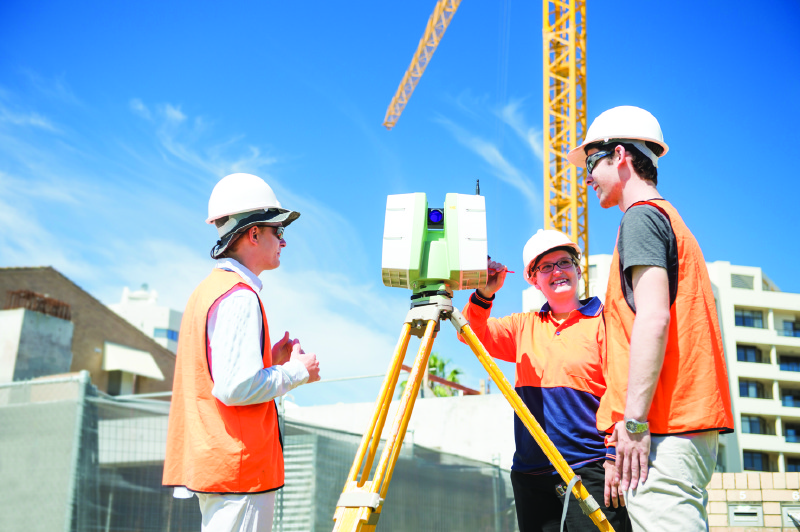
Curtin is dedicated to producing industry-ready graduates while implementing the latest technology in its teaching programmes. Here students are being shown the use of a terrestrial laser scanner.
Teaching Programs
Enrollment generally varies between 450 and 500+ students, making the department the largest autonomous department dedicated to teaching and research in the spatial sciences in Australia and New Zealand.
Local students make up the bulk of undergraduate and postgraduate coursework enrollment, although international students, mainly from nearby Asian countries and a smaller number from middle-eastern countries, make up approximately 5 to 10% of total student numbers. International students, however, make up almost 50% of the Higher Degree by Research student enrolments.
Students enjoy up-to-date facilities and equipment throughout their studies, while the teaching programs, designed with direct input from industry, are delivered by experienced teaching staff in a supportive, practical, and student-focused learning environment. The mine and engineering surveying students additionally spend their final year studying in Kalgoorlie, one of the strong regional mining communities in Western Australia, with exposure to the real-world mining environment.
-
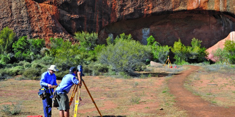
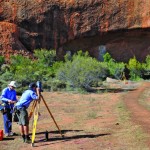
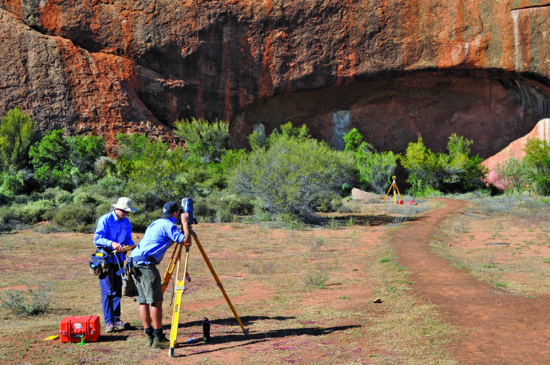
- Student fieldwork exercised not only take place in metropolitan areas but also in remote areas. Here students are observing a control network near Cue, in Western Australia.
-
- Student fieldwork exercised not only take place in metropolitan areas but also in remote areas. Here students are observing a control network near Cue, in Western Australia.
Exposure to industry is met through field trips, camps, expeditions, work experience, work placements, work-integrated learning activities, guest lecturers, and networking events, thereby providing students with the necessary skills to be industry-ready when they graduate.
While the practical, hands-on nature of much of the surveying (including mine and engineering surveying) teaching programs require students to be learning on campus, the department is also known for the quality and flexibility of its online and distance learning, which underpin the GISc teaching programs, particularly at the postgraduate level.
At the undergraduate level, the department offers the following study programs:
- Bachelor of Surveying
- Bachelor of Science (Mine and Engineering Surveying)
- Bachelor of Science (GISc)
- Double degree Bachelor of Science (GISc)/Bachelor of Science (Applied Geology)
At the postgraduate coursework level, the following courses are offered:
- Graduate Certificate in GISc
- Graduate Diploma in GISc
- Master of Science (Geospatial Science)
The research programs include:
- Master of Philosophy (Surveying and Mapping)
- Master of Philosophy (GISc)
- Doctor of Philosophy
Graduate Market
Western Australia recently emerged from a prolonged mining and resources boom that enabled its graduate surveyors, and mine surveyors in particular, to be exposed to highly paid employment opportunities, the majority being in Western Australia’s regional areas on a fly-in, fly-out basis.
This period created a flow-on effect to other employment sectors, namely in engineering, construction, infrastructure, and urban and regional planning, thereby providing young surveying graduates an abundance of diverse employment opportunities across a range of application areas.
Western Australian GISc graduates also benefited greatly during the resources boom with employment across a wide range of sectors.
Across Australia in general, universities have failed in recent years to attract sufficient students into the surveying and GISc courses to meet industry demands. This, coupled with an aging surveying and geospatial professional pool, has meant the surveying and GISc sectors are facing a severe shortage of professionals throughout Australia.
Indeed, a report in 2015 projected there would be a shortage of 1,816 surveyors across Australia in 2020-2021, and that number would hover around 1,400 for each of the five years to 2023-2024. The shortage outlook for GISc/geospatial graduates is similar.
For the next generation of Australian surveying and spatial graduates, their employment situation looks very positive.
Surveying Course Curriculum
Details concerning the Bachelor of Surveying curriculum can be viewed on our website.
Three units within the program relate directly to boundary/field or cadastral surveying.
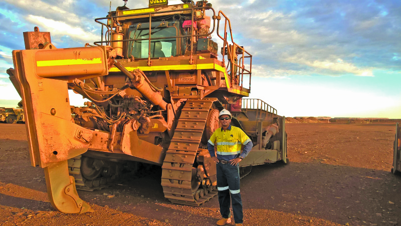
Students have the opportunity to do their fieldwork practicals in real mine sites
Surveying Licensure in Western Australia
The path to be a licensed surveyor in Western Australia involves the following steps:
- The student graduates with a four-year surveying degree.
- A formal training agreement between a licensed surveyor and the graduate is registered with the Land Surveying Licensing Board (LSLB).
- A training program involving two years of structured cadastral (land or boundary) surveying is undertaken with the licensed surveyor.
- The graduate completes four cadastral projects as set out by the LSLB.
- The graduate passes a land survey law exam.
- The graduate passes three days of field examination as set out by the LSLB.
This licensing system is similar throughout each state of Australia with only slight variations to meet each state’s particular requirements.
Research in the Department
The department has a strong tradition of producing nationally and internationally significant research outcomes. We draw expertise from a wide range of disciplines and regularly invest in novel methods and new technologies related to the spatial sciences. The research groups are: GNSS, geodesy, GIS and remote sensing, and photogrammetry and laser scanning.
Significant projects in recent years include:
- Theory, models and methods for high-accuracy, high-integrity GNSS positioning
- Array-aided Precise Point Positioning (APPP) for formation flying
- Global and regional geoid modelling, culminating in the national standards AUSGeoid98 and AUSGeoid09
- Sea level variability on global, regional, and local scales
- Rapid assessment and monitoring of vegetation degradation and rangelands conditions using remote sensing and GIS
- Spatial data management and geovisualisation for health, megacities, and river basins
- Participatory GIS for empowering developing communities
- Photogrammetry and laser scanner-based data acquisition and processing
- Extraction from mobile mapping systems for transport corridor asset management.
For full research details visit spatial.curtin.edu.au.