Surveying and Geomatics Engineering Technology
By Adam Thayer
One of the many things I enjoy about this program at Idaho State University (ISU) is the history and investigations involved with surveying, specifically boundary surveying. There is nothing quite like finding an original stone or visiting a monument that hasn’t been uncovered since it was originally set 100+ years ago. I never imagined that I would find such joy and satisfaction in digging up a rock.
I originally was a civil engineering student but quickly found out that my passion was in surveying and geomatics. I enjoy the fact that as surveyors we get to spend time outdoors and interact and work with others in the field.
It is good to have a great basis of knowledge of the traditional surveying elements, but students should also be exposed to the new, expanding fields of surveying and geomatics such as aerial mapping and UAS, lidar, agriculture, and 3D scanning. The program at ISU is preparing me for a career in surveying and geomatics by introducing students to these new technologies. While many firms and agencies will continue providing traditional surveying services, more employers are looking for students who have a knowledge in GPS, 3D scanning, and UAS.
Recently, the program has been putting more and more focus on these technologies as they become more prominent. Often times, graduates are tasked with teaching their peers about the new technologies that are coming onto the market. This is because as students we have the opportunity of learning about them and having the necessary hands-on experience.
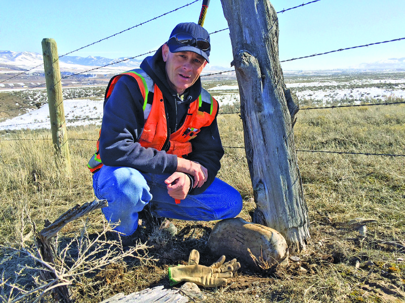
Darrell Hanners, ISU Surveying and Geomatics Engineering Technology graduate (2005) poses with an original marked stone found while conducting a monument search in southeastern Idaho (Credit: Cardon Payne)
The Program
ISU is situated in the beautiful environs of Pocatello, Idaho. The program offers a B.S. degree in surveying aand geomatics engineering technology. It provides a great foundation in surveying fundamentals as well as broader geomatics elements. There’s an emphasis on actual project work in both the field and office that involves the local surveying community.
We are very fortunate to be able to utilize some of the latest equipment as well, and the program has added new distance-learning options to provide flexibility for working students and students in other parts of Idaho and the region.
Enrolment has been a steady 30 students for several years. Most lectures and labs are held on campus in Pocatello, mornings and afternoons, and/or by traditional audio/video links with other campuses. Some of the upper-division courses are offered afternoons and evenings (and some Saturdays) via traditional video/audio, and some are even accessible via Jabber sessions where students can attend classes virtually. Through this software, class sessions are recorded and uploaded online (you do, though, need a powerful computer and solid internet connection).
Students often find employment before graduating, and while the employment rate for graduates dipped below 70% during the recent recession, the percentage climbed back to nearly 90% in 2015. The coursework speaks for itself with all of the fundamentals to be an attractive recruit for a modern surveying employer and to be ready to hit the ground running when we get there.
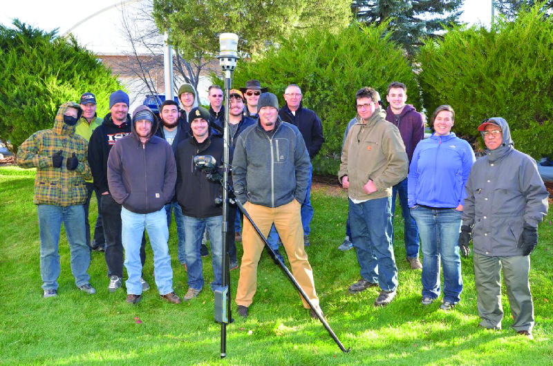
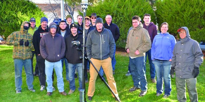
Eric Stricker, PLS (front, centre) Demonstrates the Trimble R10 GNSS receiver and v10 imaging rover for ISU students and instructors
Classes
Years one and two provide the foundation: Drawing with CAD, Civil Engineering Technology Drafting, Beginning Surveying, Intermediate Surveying, Route Survey and Design, and Construction Surveying.
Years three and four include: Surveying Law & Boundary Descriptions, Public Land Survey System, Research and Evidence in Surveying, Subdivision Planning and Platting, Survey Office Practice, Surveying project, Advanced Surveying, Surveying Software Applications, Surveying Adjustments and Coordinate Systems, Geodesy, Principles of Cartography, GNSS Principles and Applications, and Principles of Photogrammetry or Remote Sensing.
We also select one of the following: Principles of Cartography, Advanced Geographic Information Systems, and Cartography: History and Design.
And we select another of the following: Land Information System, Principles of Geographic Information Systems and Lab, and GIS for Social Science.
Software and Hardware
The software that we’re instructed in and that we apply in our practical projects include: AutoCAD, Civil 3D, Carlson Survey/Civil, Trimble Business Center, Leica Photogrammetry Suite, ArcGIS, Traverse PC, and Wolfpack.
Students should be exposed to the new, expanding fields of surveying as well as traditional surveying elements.
We get trained on total stations, robotic total stations, a precise level with parallel plate micrometer, digital levels, precise digital levels, a Trimble VX 3D scanner, Leica 500 GPS receivers, Leica 1200 GPS receivers, two sets of Topcon GR3 GPS receivers, Trimble R6, R8, R10, V10, and a Trimble TX5 3D scanner.
Distance learning students, students at Lewis and Clark State College (across the state in Lewiston, Idaho), and those working in surveying companies can use company fieldwork time and data for fieldwork requisites. This is done with a recommendation from the instructor, communicating with the company’s PLS.
Job Preparation
I do enjoy the many fields that surveying and geomatics are evolving into; however, I still enjoy the traditional elements as well. I currently work as a survey technician for a company in Chubbuck, Idaho: Dioptra.
Dioptra is involved in traditional surveying, such as boundary surveying and construction staking, but is also in some of the newer markets and technologies such as high density scanning (HDS) and GIS. Dioptra is one of the few companies providing HDS services in eastern Idaho.