
Editor’s Note (from Scott Martin):
When I learned that NGS and Dru Smith (the NSRS modernization manager for the NGS) had requested to respond to my August Field Notes, I was quite intimidated. However, my fears were quickly quelled. Thank you, Dr. Smith!
As mentioned below, a more extensive and informative response on the monumental task that is the modernization of the National Spatial Reference System (NSRS) will appear in an upcoming issue of xyHt magazine. Perhaps as important as the technical details is the strong encouragement from NGS as to how we, as surveyors and users of the NSRS, can contribute to this effort as well as discussion of the programs NGS has established to assist us with doing so.
That was the premise of my HARN article, a call for action, so having NGS directly explain the benefits is a huge bonus. I thank them for seeing this as an opportunity to continue their extensive outreach as we march towards 2022 and beyond.
A Response to the Article, “Are HARNS on Death Row?”
In a recent article for Surveyor’s Field Notes, Scott Martin posed the question “Are HARNs on Death Row?” NGS would like to thank Scott for writing the article, raising this question (and others), and giving everyone a chance to consider what the modernized NSRS will look like, and especially what role passive geodetic control marks will play in the future.
A complete response to the article has been prepared and submitted to xyHt for publication, but it is far too lengthy for Surveyor’s Field Notes. However, NGS felt it was important to get the highlights of that response out quickly, and so this summary of the longer response was put together for immediate release.
In reading the article, one might gauge that the question behind the question was really, “What will happen to the HARN coordinates on HARN marks once NATRF2022 (and PATRF2022, CATRF2022 and MATRF2022) are the official reference frames of the NSRS?” Unfortunately, that answer is very long, very complicated but will be fully addressed in the longer article in xyHt.
However, one other question (in fact, the most important question in Scott’s entire article) was also asked and will be addressed in just a moment.
NSRS Change
Before addressing that question though, here’s a brief reminder about the changes coming to the National Spatial Reference System (NSRS) in 2022. First, the three NAD 83 reference frames [NAD 83(2011), NAD 83(PA11), and NAD 83(MA11)] will be replaced with four terrestrial reference frames:
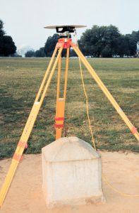
GPS antenna over Station Jefferson Pier, looking south with the Jefferson Memorial in the background in Washington, D.C.
- North American Terrestrial Reference Frame of 2022 (NATRF2022)
- Pacific Terrestrial Reference Frame of 2022 (PATRF2022)
- Caribbean Terrestrial Reference Frame of 2022 (CATRF2022)
- Marianas Terrestrial Reference Frame of 2022 (MATRF2022)
Additionally, all vertical datums (including NAVD 88) and all related physical quantities (geoid models, deflection of the vertical models, etc.) will be replaced with a single new datum called the North American-Pacific Geopotential Datum of 2022 (NAPGD2022.)
Lastly, all of the above will be used to provide time-dependent coordinates, with both a geoid monitoring service and an intra-frame velocity model (IFVM) provided to model the changes that occur to coordinates through time.
Re-surveying Historic Marks
So, to begin, the most important question asked was this:
“…should local, grassroots efforts be mounted to perform a campaign for submission to NGS through the Bluebook process or the successor thereto (part three of the Blueprint for 2022), to ensure that they will be included in NATRF2022?”
YES! NGS strongly encourages the re-surveying of historic marks. This recommendation ties in to so many efforts at NGS that a list is needed to hit them all:
- In order to provide data to NADCON which will allow NGS to build a transformation between NAD 83(2011) and the four TRFs in 2022 (as well as to provide VERTCON with the data to transform from NAVD 88 to NAPGD2022), NGS has initiated a new project called “GPS campaign for transformations,” being led by Galen Scott. The goal of that campaign is to have as many “recent” GPS occupations on marks with NAD 83(2011) and/or NAVD 88 (preferably both) coordinates.
- The same goes for the other two NAD 83 frames and all other vertical datums.
- Supporting the above campaign, NGS is also engaged in research and development to facilitate such GPS surveys, specifically aimed at using RTK/RTN data. NGS is currently engaged in internal discussions about developing a prototype of OPUS-Projects which accepts mixed long-session GPS/RTN surveys by some time in 2018. Feedback on that question is most welcome!
- NGS has recently developed a prototype version of OPUS-Projects which performs bluebooking (and thus makes it a valid streamlined path for GPS surveys to be turned in to NGS and included in the NSRS in the NGS Integrated Database, or NGS IDB). After a few months of internal testing, this prototype tool is expected to be publicly available for beta testing in the fall of 2017. Such a tool, it is hoped, will alleviate some of the onerousness of bluebooking while not removing the important standardization of data which bluebooking has provided.
- As mentioned in the original article, there will be a third “Blueprint” document, probably some time in early 2018, which will address the “re-invention” of bluebooking. That is, the document will answer questions like, “As a surveyor, how do I use the new reference frames?” and “What will datasheets look like in the future?” etc.
With all that in mind, NGS strongly urges anyone who is interested in improving their state’s geodetic control (especially those users whose work relies upon up-to-date geodetic coordinates on passive marks) in the NSRS of 2022 to get involved in re-surveying their favorite or important marks. After all, NGS is not out there setting marks anymore. The care and maintenance of passive control is on the shoulders of the users, and that includes keeping the coordinates “fresh.” Begin by talking to your regional advisor, but also look for guidance in the next year, coming from NGS.
Additional Issues
Aside from encouraging the re-surveying of existing passive control, a complete response to Scott’s original article must address other complicated issues, such as:
- What is the difference between a HARN survey, a HARN adjustment, the HARN coordinates, and the HARN marks?
- Similarly, how are they related to, and different from, an FBN survey, an FBN adjustment, the FBN coordinates, and the FBN marks?
- What percentage of HARN coordinates were computed without any GPS observations? (Spoiler alert: about 70%.)
- What data can and cannot be re-processed to yield NATRF2022 (and other) coordinates, and why was 1997 chosen as a cut-off date?
- How many of the HARN coordinates are actually obsolete? (Spoiler alert: “all of them.”)
These questions and many more will be forthcoming in the full response in xyHt.
Let me close by re-iterating my thanks to Scott for writing an article that stimulated so much thought here at NGS and which shows how much importance the passive control will continue to play even as NGS modernizes the NSRS.
Image above: Caption: Fair. J. Bryant, an observer in 1929. Credit: Family of Captain Fair J. Bryant, C & GS, NOAA’s People Collection.

This article appeared in xyHt‘s e-newsletter, Field Notes. We email it once a month, and it covers a variety of land surveying topics in a conversational tone. You’re welcome to subscribe to the e-newsletter here. (You’ll also receive the twice-monthly Pangaea newsletter with your subscription.)