How to use them for land survey planning and reconnaissance.
When I first used GNSS, it was my usual practice to go to the National Geodetic Survey (NGS) website to gather the data sheets for control monuments in the vicinity of my project area. I would plot these in a program called TopoScout, a topographic mapping software from Maptech. With tie sheets and topographic map plots in hand, my field crews would go out in search of those elusive marks.
 Over the last decade, the rapid development of GNSS technology, coupled with expanding Web services on the internet, has provided us with many useful tools to save time and increase productivity in land surveying.
Today, in addition to an unprecedented number of GNSS satellites available (63) we have Google Earth—a web-based software that allows us to plot points on digital orthophotos instead of the 1:24,000 USGS quad maps we were using. When you couple this mapping capability with DSWorld from the NGS, you have at your disposal a powerful reconnaissance tool whenever you need it.
Here are six easy steps to using these Web tools for survey planning and reconnaissance.
Step 1
Check out your project area in Google Earth.
 Step 2

Turn on DSWorld and import the NGS control monuments that are in your area.
Step 3
Examine the data sheets for the control marks and see which ones offer the type of control and accuracy that you are looking for.
Step 4
Once you find a suitable point based on the content of the datasheet, take a look at where it plots in DSWorld. Bear in mind that the horizontal control points will plot accurately in Google Earth, but vertical-only points often will not. Vertical control points usually have scaled horizontal positions, typically +/- 180 meters. The datasheet will tell you how accurately the point location was plotted.
Step 5
Try to determine if the point is GNSS observable. It’s usually listed in the NGS Data Sheet text (see image 5a).
5a
However, relying on someone’s judgment of observability can be problematic, particularly if the report of suitability was made some time ago. Many formerly acceptable points are now overgrown or in the shadow of trees, and in some cases the observer’s determination of acceptability may not match your own standards.
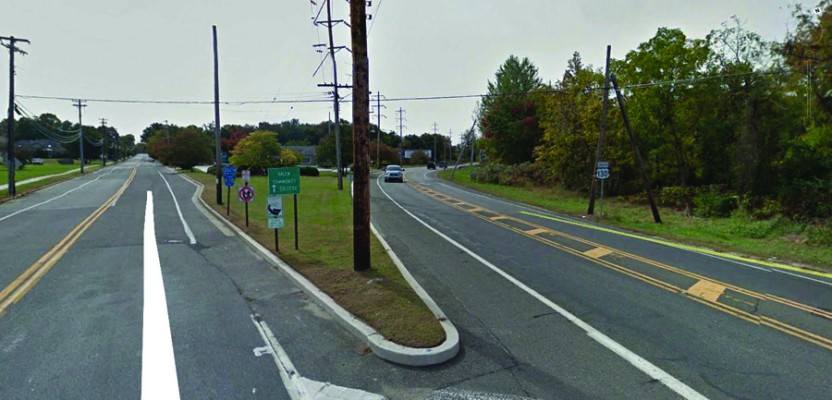
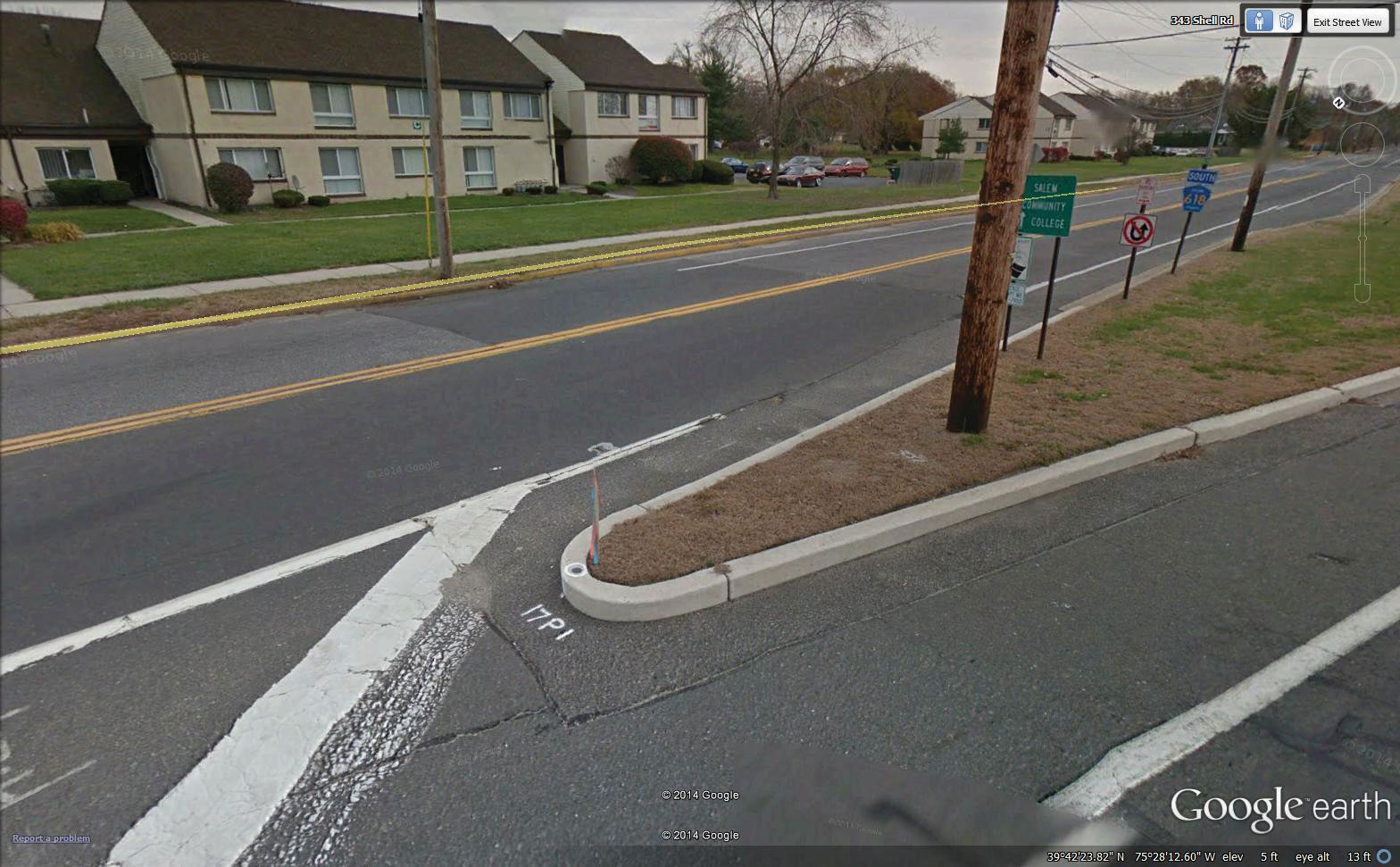
You can easily check for obstructions in either overhead or StreetView (5b).
5b
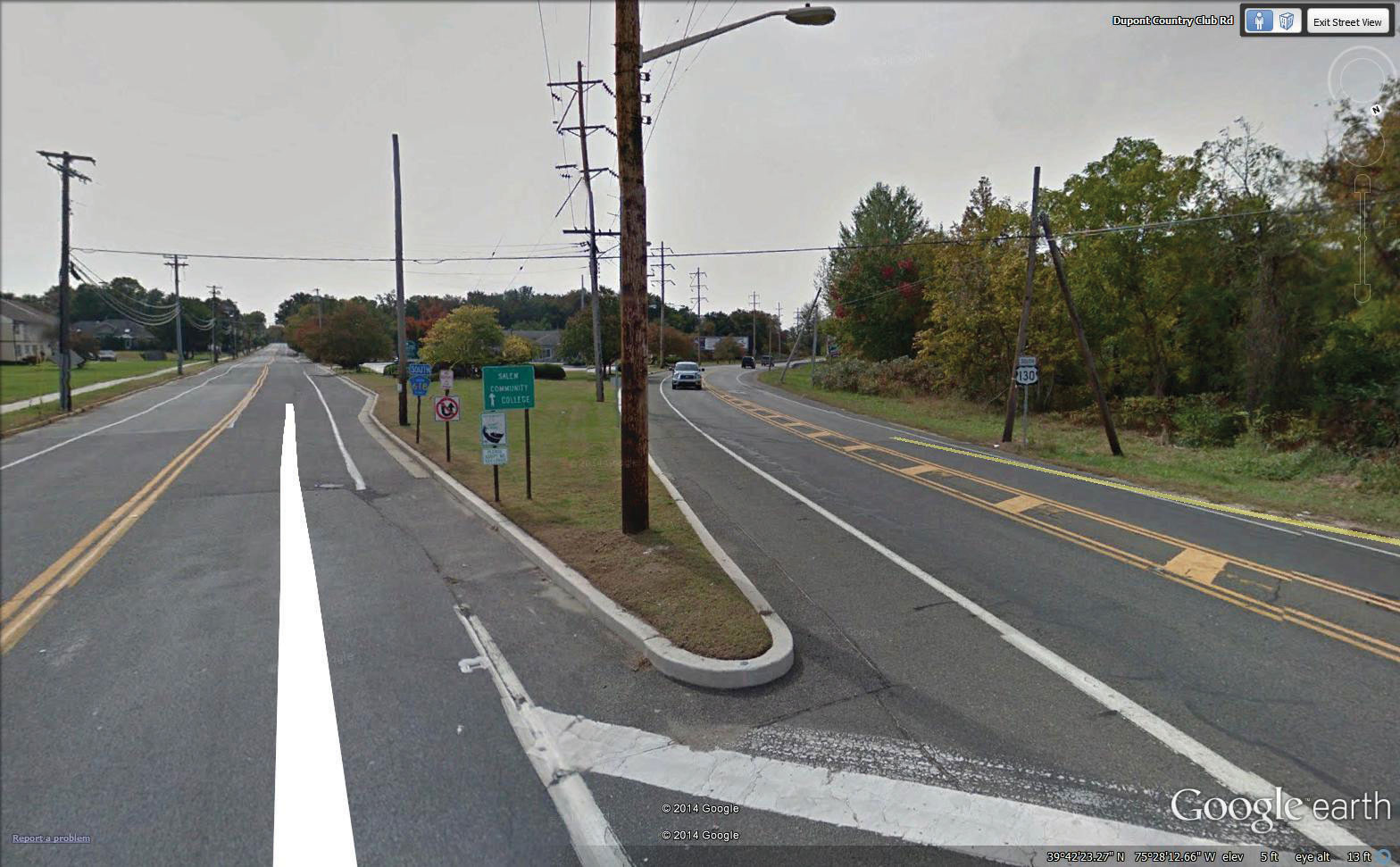
A thorough search utilizing StreetView in Google Earth may help you locate the mark or verify its true location. And, if you’re really lucky you may find that someone may have already spotted the mark (5c)!
5c
Step 6
Once you have performed your site visit and completed your observations, don’t forget to go back to DSWorld and update the data sheet with the newly found position, photographs, and notes.
Using Google Earth and StreetView can help you to perform a virtual reconnaissance of your control points, verify observability conditions, mitigate traffic safety concerns, and even plan equipment needs to make your job more efficient and productive.