I have been surveying going on 39 years now. It’s a darn good thing I have succeeded, or at least survived in this profession, because I never really learned how to do anything else. Never really wanted to.
As I have watched our profession change drastically over that time, mostly driven by technology and the tools we use, I can’t help but feel a bit saddened by what has been lost, or is close to extinction, as a result. Sure, we can measure better, faster, and more precisely and accurately than ever. We are able to operate as one-person field crews with that whiz-bang robotic total station, saving on the bottom line. We can run almost idiot-proof levels with amazing closures. All great stuff and attractive to the younger generation, no doubt, but what have we lost in that time?
The most obvious loss, and likely the most detrimental to the profession, is mentoring. In the age when a field crew had a specific pecking order, when the pack mule dreamed of someday just being able to touch that magical instrument, much less learn to operate it, there was a lineage of knowledge-transfer down through the crew. There was an incentive for subordinates to improve their skills to work their way up. With a few exceptions, that crew structure is gone, and the ability to mentor future party chiefs and professional land surveyors has gone with it. I can’t think of any feasible way to ever get it back, but there are representatives from many factions of our profession diligently working towards solutions to this issue.
Gone are the days of maps with the personal flair of the draftsman who prepared them. Many of them were and are works of art, in my opinion. But even the best “ink slingers” I ever knew became dinosaurs as CAD evolved to replace them.
Gone are the days of setting up a “beer leg” for a stakeout session chaining in lot corners or construction stakes. It was almost an honor to have to buy the crew that beer at the end of the day and to be on the receiving end of the party chief’s ribbing.
Gone are the days of slope chaining, making corrections on the fly, and adjusting for tape stretch as the day got hotter. Do any of the up-and-comers even know how to use a plumb bob anymore? Do they even carry one? I think not.
Gone are the days of having to “raise for red” or “wave the rod,” because a digital level never reads or writes down the wrong foot or takes a reading on an out-of-plumb rod.
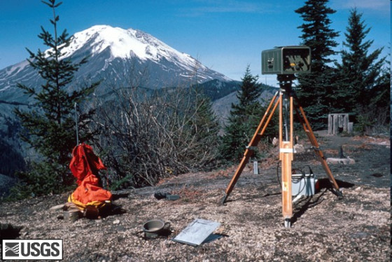
Gone are the days, mostly, of manually wrapping several sets of angles, then quickly doing the math in the field book. Today’s servo-driven total stations with automatic target recognition will wrap as many sets as you tell them to and electronically book the results instantly.
Gone are the days of doing station/offset topographic surveys with a right angle prism and a rag tape or using those same tools to layout rough grade for an entire construction site. With 3D models and automated machine guidance, staking is almost obsolete using any tools.
Gone are the days of bound field books used to capture every detail of a survey, including sometimes elaborate and ornate sketches. Who needs them when you have data collectors and digital cameras, some even built right into your total station?
Gone are the planimeter, dip needle, plane table, Rhodes Arc, and the top mount EDM.
Not gone are the hard-working, intelligent people of the highest integrity who comprise our noble profession. So, while our tools have changed dramatically because of technology, our purpose, role, and importance regarding determining boundary locations has not. Hopefully, it never will.