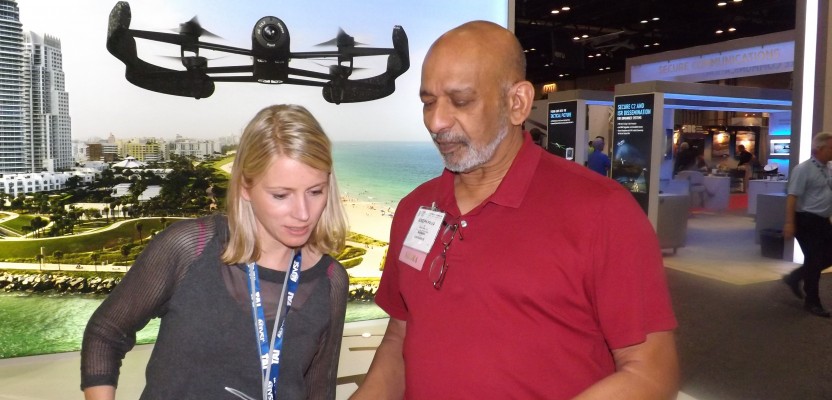
The Association for Unmanned Systems International is a 10-year old association dedicated to tracking products, research, and applications for unmanned vehicles. This year’s conference in May in Orlando brought over 6,500 conference-goers to see products and information at the booths of over 500 exhibitors.
The primary focus of the conference was airborne vehicles, but marine and land vehicles were represented, too. The air vehicles on display were predominantly for military or research, some of them as large as small manned passenger aircraft. But many were shown that were expressly designed, or ostensibly suitable, for a variety of surveying, mapping, and other geospatial applications. Experienced conference-goers from previous years remarked on the much-greater presence of non-military-purposed vehicles
UAS vendors relatively well known to geospatial professionals in the U.S. included Trimble, Topcon, Sensefly, C-Astral, Aeryon, and Microdrone. UAS photogrammetry vendors Pix4D, Trimble, and Mosaic Mill were also present. Laser scanner manufacturer Riegl, who recently introduced their 3.6 kg model VUX-1 was there; so was Esri.
But there were many names that are not yet household words. And there were many absent; a notable one was recent Hexagon rotorcraft acquisition Aibotix. And this is aside from military and other governmental aircraft such as the Army’s Raven, Air Force’s Global Hawk and Predator, and Customs and Border Patrol’s Reaper.
FAA’s Message
With the current restriction on commercial UAS flying imposed by the FAA, it would be understandable if readers are unaware of even these players. At this conference, the FAA’s UAS program manager Jim Williams spoke at several sessions. He reported that we are likely to see a notice of proposed rulemaking (NPRM) on small UAS (sUAS—under 55 pounds under current definitions) in the fall of this year. He predicted a nominal 18 months to then take the comments from the public that the FAA is obliged to consider and implement the final rule. This, especially when considering that the FAA typically is late on its published schedules, puts sUAS for commercial enterprises into 2016. There’s not much that has been hinted about what those rules might be.
Williams held out an interesting tidbit of information that could enable geospatial professionals (and others desirous of making sUAS flights) to fly earlier. Williams announced an initiative (called the Section 333 initiative due to the relevant section in the 2012 FAA Modernization Act) that will allow groups (presumably industry groups and associations) to apply to the FAA for an exemption to the current flight restriction in cases of minimal risk. Williams announced that four industries are being considered for this exception: film making, flare stack inspections, power line inspections and agriculture (two sub-categories were mentioned here—crop spraying and field mapping). Presumably other groups will be allowed to make a case for their applications under this section.
Even if the exemptions are approved, it is suspected that they would not be blanket, still requiring flights over relatively unpopulated areas, within line of sight of the sUAS pilot, and at only certain altitudes above ground level. It is not known whether a pilot certificate, as is currently required, would be needed.
Hardware, Software & Applications
Fixed wing UAS can cover today hundreds of acres at phenomenal resolution. The dominant technology is still visible light, i.e. RGB cameras. But the conference showed great promise for miniaturized laser scanners, flash scanners, infrared and multispectral cameras, and even hyperspectral sensors. Maybe even radar.
Using an air vehicle will open up potential tasks that we may be asked to do, and this could involve new sensors. This would be particularly true in the worldwide UAS market and applications for agriculture. Many nations are capitalizing on this technology for field mapping and monitoring (easily within the bailiwick of geospatial players) and crop spraying. Even in the U.S., it appears that illegal UAS use is growing for this particular sector of the economy that is particularly susceptible to market erosion due to technology enhancements that benefit overseas competitors.
Rotor UAS are also being used more extensively for geospatial applications (flight strip patterns) and inspections. If you include as inspections small (very small, as in a couple of acres) mapping as well as examination of features of structures and even large ocean-going vessels, for instance, the speed, safety, and ease of documentation is huge.
Furthermore, software, using technologies such as change detection, is being developed that enables inspection of found conditions in the images or videos to contrast with what the plans call for or what was found on the previous visit. This can create productivity enhancements that may be an order of magnitude or more better in quite a few industries.
Some of these include electricity transmission, wind power, highway and railroad bridges, antenna masts on tall structures, tall and massive building construction, etc. What is particularly fascinating are the possibilities for UAS technology to participation in the planning, surveying-prior-to-construction, construction, as-built generation, maintenance, and rehabilitation stages of a fixture, facility or transportation vehicle. For many of these, it will take a combined complement of fixed wing and rotorcraft platforms.
Rotor UAS can often carry the burgeoning miniaturized sensors too big for fixed wing. They are also increasing in flight stamina (duration) and in general have demonstrated a greater ability to carrier heavier payloads that are variable. Many fixed-wing aircraft are susceptible to slight load balance variations that can occur when payloads (i.e. cameras) are swapped, which can make them unstable in flight or downright unflyable.
My Take
To work in the 3D world of the future that includes our airspace, our ability to understand the technology we use will have to grow exponentially. We’ve become used to being push-button instrumentation users. That will definitely not be the case with UAS, regardless of what the advertising says.
So, the future brings higher-spec aircraft, with higher-spec sensors. When the FAA says, “Go,” be prepared. You will need to train to use and fly the aircraft according to rules that many of you have never even thought about. Demands for you to keep records will skyrocket. Your training and servicing of your people and your aircraft will have to be scheduled. You’ll have to be uncompromising in how you prepare to fly and perform the mission. And that’s all before you then process the data to create products for your client that will take you and them to new horizons.
To give you a glimpse of the knowledge and information demands you will have to understand, absorb, digest, and comply with, take a peek at the ongoing battle between Pirker v. Huerta. This is a famous FAA case where a $10,000 fine was levied on a UAS-for-commerce flier.
The fine was overturned at the first level administrative hearing, but it is now in the appeals process. Somewhat smarting from this experience, the FAA has recently (June 23, 2014) released more information on what the model aviators’ rules are and whom they are for. They are quite explicit in stating that commercial use is forbidden even if the aircraft was originally acquired for model or hobby purposes. Scoffing at this brings other business issues to the forefront, particularly the one about your liability insurance, but even your ability to continue to be professionally licensed.
The FAA continues to award certificates of authorization (COAs) to its newly initiated UAS test-site program. At the time of this writing, four of the six sites have received them (North Dakota, Alaska, Nevada, and, on June 20, Texas). On June 2, under the aforementioned Section 333 initiative, the FAA announced that it had received a petition for exemption from the current commercial UAS flight prohibition from seven movie production companies. Of particular note is that the Motion Picture Association of America facilitated these petitions on behalf of the seven companies.
This action lends weight (and hope) for industry groups and associations to petition similarly for surveying, mapping and other geospatial activities. If approved, such a petition is not likely to offer carte blanche approval for all activities in our industry, but with proper documentation complete certain activities that are found by the FAA to be safe to other air traffic and the populations and property below.
I recommend to those who have an appetite for the benefits flying UAS for geospatial activities to learn as much as they can now in anticipation of a green light, possibly in 2016. This must be seen against the background of a regulatory environment and a mandatory self-discipline that businesses and individuals involved in the UAS activity must have to be able to harvest lots of benefits while staying within a strict operating envelope.
Additionally, it may be time for those of you who understand the issues —including costs for applying for a petition for exemption and the benefits—to be the nucleus of a group flying under the flag of a society or association. You could be in the forefront of legal commercial UAS flights for the geospatial industry.