By xyHt
Visual Intelligence captured the Grand Award at the 8th annual MAPPS Geospatial Products and Services Excellence Awards ceremony. The award was presented at the 2014 Geospatial and Engineering International Marketing Conference in Alexandria, Virginia on September 25, 2014.
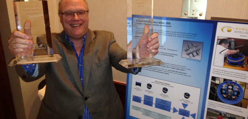
A software and sensor technology company based in Houston, Texas Visual Intelligence won with their patented new method for coupling sensors into a single housing. The company’s iOne SRK allows for reconfiguration of the sensors to meet the unique geospatial demands of their clients.
“Versatility, ease of use, and budget were key reasons Visual Intelligence won this year’s Grand Award,” said Robert “Bob” Burtch PS, CP, Professor Emeritus at Ferris State University in Big Rapids, Michigan, and chairman of the judges’ panel. “They created both software and sensors that can be reconfigured by the data collector. For example, cameras can be seamlessly combined into a single sensor to create a large format sensor for about half the price. The system is economical, simple, flexible, and provides the necessary accuracy for clients new and old.”
MAPPS also awarded 2014 Winners for Excellence in six technical categories:
- Quantum Spatial (Lexington, KY) won the Airborne and Satellite Data Acquisition award for the work they did to provide crucial data on the full extent of the Oso Landslide in Washington State.
- Wilson & Company (Albuquerque, NM) won in the Photogrammetry/Elevation Data Generation category for their work on the “Cochiti Dam and Reservoir Sedimentation Study.”
- Woolpert (Dayton, OH) took home the Remote Sensing award for their work with the State of Ohio to assess the viability of utilizing solar power to provide electric power.
- For their work on the first-floor elevations for flood impact studies, Michael Baker (Moon Township, PA) won for Surveying and Field Data Collection for the Pearl River, MS project.
- The Atlantic Group (Huntsville, AL) took the Small Projects award for their LiDAR data processing project “Helping Weakley County, Tennessee’s Tactical GIS Team Maximize Their LiDAR ROI.”
- Visual Intelligence’s (Houston, TX) iOne SRK also took the Technology Innovation award.
“This year’s awards recognize our member firms as leaders in cutting-edge, innovative solutions that fit a plethora of needs and budgets,” said MAPPS executive director John Palatiello. “The products and services demonstrate the enormous impact that private sector geospatial firms has on the community and throughout the world.”
A panel of independent judges evaluated projects submitted by MAPPS members for the awards program. Joining Burtch on the panel was Doug Domenech, former secretary of natural resources for the Commonwealth of Virginia; Leonard C. Gilroy, a certified planner and director of government reform at Reason Foundation; Bruce MacLeod, editor of POB magazine; and Neil Sandler, publisher of xyHt. Sandler served as master of ceremonies at the awards ceremony.
Above picture: Phil Kerns of Visual Intelligence accepts the Grand Award at the 2014 MAPPS Geospatial Products and Services Excellence competition.