Tag Archives: Google Earth
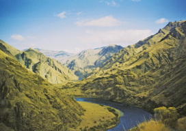
Re-imaging Hells Canyon
A geospatial company helps prepare for an environmental impact statement by scanning and orthorectifying historic imagery. Hells Canyon, North America’s deepest river gorge, encompasses a vast and remote region with dramatic changes in elevation, terrain, climate, and vegetation. Carved by the great Snake River, Hells Canyon plunges more than a mile below Oregon’s west rim...

Using Google Earth to Make 3D Models
No, I haven’t gone crazy; in fact quite the opposite. I was sent a visualisation of a wind farm from a company this week, and the back of my mind was niggling at me, telling me that I could do better at little or no cost. My first few attempts were involving QGIS2Threejs (QGIS 3D...
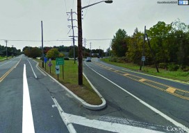
Survey Web Tools
How to use them for land survey planning and reconnaissance. When I first used GNSS, it was my usual practice to go to the National Geodetic Survey (NGS) website to gather the data sheets for control monuments in the vicinity of my project area. I would plot these in a program called TopoScout, a topographic...