All posts by Annie Ellis
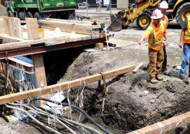
Preventing Damage to Underground Utility Lines
Common Ground Alliance (CGA), the national nonprofit trade association dedicated to protecting underground utility lines, people who dig near them and their communities, today published a Report to the Industry as part of its Next Practices Initiative. The Next Practices Initiative launched in 2020 with the goal of driving innovative solutions to the damage prevention industry’s biggest challenges,...
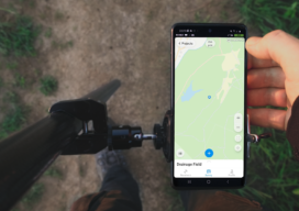
ReachView 3: Native App for Reach Receivers
ReachView 3 is the new mobile app by Emlid for working with Reach RTK receivers. Familiar point collection and stakeout tools are now powered with the new user interface, coordinate system support, and ability to manage big projects. It is a free app available for Android and iOS devices. Coordinate Systems on Board In ReachView...
2021 NSPS Student Competition
The 2021 NSPS Student Competition will be held in conjunction with the Spring meetings of the National Society of Professional Surveyors. This year’s competition will not include field exercises in order to accommodate official health and safety advice. The Competition will begin with an online briefing event on February 16, 2021 with a presentation by NSPS of...

senseFly Expands its Line of Fixed-Wing Mapping Drones
A mapping drone in the $10,000 price range might sound like one of those things that’s too good to be true. And up until now, maybe it was. A Swiss company called senseFly, a global leader in fixed-wing mapping drones, has expanded its flagship eBee X drone solution with the launch of eBee Geo. The...
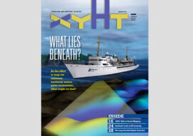
xyHt Magazine Digital Edition: February 2021
xyHt‘s February issue focuses on hydrography and the quest to map America’s coastlines and ocean floor.
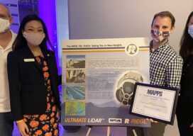
MAPPS 2020 Geospatial Excellence Awards
MAPPS honored members with the 2020 Geospatial Excellence Awards as part of the organization’s 14th annual Awards Presentation that took place January 26, 2021. The event was hosted by Riegl USA in conjunction with the 2021 winter meeting in Orlando, Florida. The Geospatial Excellence Awards are presented to regular and associate member firms whose entries...