Tag Archives: GIS. Lighting
Using Google Earth to Make 3D Models
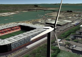
No, I haven’t gone crazy; in fact quite the opposite. I was sent a visualisation of a wind farm from a company this week, and the back of my mind was niggling at me, telling me that I could do better at little or no cost. My first few attempts were involving QGIS2Threejs (QGIS 3D...