Tag Archives: mapping disasters
USACE GIS Cadre Mapping Team’s Future
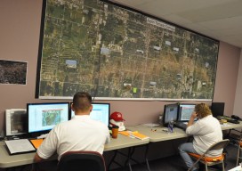
The cadre is a team of Army Corps employees from throughout the nation who are GIS subject-matter experts. When a federally declared disaster occurs the team gets ready to deploy and can be on the ground in just hours, setting up their own equipment even before other agencies are on the scene.