Tag Archives: Open Data
Recreating the Ordnance Survey Explorer Maps with Open Data
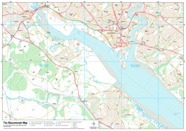
The holy grail for many (UK) map users is the Ordnance Survey 1:25,000 scale “Explorer” map. Not only are they easy to read due to the fantastic cartography used, but they also have information which is hard to source such as public rights of way, National Trust & Woodland Trust sites, even wind farms. To...