Tag Archives: terrestrial lidar
Handheld vs terrestrial lidar for building documentation
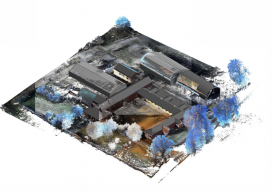
Sponsored by Paracosm Above: nmcn’s final CAD model as generated from PX-80 data. The 3D model is situated in the topographical point cloud data. Are these new tools accurate enough? Handheld mobile lidar scanners have gained market share in recent years by offering faster capture in GPS-denied indoor environments, easier documentation workflows for large, complex spaces,...