Tag Archives: Aerial Services
SGM
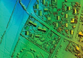
Obtaining economical and accurate point clouds from semi-global matching. In the old days, mappers were thrilled with 30 meter USGS digital elevation models (DEMs). These were available for almost everywhere in the United States. Years later they started producing 10m DEMs, and life was really good. We had one elevation point “on the ground” every...