Tag Archives: blackbridge
Satellite Imagery for Precision Agriculture
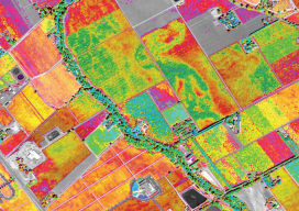
Precision agriculture consists primarily of using geospatial technologies to map spatial variations in crop and soil conditions and to match inputs—such as water, seed, and fertilizer—to those variations by applying them at variable rates. The link between the spatial variations and the variable rates are zone maps and prescription maps. The former show the difference...