Tag Archives: CityEngine
What Is Esri?
Over the last few years we (at xyHt) have discussed Esri as an industry-leading GIS many times, but what is it? What is ArcMap, ArcGIS Pro, or any of the other things with “Arc” names? The truth is a little confusing, but at the same time a little clever. In this blog I hope to demystify...

Interview with Esri’s Eric Wittner
Eric Wittner is the CityEngine and Procedural Technology product manager at Esri. He works to expand public understanding of how Esri’s 3D products can enhance an organization’s products and process and help bring them success. Nick Duggan: What exactly is CityEngine? Eric Wittner: CityEngine has been with us for a while. They started as an...
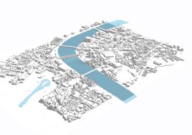
Esri CityEngine: What Is It?
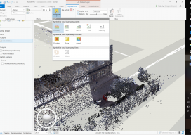
These past few weeks I’ve been trying to do some clever augmented reality stuff with Unity involving putting an object on the floor and ensuring it doesn’t wobble when you walk around it. (Yay for SLAM in mobile devices.) Although in software like Unreal and Unity you can download or buy models, what do you...

xyHt News Links: 12/30/16
Latest Release of TerraGo Edge and TerraGo Magic Provides Seamless Integration with Esri ArcGIS Esri Unveils CityEngine Mobile Virtual Reality Solution Laser Scanner in a Backpack
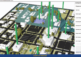
A State Gets Smart: SmarterBetterCities
To create and share interactive 3D building models, Oregon adopts SmarterBetterCities. To help formulate a 10-year strategic capital investment plan for the State of Oregon, the state’s Chief Financial Office (CFO) wanted to develop a dynamic, immersive, and collaborative visual platform that would illuminate key issues often lost in a tabular summary. Its audience was...

Why 3D GIS Is the Future
“The world we live in is a three-dimensional world, so why do we map it and analyse it in just two dimensions?” —Dragons8mycat, 2013 In the last five years, we, the GIS industry, have made some fantastic advances. So, why is it that we are so slow with the adoption of using 3D data? Surveyors...