Tag Archives: Georeferencing

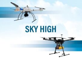
Sky High
UAVs deliver practical and highly technical mobile mapping Collecting imagery with uncrewed aerial vehicles (UAVs) is ideal for a variety of applications including topographic mapping, forestry ground and canopy measurements, powerline corridor mapping, Digital Terrain Model (DTM) generation, high-resolution digital imagery, and orthophoto production, along with support for a variety of other mapping needs. Historically,...

xyHt Weekly News Links: 09/11/20
Gary Sladic Appointed to USGIF Board of Directors Applanix Introduces Next Generation OEM Solution for Georeferencing of Sensor Data AirMap and DoD Partner to Develop AirBoss Aerial Intelligence Platform Geospatial World Leadership Award Winners

xyHt Weekly News Links: 09/03/2020
U.S. Geospatial Intelligence Foundation Awards Scholarships Carlson Brings Robotic Dog to Life Applanix Introduces Solution for Georeferencing Data

xyHt Weekly News Links: 9/29/17
Teledyne Optech and IGI announce new cooperative agreement and first product offering Hemisphere GNSS Debuts Next-Generation S321+ and C321+ GNSS Smart Antennas Septentrio unveils the new Altus NR3 at InterGEO GeoSLAM Launching Enhanced SLAM Software and Next Generation Mobile Scanner at InterGEO 2017 INTERGEO 2017 Berlin: Geo-IT-event officially opened Applanix Announces POSPac Cloud for Mobile Mapping...
