Tag Archives: Prince Edward Island
CLIVE: Communicating Risk in 3D
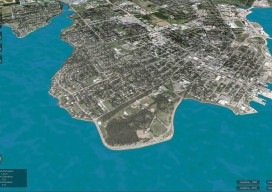
Above: The current sea level and coastline of the city of Charlottetown on Prince Edward Island, Canada. Static 3D models of topography and buildings are commonplace in both technical and popular geospatial software. There are still very few 3D tools, however, that enable users to geo-visualize dynamic phenomena, such as the effects of climate...