Tag Archives: sea level
Minimum and Maximum Z Values in ArcGIS Pro
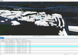
In ArcGIS Pro, why are my minimum and maximum Z values wrong, and how do I fix it? Until recently, this isn’t the kind of question you would expect a GIS user to ask. Of late there have been many innovations in the geospatial software world, and the GIS user is now having to come...

Dealing with Vertical Datum, the Mariners’ Way
Before 3D GIS, we were able to measure miles below the sea and miles beyond our own atmosphere to a great level of accuracy, so how did we do it? There are a few methods for working between vertical coordinate systems, but the one I want to discuss is possibly the simplest, not always the...
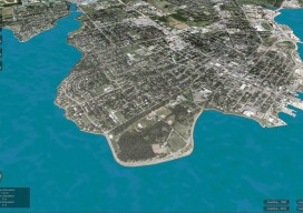
CLIVE: Communicating Risk in 3D
Above: The current sea level and coastline of the city of Charlottetown on Prince Edward Island, Canada. Static 3D models of topography and buildings are commonplace in both technical and popular geospatial software. There are still very few 3D tools, however, that enable users to geo-visualize dynamic phenomena, such as the effects of climate...