Tag Archives: ZX5

xyHt News Links: 7/29/16
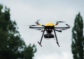
OpenStreetMap conference inspires hundreds to grow the opendata mapping community and help save lives worldwide MULTIROTOR service-drone introduces the Hexacopter ZX5

Multicopter Profiles
The eXom, RiCOPTER, Aibot X6, and Trimble ZX5 SenseFly’s eXom Inspection and close-in mapping sUAS I first saw sensFly’s new eXom sUAS at the ILMF conference in Denver early this year. It’s billed as an inspection and close-in mapping platform, and I thought, “Inspection? That’s interesting” and moved on. Turns out the team at senseFly...
Trimble Takes Flight with New Multirotor Unmanned Aircraft System
Latest Addition to UAS Portfolio Makes Working in Tight Spaces Easy Trimble announced the ZX5 Multirotor Unmanned Aircraft System (UAS), a new aerial imaging and workflow solution that captures and processes geo-referenced photo and video data for mapping, agriculture and inspection applications. The Trimble® ZX5 complements the UAS portfolio with the ability to reach smaller,...
