Tag Archives: agriculture
Mapping Internet Deserts
North Carolina uses GIS to identify rural communities with poor broadband access to help farmers and fight poverty When Agriculture Secretary Tom Vilsack visited North Carolina last year to announce a $17.5 million grant for broadband connectivity, it felt like a lottery win for Warren County officials. Without the vital Internet connections that drive economic...
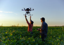
Farming From Space
Airbus and Sentinel Fertigation use satellite imagery to improve sustainable crop production With help from Airbus’ detailed high-resolution 30cm satellite imagery provided by Pléiades Neo, a Midwest crop management software platform is offering a streamlined process for farmers fertilizing crops via irrigation (known as fertigation). Using multispectral imagery of field conditions, Lincoln, Nebraska-based Sentinel Fertigation...

xyHt Weekly News Links: 11/24/17
Topcon Agriculture announces TAP, a connected agriculture ecosystem Trimble’s 3D laser scanning and modeling offers a new way to conduct storage tank inspection in the oil and gas industry Carlson 2018 Precision 3D Topo Geospatial Data Act Save the Date for Feb. 5-7, 2018, Co-Located with ASPRS!
xyHt Weekly News Links: 9/1/17
HP Unveils HP Mars Home Planet and New Wearable HP Z VR Backpack Icaros and Agrowing Announce Integrated Drone Multispectral Mapping Solution for Agriculture Crowdsourced Mapping Projects Aid Post-Harvey Disaster Management Start-up Wingtra Expands UAV Solutions to China and US Boundless Donates $100,000 to LaunchCode in Support of CoderGirl Education Program
xyHt News Links: 11/11/16
Trimble Software GNSS Receiver Provides High-Accuracy, On-Demand Positioning-as- a-Service Lead’Air Creates an Unparalleled Multi-use “HELIDAS” Oblique Camera System for Helicopter and Fixed-wing Aircraft Caterpillar and Trimble to Expand Mining Technology Collaboration Microdrones™ partners with Delair-Tech to offer complete aerial mapping toolkit Trimble Business Center Software Adds Scanning Module, Support for Complete Third-Party Data Integration and...
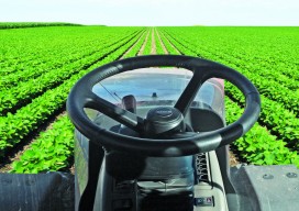
Satellite Signals Steer Farmers Straight
Precision agriculture combines GPS, remote sensing, and GIS to capture large amounts of georeferenced data on spatial variations in soil types, moisture content, nutrient availability, and crop yields and then create and follow prescription maps. Until recently, it was difficult for growers to correlate soil and crop information with production techniques, so they generally treated...