Tag Archives: CR Mapper
Drone design: What Goes into Designing a Drone?
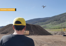
A UAS firm tackles a topographic mission at 10,000 feet above sea level with their own system. (Above: IST Aerial’s Bo LeRoy uses the firm’s DJI Inspire One to collect data for volumetric calculations for compost piles located on a landfill in Colorado.) IST Aerial is a division of Integrated Science and Technology (IST), founded 25...