Tag Archives: hurricane Irma
Aerial Imagery to the Rescue
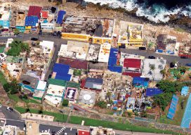
Events in 2017 demonstrated without any doubts or reservations how vitally important georeferenced aerial imagery is in assessing damage and supporting relief efforts following a natural calamity. Last September, an impromptu consortium of companies in North America mobilized their forces and collected and analyzed mountains of data at near cost to help out in what...