Tag Archives: infrastructure

xyHt Weekly News Recap: 01/28/2022
Teledyne Geospatial’s Hardware and Software Solutions Highlighted at Geo Week 2022 Applications for Funds to Participate in the 7th FIG Young Surveyors Conference Infrastructure Czar Focuses on Grants to Local Government Marine-i Welcomes Government Funding for Floating Offshore Wind Innovation Bad Elf Adds Android Support for Laser Offset Workflow in Esri ArcGIS Field Maps Geo...
xyHt Weekly News Recap: 01/21/2022
John Palatiello: 40 Years on the Geospatial Job DOT Makes Historic Bridge Investment Under Bipartisan Infrastructure Law Phase One Unveils Wide-Area Aerial Camera with Global Shutter Sensor Technology Sonardyne Hybrid Positioning Chosen for Vessels Across Energy and Science Seiler Instrument to Expand Presence as a Geospatial Solutions Provider in Iowa and Illinois Kinematic Lidar Data Processing...
xyHt Weekly News Recap: 10/15/2021
URISA Leaders Recognized at GIS-Pro 2021 Aero-Graphics Hires Daryl Southard as Director of Business Development Dewberry Acquires the Latest RIEGL VQ-1560 II-S Airborne LiDAR System Seamless, Automatic Thermal Imagery Based Inspection Available now for Remote Digital Inspections AI Surveyor is First Intelligence Platform for Large Infrastructure Projects Septentrio, ArduSimple Bringing Reliable GPS/GNSS to Emerging Applications North...
xyHt Weekly News Recap: 06/25/2021
Teledyne Optech makes First Delivery of CZMIL SuperNova Robotic-based Solutions Enhances Curb and Gutter Paving Performance Bentley Acquires 3D Modeling Software Company Seequent Keynote Lineup Announced for Commercial UAV Expo Americas 2021 Trimble and Infotech to Streamline Inspection Workflows for Infrastructure Projects J. Dan Bremser Named President of Massachusetts Surveyors Organization Geo Week has Massive...
xyHt Weekly News Recap: 02/26/2021
Emlid NTRIP Caster Makes Workflow Easier Breitschwerdt Elected to Construction Equipment Sector Board Alaska Glacier Ice Mass is Thinning Preventing Damage to Underground Utility Lines Coalition Urges Congress to Move on Infrastructure Improvements Dimensions Series Offers Insights from Industry Experts
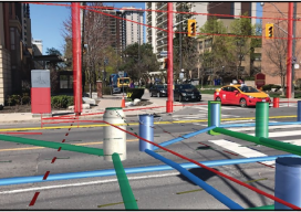
Hidden Infrastructure in 3D: Visualizing with AR
A visualization platform overlays data displays on your view of a job site by fusing data, AR software, and mobile-device sensors. From Superman’s x-ray vision, to current technologies that use radio waves to sense objects through walls. The ability, fictional or actual, to “see” through obstacles has long been a source of fascination. (Above: An...